Month: February 2014

After two intense days of running around the Big Island, we decided to take some time off and do what “normal” people do – beach, sun and bathing. We talked to some of the locals and they directed us to a local beach nearby – a very nice one. Unfortunately, the access road was not that great, but this is exactly what made the beach even better – there was almost nobody there. Plus, it had shade from a couple of trees just on the edge of the water… Paradise.
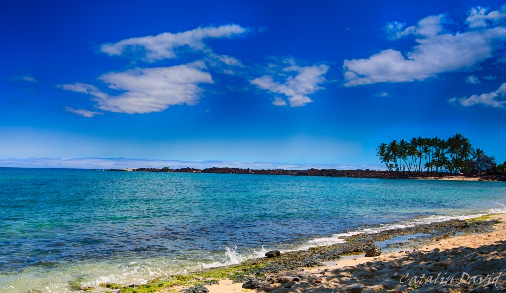
Unfortunately, with every good thing (most likely) comes a bad thing. So, I fell asleep on the beach and… the shade moved. So after about 1h of sitting in the sun at noon time, my feet felt like they were melting. Plus, they were extremely red. Oh, well, we’ll have lotion at home, just stay hydrated and work through the burns.
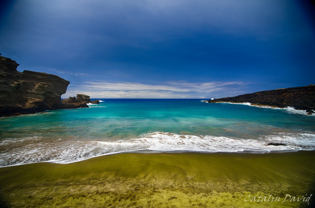
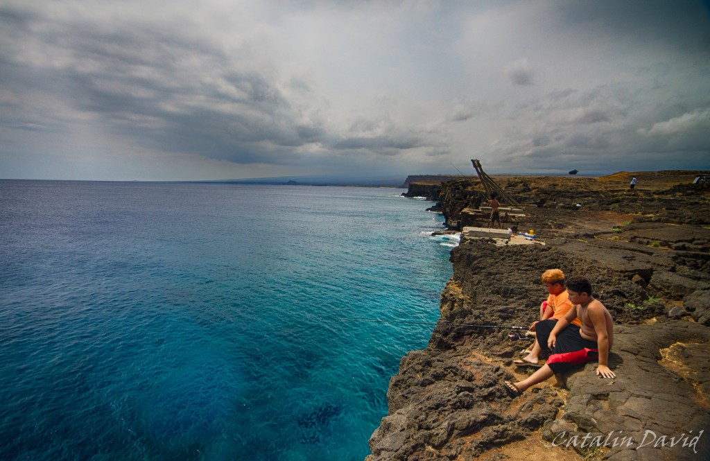
On another day, we took a trip to the “Green Sand Beach” – this is a beach in the Southern part of the Big Island that has … green sand. After seeing black sand beaches and “normal” beaches, green sand felt a bit of a stretch and exotic. Unfortunately, like any well-guarded secret, the road to the Green Sand Beach is … not paved. You can get within 3 miles of the beach on a public paved road, but the rest of the road requires a 4×4 car and some experience with the area. Why? Well, first of all, there is not only one road – there are about 10 roads that start from where you leave your car and get to the beach, all intersecting each other. Some of them have 1m high rocks in the middle of them over which your car needs to climb, some are smooth. One thing is certain – all of them are dusty, so this is a big problem if driving slow. Of course, some local drivers were kind enough to take us there for a small donation of $15/person. But once you get there… once you get there, it gets interesting. You are confronted with this:
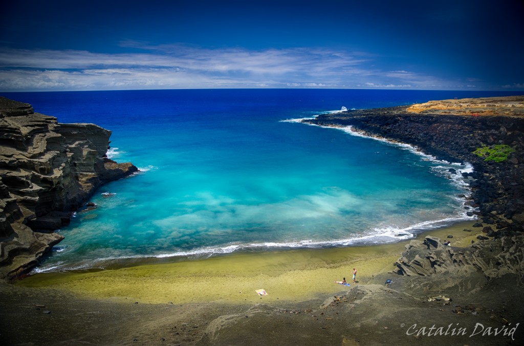
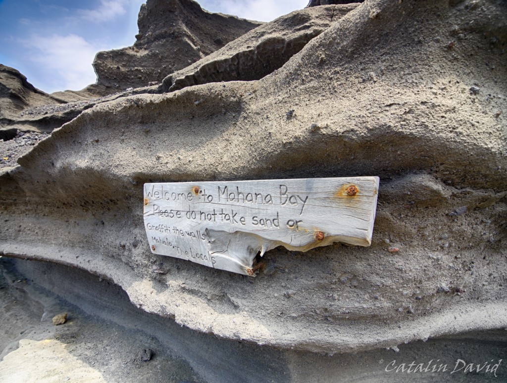
You are sitting on the edge of a cliff, with nothing underneath you for 30 meters. And the green sand beach awaits you at the bottom, contrasting with the blue of the ocean and the sky. There are some not-trivial-to-go-down-on steps that will take you to the beach, but, as soon as you start descending, a message from the locals:
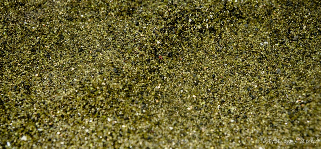
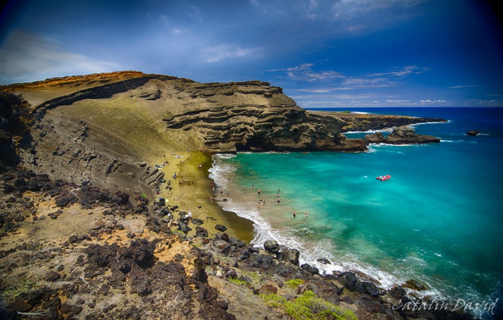
So, why is the sand green? Or at least somewhat greener… ? The source is, of course, Mother Nature – the sand is actually not sand, at least not from a chemical perspective. Due to the volcanoes on the island, high pressure and different minerals, a mineral named olivine has surfaced. The green sand is actually a bunch of small crystals that were eroded by the water and waves over many many many many years. The problem is that the crystals are not very resistant to the weather, so nobody knows for how long this beach will still have its green color. Here is the detail of the sand – once you zoom in, you can actually see the crystals there.
We safely got to the bottom, near the beach … and decided to take a dip in this beautiful place. The beach is not big, see pictures below, about 10-15 meters wide at high tide, but the fact that it’s secluded and in this awesome bay … makes up for everything.
Before we left – and believe me, we were trying not to, we decided to hike on the nearby coast for a bit. While cars could have made those signs, I still think that aliens came and X marks the spot where they will land.
On a more serious note, I really enjoyed the contrast between the dust and the dry atmosphere that the ground inspired and the blue of the ocean and the sky. Still, restless as I am, I went on the very edge of the cliff… About 20-30 meters above water, on the edge of the cliff and snapped this picture. And that is mom, hand waving in the top right corner.
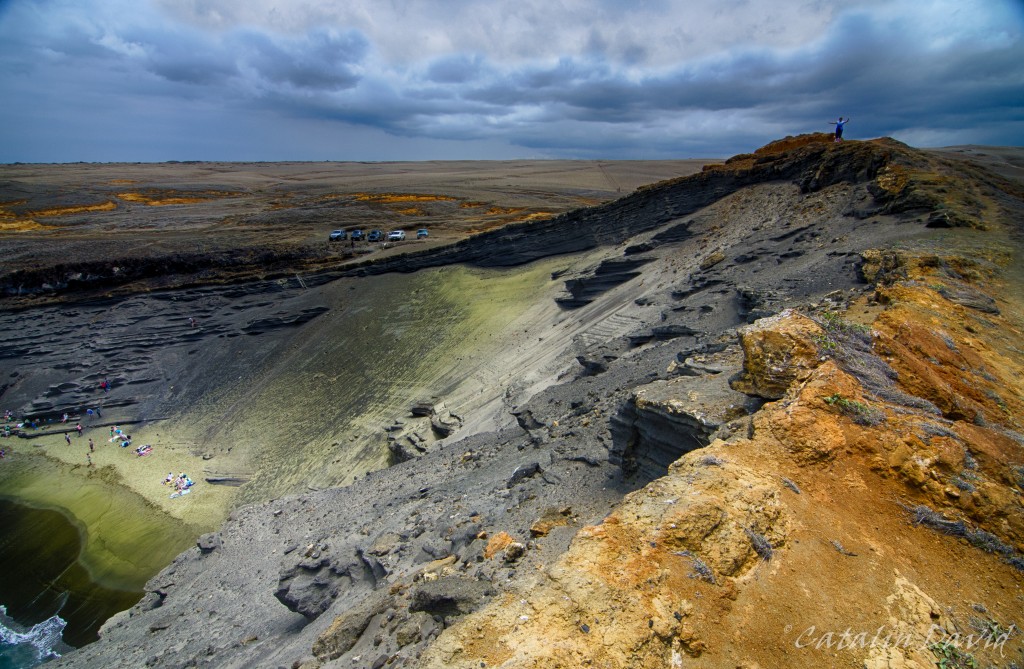
In these pictures, you can see where the olivine actually comes from – the very top and with the help of rain / wind / gravity, it makes its way to the bottom, on the beach. We had a bit of time to spare, so I went to the other side of the golf and snapped a picture from the other side, to see where I was standing when I took the picture above.
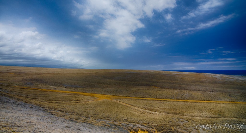
When we finally left we saw that there was a sign that said “South Point”. I had read a bit about it, but since we were already there… we decided to go. Apparently, this is the Southern-most point of the United States of America (therefore, South Point). Not much going on here, just a bunch of locals fishing…
and jumping into the clear water. You wouldn’t believe it, but the water in the picture above is about 5m deep near the edge of the cliff and we saw a couple of people jumping in. Unfortunately, I was too jaw-dropped to take pictures.
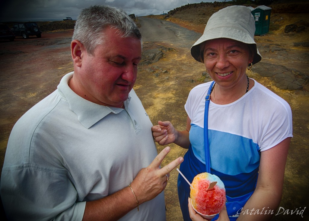
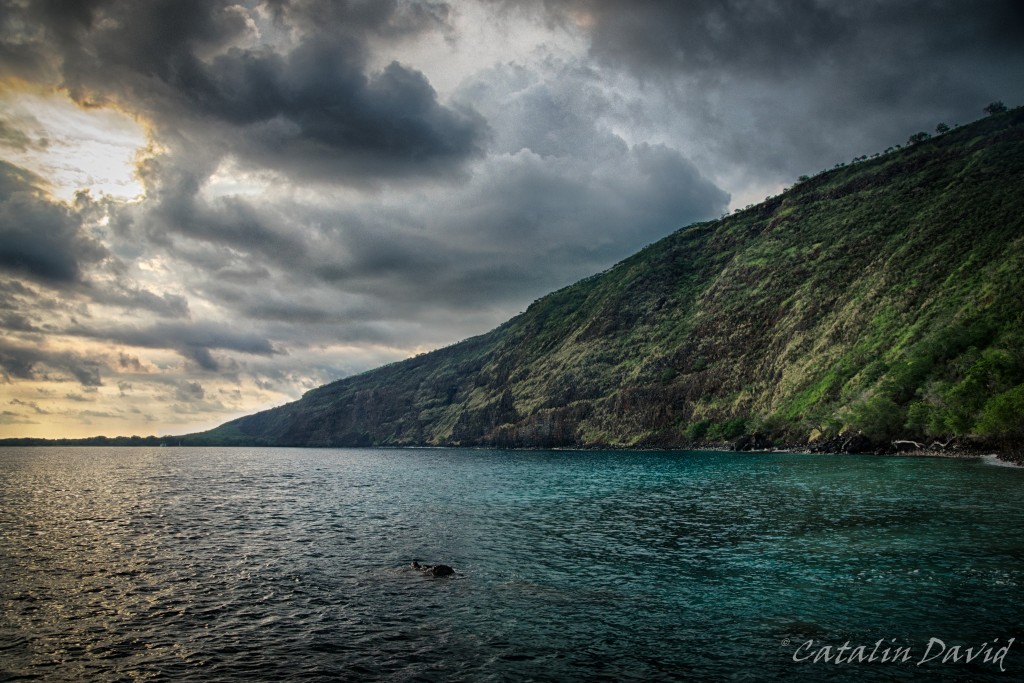
Strolling around for a bit, we got to a shaved ice stand and mom and dad had a bit of rainbow-flavored shaved ice. On our way back from the southern part of the island, we stopped at Kealakekua bay – this is where the British explorer, Captain Cook was the first documented European to step on the island. This is also the place where he died, killed by the locals.
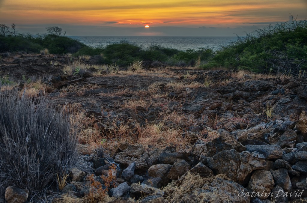
A trip to Hawaii is not a trip to Hawaii without a picture of a sunset. This is one that I snapped on a day, coming back from the beach. The clouds at the horizon usually make it so you can’t get a good picture of the sun setting into the water, but you play with what cards you are dealt 🙂
Next up, the rest of our trip (done with Hawaii, but not with the trip). Over and out,
/cd

Hi and welcome to the last part of day 2 in Hawaii! Remember to click on the pictures for full resolution – welcome and let’s go!
It’s been a fun day and it had to just end in a great way. So? On our way from Hilo to Kona, we decided to take a small detour and go to Mauna Kea – the Onizuka Center for International Astronomy. Mauna Kea is the tallest mountain in the world measured from base to top – it is about 10000m tall, while Everest is only a bit over 4500m tall. But, most of Mauna Kea is actually under water and only its peak can be explored by foot. The peak of Mauna Kea is at over 4200m above sea level, while the Onizuka Center (visitor center) is at 2800m above sea level. At the top of Mauna Kea sit some of the world-famous telescopes – besides the high altitude, Mauna Kea benefits them by usually having no clouds at the top. The people of the Big Island are respectful of such an investment in research on the island and only use sodium-based street lamps so that they don’t pollute the darkness at the top.
We got there in the evening and we were able to see quite a few buses that would go all the way to the top to see the sunset and then admire the stars. All of them had to stop, though at the visitor center. The reason? Acclimatization. The road can take you in about 2 hours from sea level to 4200m. And if you don’t stop, your body will most likely freak out.
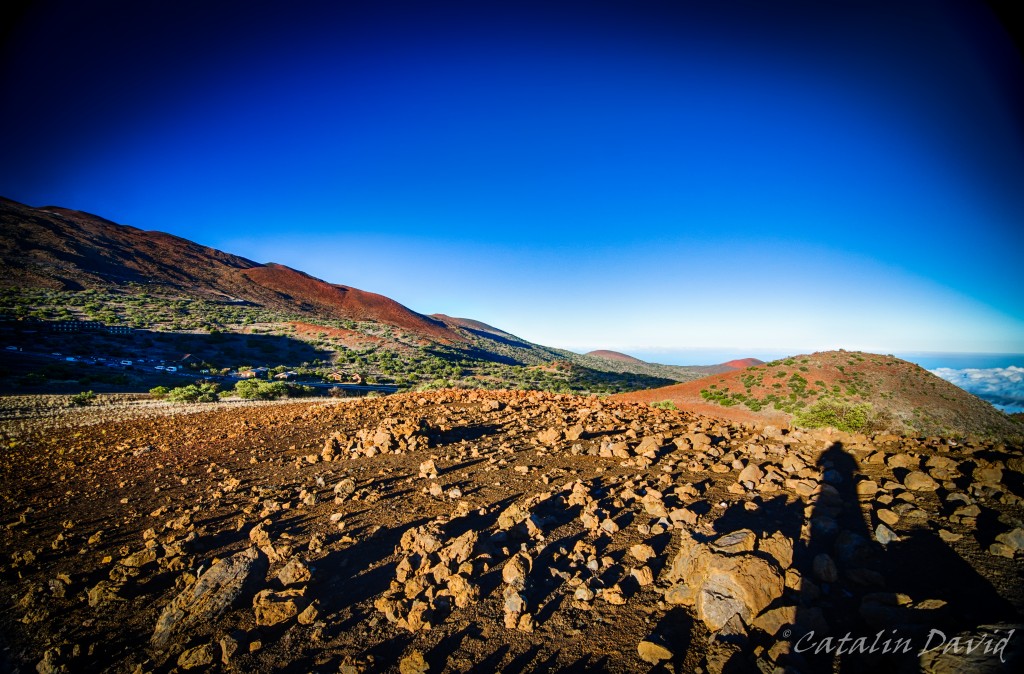
You can already see in this set of pictures the shades of blue of the sky (this is not photoshopped). This is because the air density is already lower and the air molecules are scattering less light upon us. The intensity of the blue, combined with the sunset yellow / orange are bound to create some interesting views and feelings. The soil is somewhat variable, between lava-rocks and sand (coming from lava) and it has a shade of red that would make you feel like Spirit on Mars. In the picture above, you can see the Onizuka Center for International Astronomy – we spent about 1 hour around there, learning more about the guy, the observatories at the top and what is visible from here as well as from the top. The trip to the top is interesting because you are above everything you can see around you and you get to see the telescopes from close (entrance is prohibited). once we were done with that, we decided to go hike a bit around to get a better view. We walked for a bit, I snapped some pictures. The view was good, but not great, so we had to go a bit further up.
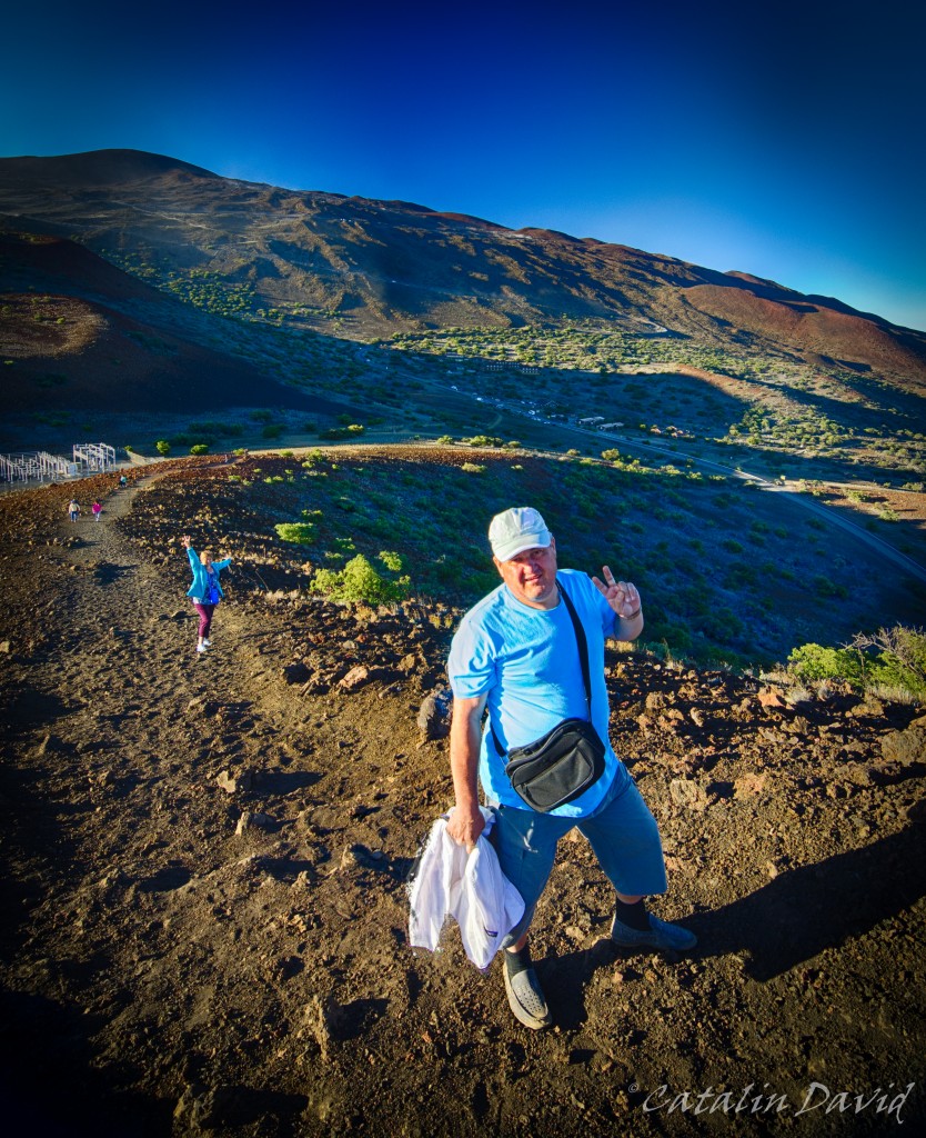
How much? Quite a bit. Especially when you feel every breath taking its toll on you and the lack of freshness in the air. Mauna Kea is actually in the background of this picture and you can see the zig-zag road that goes up the mountain (the peak is not actually visible here). There is a foot path that goes from the visitor center to the top – they say it takes about 8 hours of hiking to get up there. The foot path is rather steep, sandy and a bit of a challenge. Last time I was here … no, I did not climb by foot all the way to the top. Last time I was there, I took the foot path for about 1h, maybe 1h and a half. We were pretty beat – it was the middle of the summer, the sun was agonizing and we decided to bail out and get in the back of a truck that was coming from the top to get back to the visitor center. On our path, we encountered a funny sign: “Stay on the foot path or you risk to be shot. Private military range” – apparently the foot path goes through a US military base training land on the island – I assume that’s where they tested all their stuff for the wars in the past couple of years.
Well, that’s a better view, right?

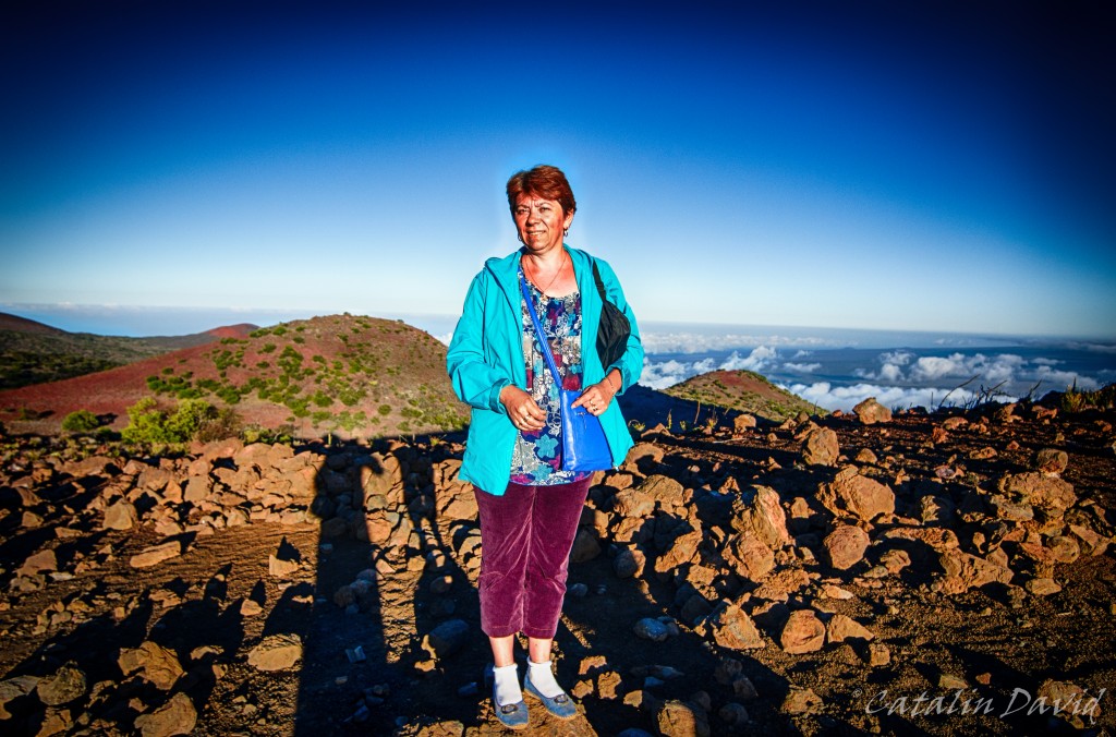
And we finally got a picture with all of us together. Yes, those small dots in the background were where we parked our car.
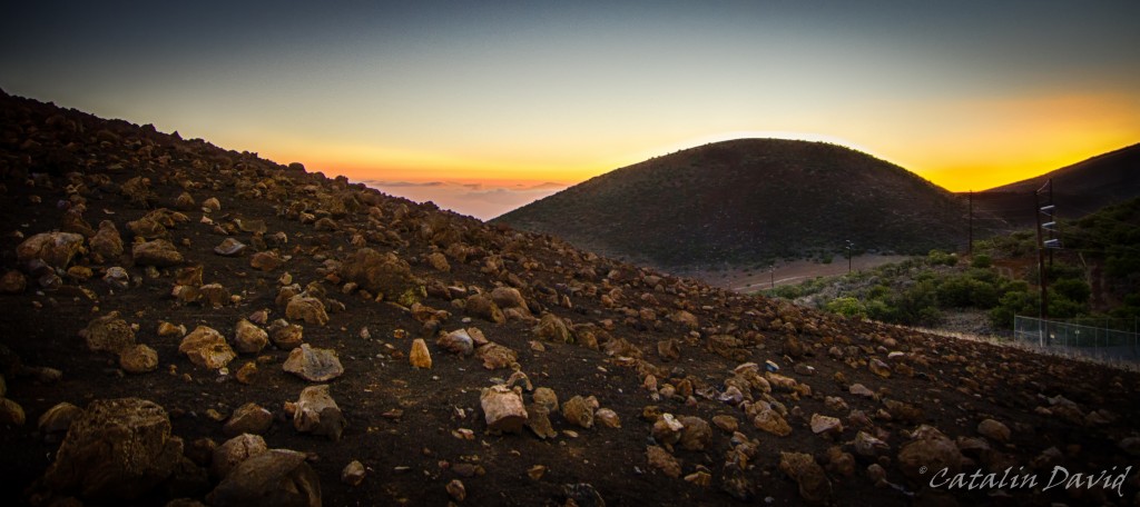
We sat around a bit for the sunset. This is actually the best sunset picture that I have from that trip (I think). And actually, one of the best ever.
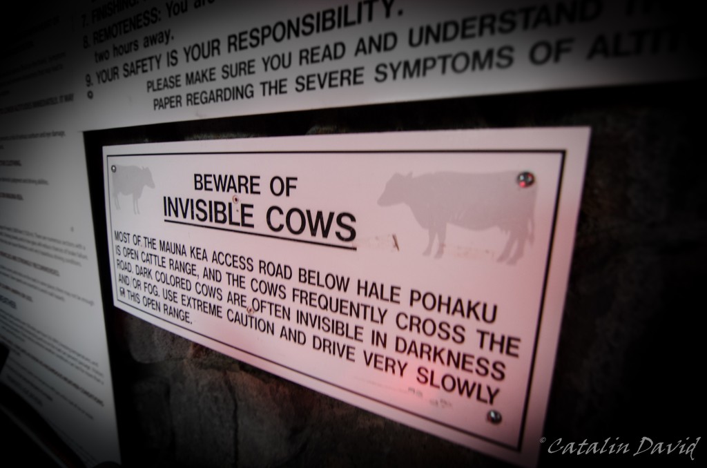
One of the coolest signs that I’ve seen.
But the main reason you go to Mauna Kea is the night sky. As I said, these are rather perfect conditions – no clouds, no light pollution, high altitude, so no air pollution. And if my camera and lens can take such pictures, imagine what they can do with more money and more technology. I present you Milky Way. The yellow patch in both the pictures is the city of Hilo (and some remote houses).
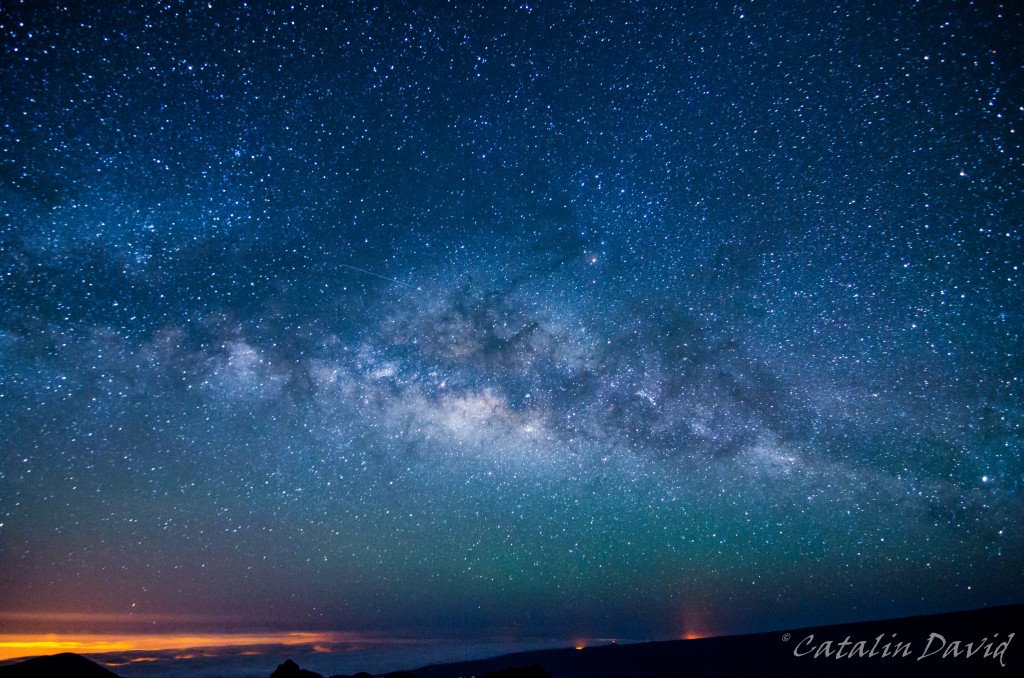
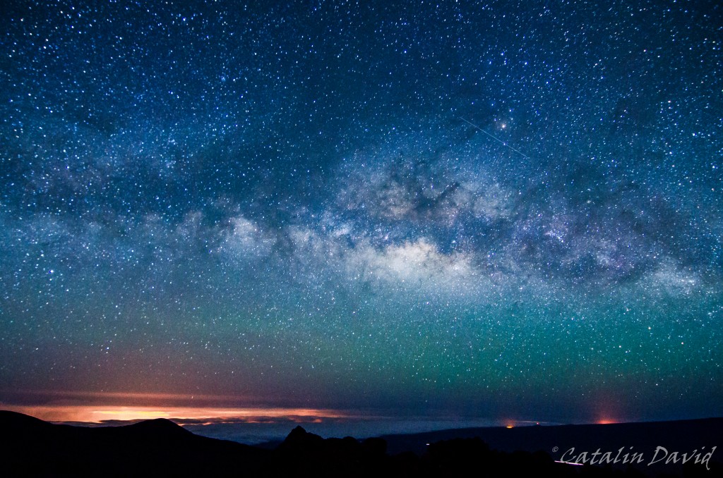
Technique? Tokina 11-16 f/2.8 @ 11mm @ f/2.8, 30s, ISO 6400. Point to the sky, make sure you don’t move either you or the camera, press the remote control button and wait. In the cold. So, in case I haven’t mentioned, it gets cold. So cold, that while I was taking pictures with my father by my side (on the hill from the pictures above) my mother was waiting outside the visitor center and got hypothermia and was shivering all the way home (2h). Some hot wine, some brandy and sleep made it better by the morning.
Good night,
/cd