Tag: summer 2013
This is the last part of our New York trip. On a partially cloudy day, we started off from West side of Manhattan on a boat trip to take us around the bay and Manhattan.
It was pretty interesting and the views were of parts of the city where we could not reach (at least easily).

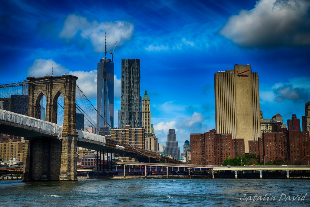
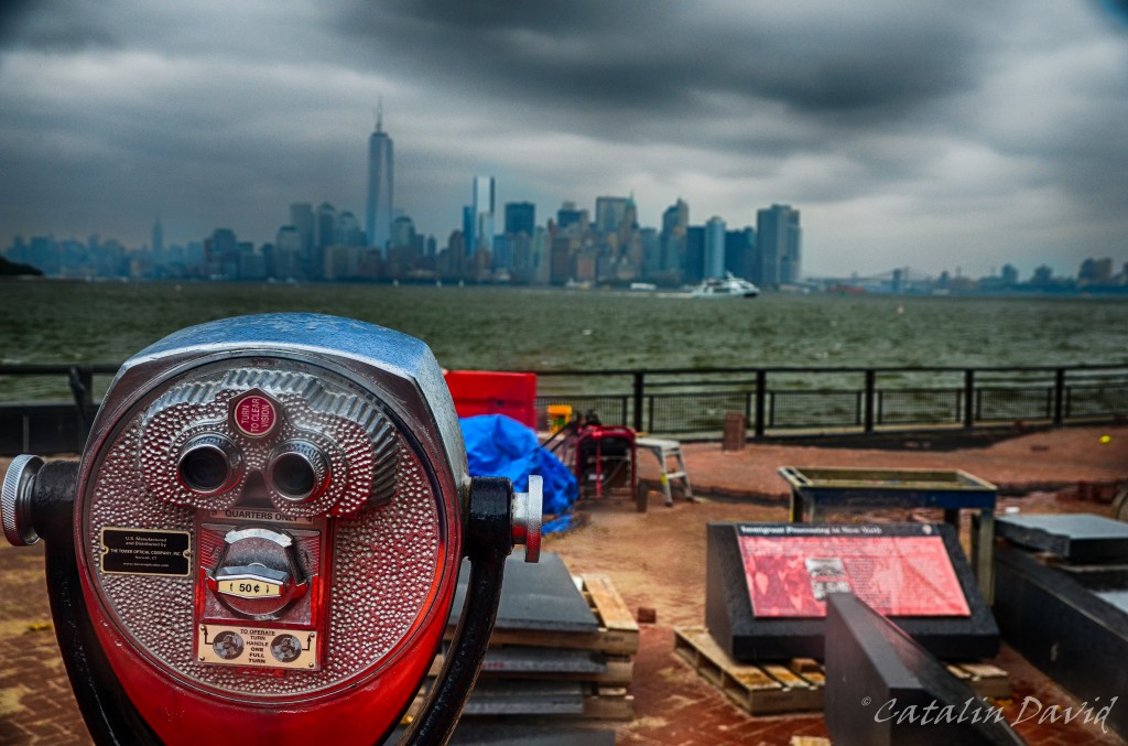
While we have had a view of Lower Manhattan when we went to Liberty Island, we did not have a view of the East Side. Here, the Brooklyn bridge and the One World Trade Center in the background.

After the boat trip, we took a stroll around the city, in particular, near the new One World Trade Center building that was just being finished.

And we walked around the place where the twin WTC towers used to be and enjoyed an icecream in the park just outside, on the shore, facing New Jersey.

Walking a bit more through the city – there was one building that I really wanted to see:

Yes, this is the “Friends” building. This is featured in the TV-show Friends as the place where Monica & the rest of the friends live. It’s not much, but I liked that show quite a lot, so it is a landmark for me.

We walked a bit more through the city and got to Central Station – I was expecting it to be more of a landmark. Instead, it is pretty covered by the tall skyscrapers just outside the building. The paintings of the ceiling show constellations and give a nice pleasant tone to the building. Unfortunately, not so nice were the officers that got their focus on me and suddenly really close to me as I was setting up my camera and tripod. It was all good, “sportsmanlike” conduct.

At some point, we also caught the sunset on the streets of the city. It is really amazing how many advantages a grid system has. Besides the obvious traffic and purely organized nature (and symmetrical and mathematical and deductive – you can find out where you are based on just numbers), if you are facing West, you are going to be treated by some lovely sunsets.

New York is a city of mixed feelings for me. On the one hand, it’s a big city, so there’s always something to do and you can easily “lose yourself” in the city and meet new people. On the other hand, it’s a big city – so it comes with everything that a big city comes with: shady areas and people, self-centered people, disorganization, pollution, crowded places, bad transportation (although better than expected) and many others that are also reasons I don’t like the city where I was born.
This ends my trip around the US from last summer. Now it’s time for more adventures.
Over and out,
/cd
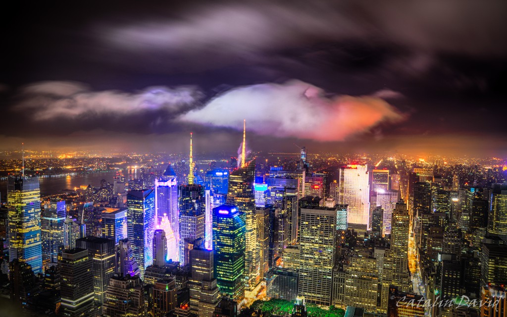
Later on Saturday, the clouds left us be, so we were able to “walk the city” and, at midnight, go to the top of Empire State Building.
First we walked around the city for a bit and ended up around Times Square.

Everyone is going to Times Square. We actually went through Times Square, BUT (and this is a really big but) it was so crowded and loud and noisy (both audio and visual) that let’s say… it made it’s presence felt on me.

Getting closer, you can already see that the camera can’t cope with the contrast. Hell, even my eyes couldn’t cope with the contrast in Times Square. Anyway… we went on top of the Empire State Building.

And the view was amazing. I have seen pictures, I have heard stories. But the feeling of being above the city, above everything that moves, being afraid to take that extra step… it is pretty breathtaking.

And being able to look everywhere and see the city and minuscule people and cars moving around – pure power and enjoyment.

Like this view of New Jersey in the background (above).

Because you sometimes feel jaded…

And the entrance sign. The Empire State Building is an amazing piece of architecture – being built so tall on a limb of land in the middle of the city, especially with the technology at the beginning of the century. Built like a tank, to last for generations.
/cd
Welcome to part 3.
On Saturday we went around town – we took a bus ride through Bronx, Queens and ended up the day on top of the Rockefeller Center. We also walked quite a bit around Central Park and around other attractions.
Here, Mom is photobombing (lower left corner) a picture just outside the Yankees stadium (it was a game day, so it was quite crowded).

As we went through the day, the clouds followed us up to the top of the Rockefeller center. Here is a view from the top towards Central Park (north).

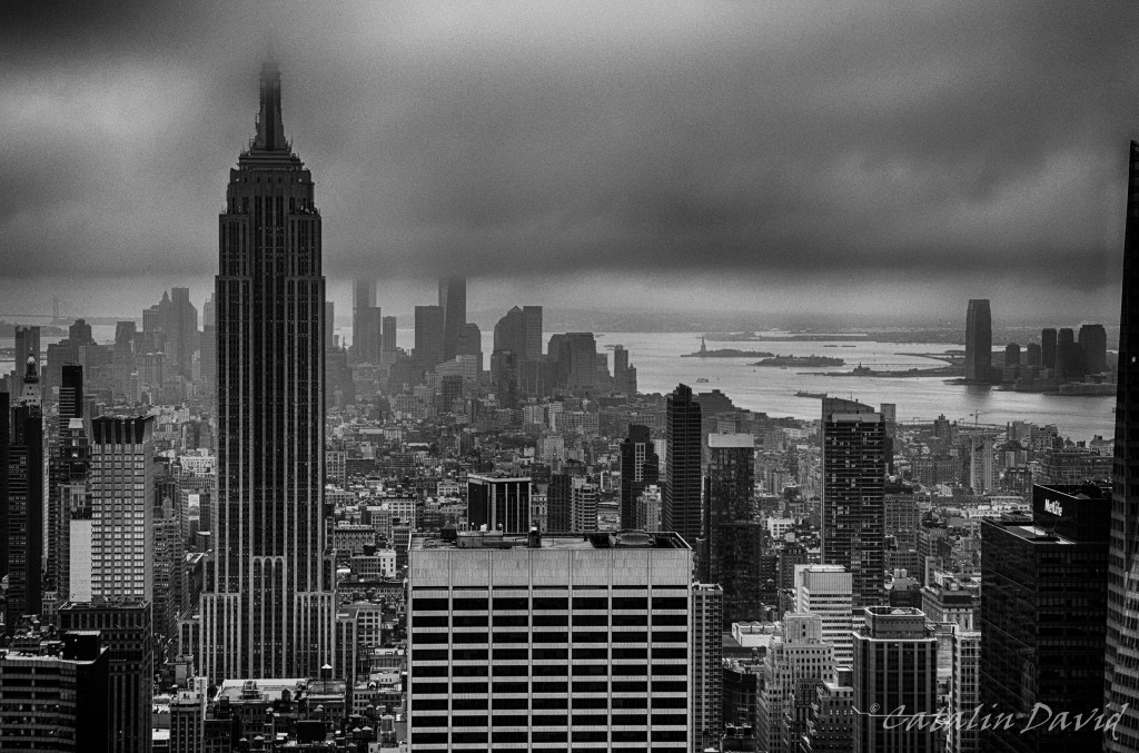
And a view towards South, with the Empire State Building in the center.

And a closer shot with Empire State Building and a tiny tiny Statue of Liberty in the background, with New Jersey on the far right.

That’s it for now.
/cd
Trying to be agile, to make small incremental updates rather than big blog posts. See – software engineering applied to real life 🙂
Back to the story. After getting some well deserved sleep on Friday, on Saturday we headed out to visit the upper Manhattan and other parts of the town. Apparently, I was not in a very picture-taking mood on that day with the exception of these two churches: Riverside Church and Cathedral church of St. John the Divine. And I know that New York is not best known for these, but I like churches.

And these churches are interesting for me because they look like some of the oldest pieces still standing of the city, while they are still pretty new – late 19th and early 20th century.

And even though the walls are pretty empty on the inside, their greatness and majesty make me appreciate them.


Walking a bit further to the front of the church gives us a better view of the altar.

And even “behind” the altar.


And while I appreciated the main halls a lot, the side rooms were pretty … creepy. I understand that they are exhibition halls, but… does that really belong in a church? And the answer is yes – it does. Since this is America, the land of the free, everyone is free to make a contribution to their religion. And since the coasts are more diversified in terms of religious choices, the churches start running out of money – so, maintaining the church becomes a business that needs to be attended like one – with entrance fees, reprofiling towards gallery exhibitions in some of the rooms etc.

I found that room pretty creepy. It looked like some small-Satan-s marching with a dog in front, willing to stop them. “Art”.

The shadow of the cross is what caught my eye in this picture.

The entrance / exit was very impressive and the whole church had an European flavor to it.

Moving on to the second church… View from the middle towards the altar.

And towards the entrance.

I like the symmetry of the buildings a lot and that is most likely what picks my brain every time.
Over and out for tonight.
/cd
This is the last part of the 2013 summer trip that I did with my parents. After visiting me in Seattle and we went on our awesome Hawaii – Vegas – Zion – Grand Canyon – Seattle trip, we decided to add one more flag to the map of visited cities (this is a figure of speech, but I actually have a map of Romania and I have marked on it all the trips that I have taken as a kid with my parents in Romania – it’s pretty cool and full).

This trip began on a Thursday evening / night when we left Seattle and caught a red-eye (overnight) flight to New York. My parents would then follow their path back to Bucharest and I would fly back to Seattle. Anyway…
We flew for 5 hours, meaning that we had to get at most that much sleep – it was not easy or comfortable. We got in New York around 8AM local time (5AM Seattle time) after only a couple of hours of sleep. We took a cab to our hotel (in Manhattan) and since the room was not ready, we had to go start visiting.
Short definition: New York has multiple boroughs – Manhattan being just one of them. The others are Queens, Bronx, Brooklyn and Staten Island.
So, we got breakfast (and MUCH NEEDED coffee) and we did what any tourist does – get tickets for a hop-on hop-off in the city and start visiting. We got on a bus with plans to head over to see the Statue of Liberty and possibly Ellis Island. Of course was not a good enough stimulant, so I fell asleep on the top level of a double-decker and I woke up with the sign above approaching me at a pretty high velocity (fortunately, it was a bit higher).
We got off the bus in Lower Manhattan, close to Wall Street and took a boat trip to the Statue of Liberty. Unfortunately, in order to actually climb in it, you need to book in advance – and moreover, the Statue was closed just until a day before due to Sandy (the hurricane). So, we strolled around for a bit.

That guy above ruins a pretty awesome pic. And below: Mom and Dad after a sleepless night, Lady Liberty and a bit of rain.

The Statue was nice, but it was also a bit disappointing. The statue is such a landmark that appears in so many movies – at least the ones that I watched as a kid – and it looks so impressive … and then you’re there and … it’s just not the same. I am pretty sure that all the movies just want to make it look bigger. Especially by putting the city with the skyscrapers in the background – see here:

As I mentioned, the island was just opening that week and you can see people were still working on remodeling after the hurricane.

After a while, we came back to the city and went through the city – just outside Times Square I got my very own version of the posters one can see everywhere with the yellow cabs:

Riding in the bus was pretty fun – on the one hand, you have a good perspective of the people on the street, of the buildings and everything going on around you. On the other hand, New York-ers look to be not so shy, so they don’t mind snapping photos of them.

In the picture above, there is so much stuff going on – first the person waiting while everyone else is moving, then the flag, then the blue building squeezed between the other two gray ones and the “American DollHouses” sign.

Even though we didn’t have the best weather for outdoors visiting – the clouds were pretty bad, but it did not rain – the trip was fun.
Switching to inside for the next post.
/cd

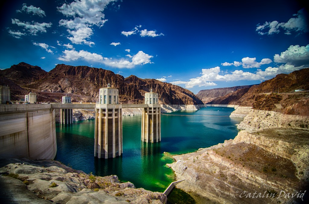
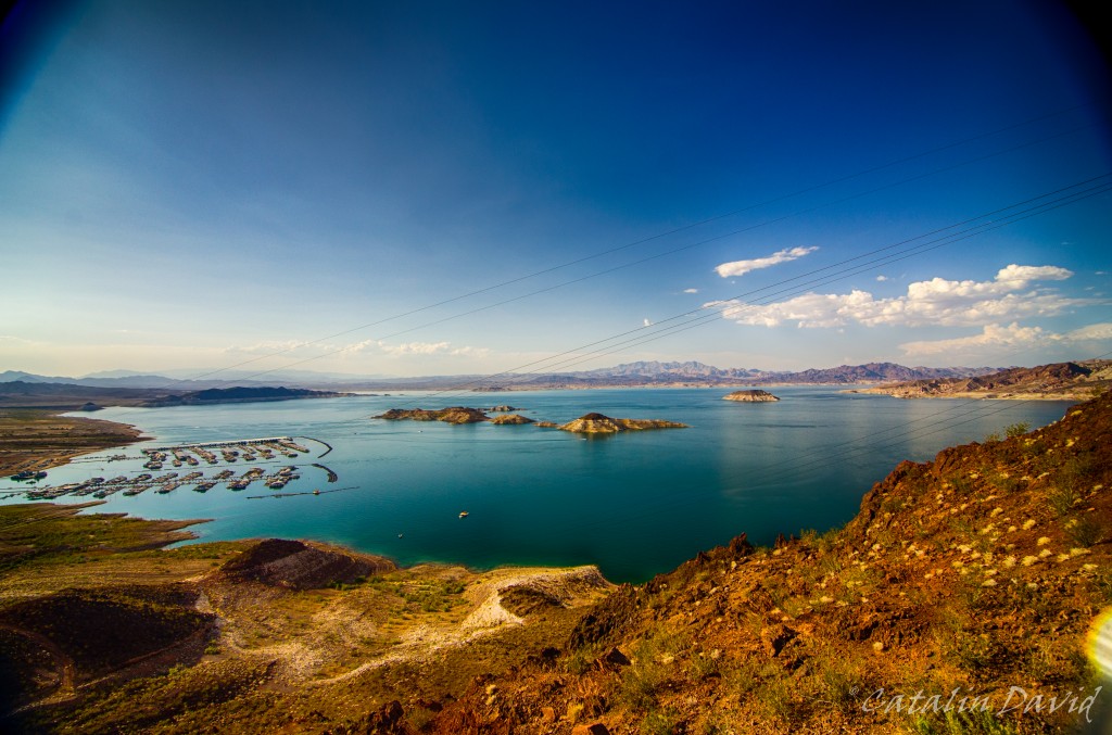
Last day in Vegas. About 1h away from Vegas lays one of the most impressive dams / lakes: Lake Mead formed by Hoover Dam. Lake Mead is the largest lake / reservoir in the US at maximum capacity (which it did not reach since 1983 due to various causes – let’s not get into the climate change debate just yet).
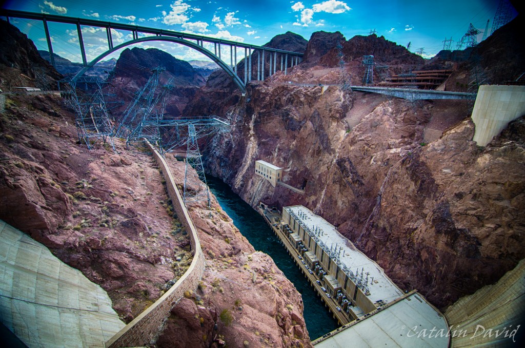
How was Lake Mead formed? Well, it’s a combination of nature and careful human planning: do you remember that river that carved the Grand Canyon (name is Colorado river)? Well, guess what! It’s not done yet. Hoover Dam is built on the Colorado river and led to the natural creation of Lake Mead. Here is Hoover Dam:
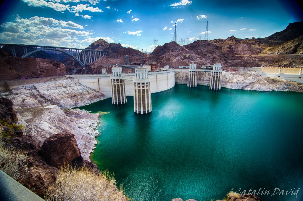
Doesn’t seem like much, right? Well, Lake Mead is big – it’s 110 miles (180 km) long when the lake is full, is 150m at it’s deepest and can hold 35km^3 of water (that can be used for irrigation and to produce electricity for Nevada, Arizona and California). So, while it might look small, it’s just part of what we actually see.
Hoover Dam is the one that is “responsible” for Lake Mead, so here is a peek down the wall. Long way down, right?
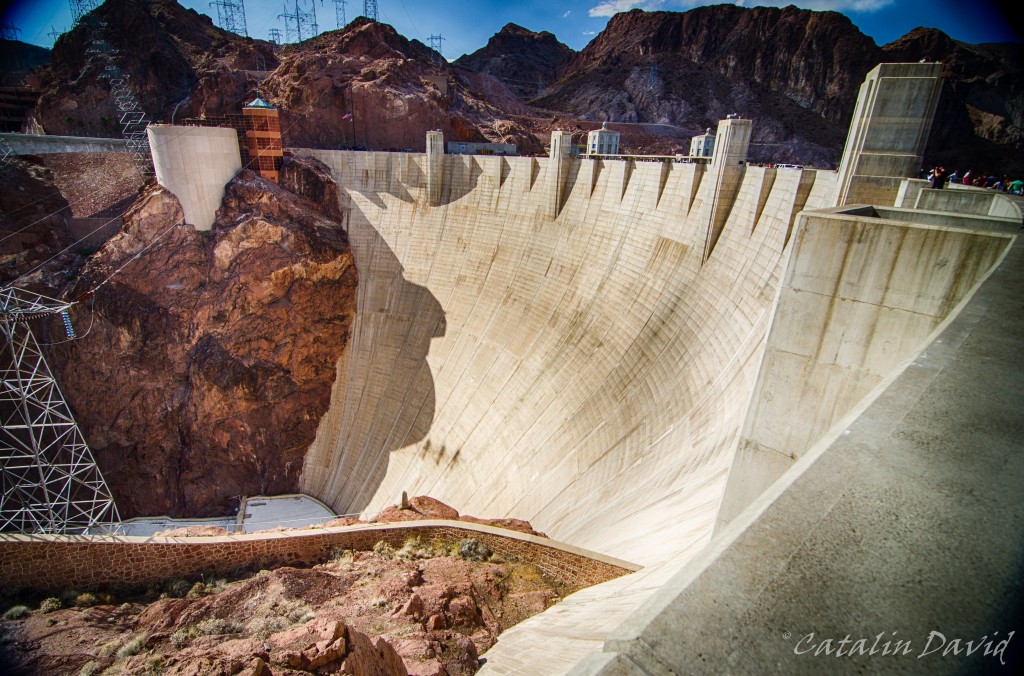
Even closer to the edge, looking down.
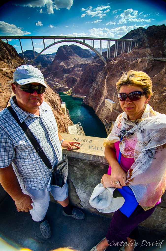
As you can see, it was a very sunny day in the middle of the desert (mom actually got sick from all the sun). But in this picture, like two bosses.
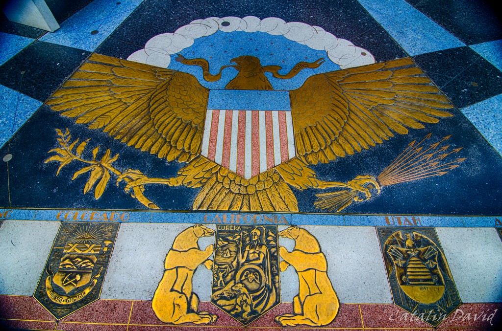
One thing I should mention – Hoover Dam sits between two states: on one side is the Nevada state (with Las Vegas just miles away) and on the other side, it’s Arizona state. The Colorado river flows through a couple of states before heading to Mexico and the Pacific Ocean. At Hoover Dam, there is a commemorative plaque that tells you through which states the Colorado river flows (in this picture, Colorado, California and Utah – also, Arizona and Nevada).
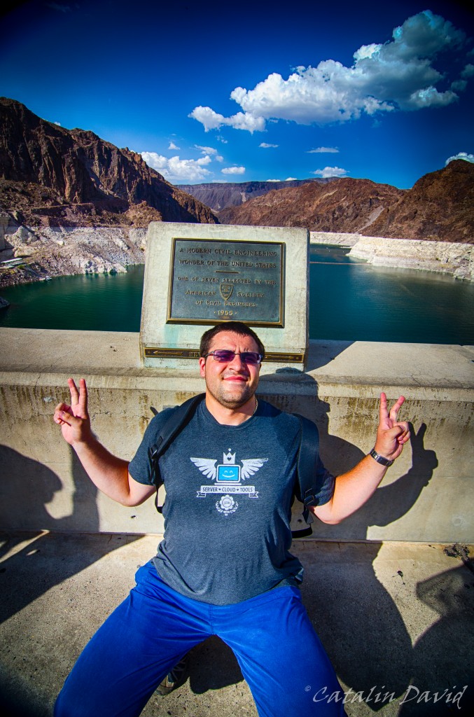
Last but not least, here I am at the border between Nevada and Arizona. Not very exciting to be within two states at the same time. It’s almost as if the state lines just belong to a map, not excising any force in the vicinity of their physical presence. Oh, wait…
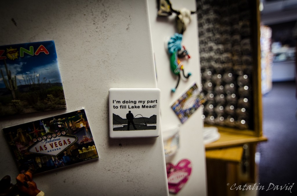
Disclaimer: I did not help fill Lake Mead, but this sign is funny:
Even after turning a corner, we can only see a small portion of the lake. I understood it’s best seen from airplane / space station:
Over and out – done with Vegas. The story goes on – we went back to Seattle, I went to work for a week and then headed for the Big Apple – pictures coming soon.
/cd
After the North Rim, on the same day, we got to Las Vegas in the evening. So, around 10 PM we walked a bit outside to walk on the Strip and see the show. At 10pm, the temperature was still upwards of 90*F (30+*C). Luckily enough, pretty much the entire city runs on air conditioning, so as long as you are inside, you are comfortable.
We walked on the strip left and right, trying to avoid all the drunk people – remember, this is around 4th of July weekend, so the city was pretty full. Besides the drunk people, also trying to avoid the shady guys that give away “business cards” for strippers / hookers. Impressions for the night: hot, drunk people, dirty people, party people (the age average must have been around 30) and, last but not least, opulent people – everybody wants to show off that they have money. One other thing that I did not like was that this place is a bachelor / bachelorette go-to and this is something I don’t get, it’s like a custom to come here and the people that come here for this event seem imagination-less (booze, strippers, maybe gambling and go crazy). Seems like pre-defined “fun” to me (yes, I know I am a rebel and extremist). Anyway…
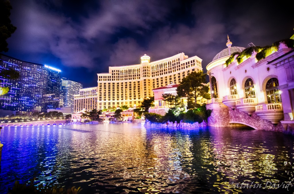
The Strip – it’s the main street in the city and it hosts all the big casinos in Las Vegas. And again, this is the epitome of opulence – in the middle of the desert, build an entire city (based on A/C), with artificial pools (I have to agree that the fountain in front of the Bellagio is nice and impressive):

And yes, things are impressive because they are there and they are special, but after a while, all of this is getting to me and in my eye. The strip is full of all types of casinos and hotels and entertainment places (the hotel in the background is where we were for our stay).
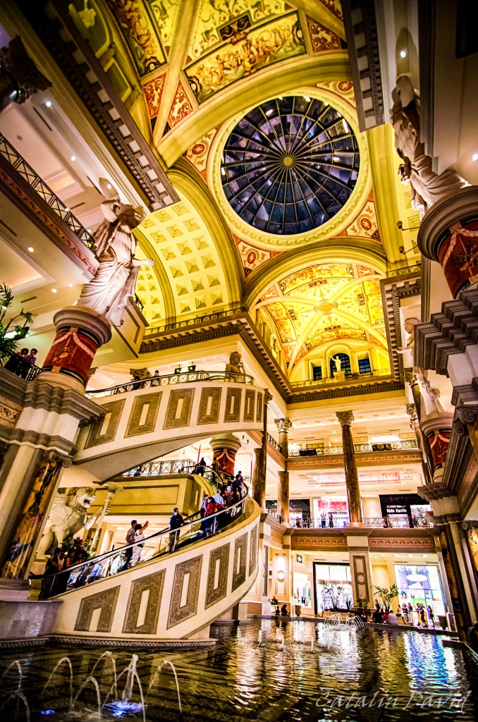
There’s architecture everywhere, there are paintings, but … at least to me, they seem out of place – the styles, patterns are mixed and in the end I think that the whole concept of insert of ancient architecture in everyday life (like in the picture below, inside a shopping mall) is just … kitsch.
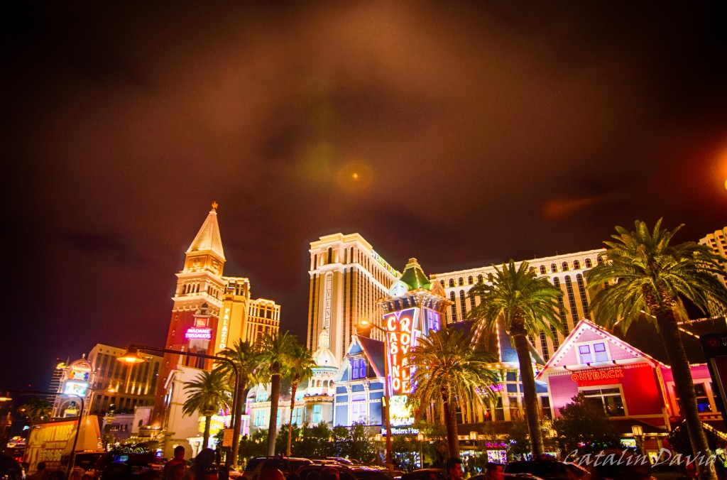
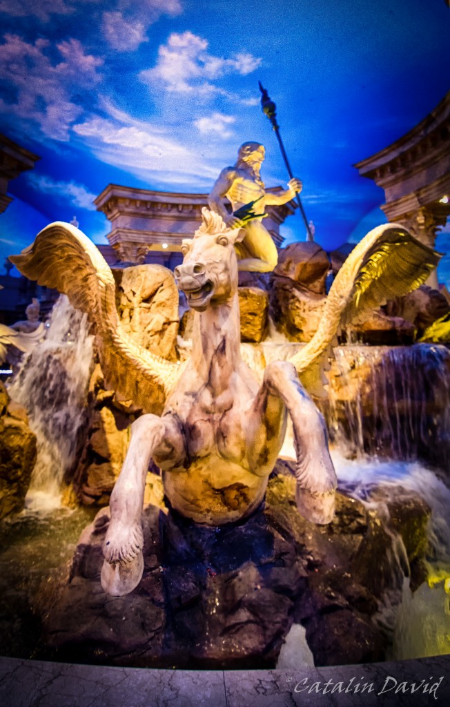
Also on the strip are some highlights from other cities – there is an Eiffel Tower replica (smaller size, see below) that hosts some restaurants, a Brooklyn bridge, a Pyramid hotel and others that I don’t remember. The city, the people and the constant distraction and stress to my senses (skin, eyes, ears – did I mention it was loud?) took their toll on my memory.

The casions are not disappointing, though – I liked the mix of technology and games and it was everything that I saw in the movies (and imagined). And the casino floor spreads for thousands of square feet / meters. An interesting interior was in the Bellagio:
This is a picture taken around 1-2 AM. How come? Well, the ceiling of the shopping alley is painted and lighted in (quite realistic) sky colors. At some point I lost track of time and was wondering why I was so tired in the middle of the day – took me a second to realize it’s the middle of the night and that I’ve been driving all day.
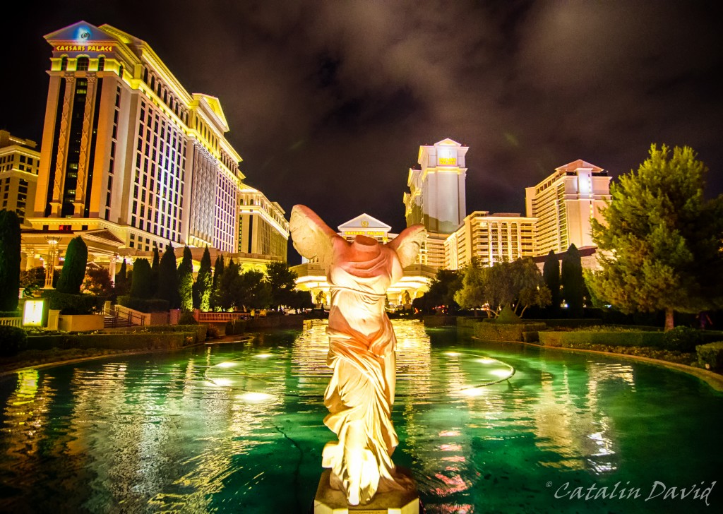
We walked around some more until late in the night up and down the strip and enjoyed the “cooling down” of the city. Next picture is outside the Caesar’s Palace casino:
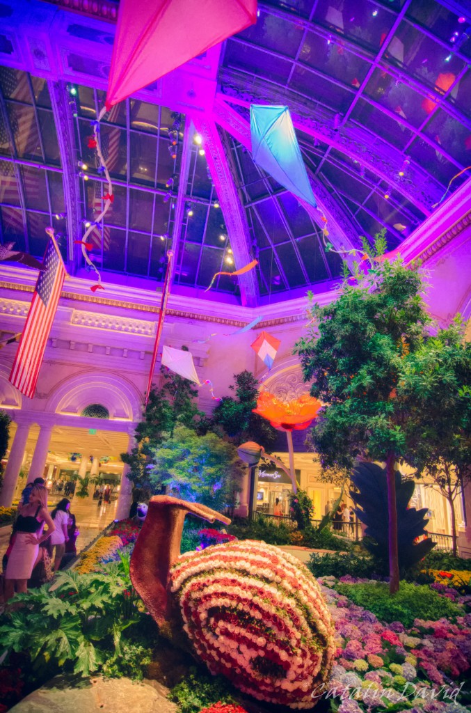
And this one is in a botanical garden arranged inside the Bellagio casino.
Overall, Vegas is an interesting city, definitely worth visiting for a couple of days – but not the kind of place I would go back to except for the activitiesspecifically (they have lots of shows, you can drive sports cars in the desert and other fun activities) or for photography (drunk people usually make for interesting subjects).
This was my Vegas adventure, one day left.
Catalin
Yes, I know – long time, no pictures.
Why? Life caught up with me. First, I bought a house. Yes, I am an owner – or almost, 29 years and a half to pay for mortgage, but still (pictures to come). Then, things happened, my girlfriend came to visit, we went to places, I moved from the apartment to the house etc.
Getting back to the story though 🙂
Last you heard we were in Hawaii and heading to another destination. This was on 4th of July – we flew Kona – San Francisco (again, 5 hour flight with nothing but water underneath) and then we boarded on a flight to the middle of the desert: Las Vegas. We got to Vegas around midnight and we finally made it to a bed on the strip around 2AM (“the strip” is the main street in Las Vegas where all the casinos and hotels are). At 2AM, the temperature outside was 85F (about 30 C). Unfortunately, we didn’t have a lot of time to spare since we had quite a travel planned for the next day.
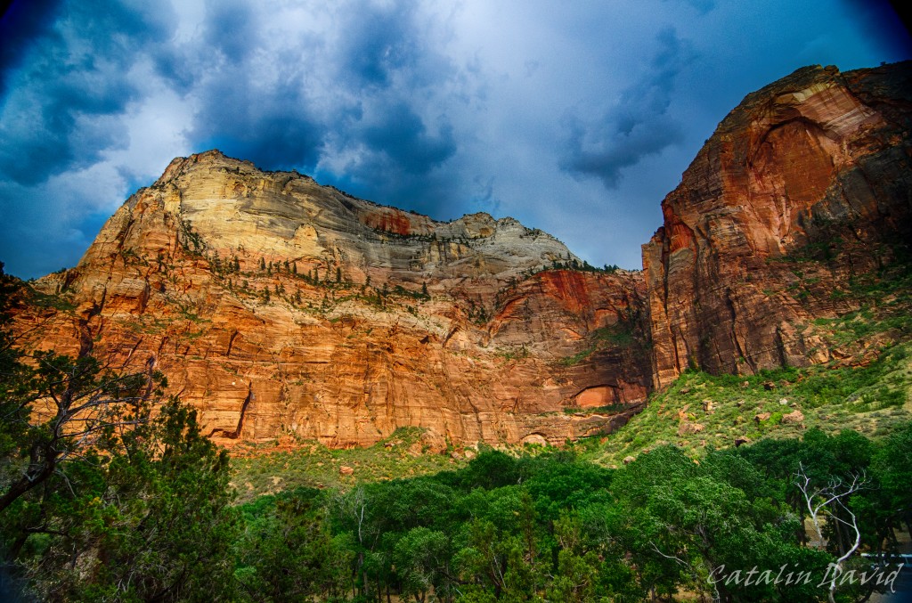
What trip? About 300km (160 miles) NE of Las Vegas is Zion National Park with its Zion Canyon. The Zion Canyon is impressive due to its color (see above – pretty much everything is reddish) and its design (see more below). I have been in Zion some time earlier and liked it a lot – more pictures and details to come.
So, after about 3 hours of me driving and mom sitting in the front seat paying attention so I don’t fall asleep, we reached the Canyon. The national park is really nice, you drive into it and then you park your car and hop on a bus that goes around the accessible part of the park. Like this, everyone is happy – you don’t have to spend time searching for a parking spot near the hike you want to take, no traffic on those narrow roads.
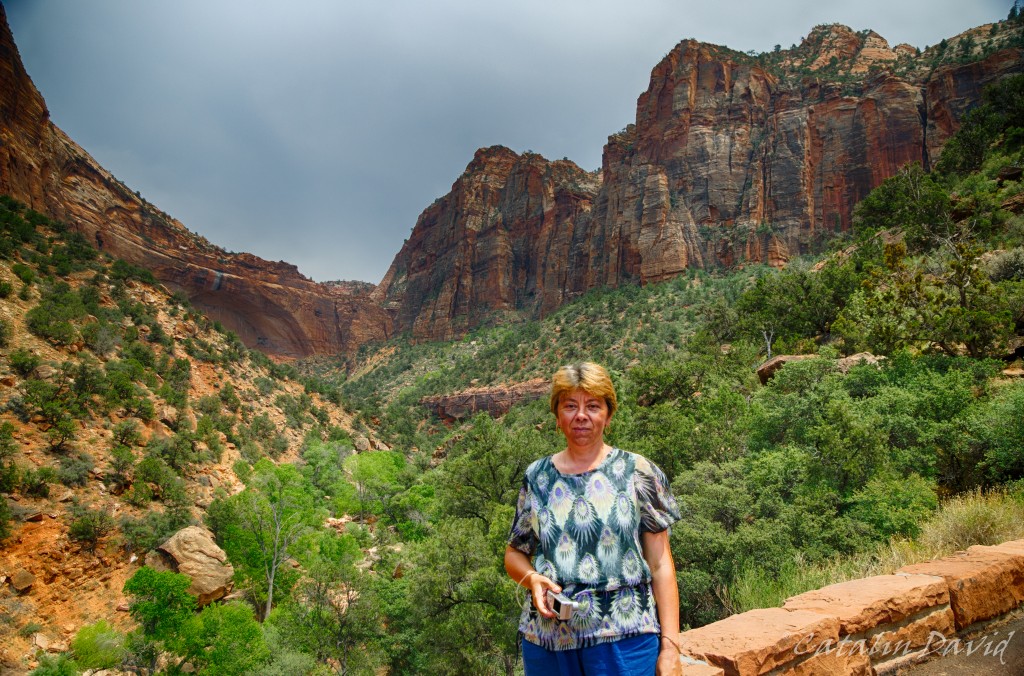
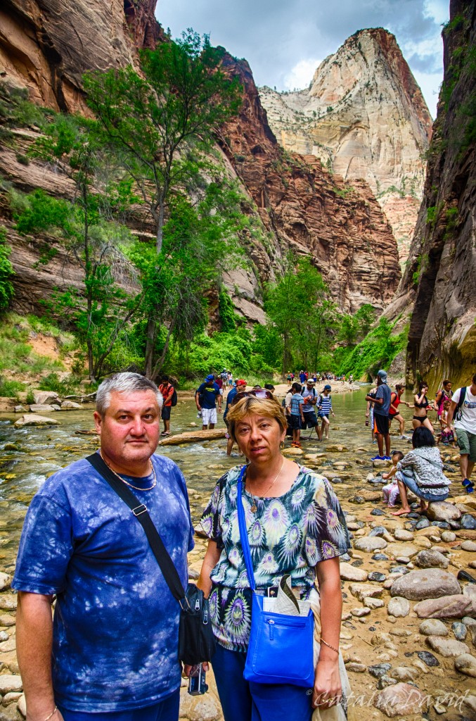
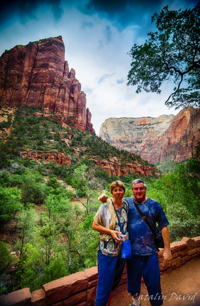
One of the things I liked most about Zion National Park is the perspective it gives you on the Canyon. Unlike the Grand Canyon (we’ll get there, no worries) where you are at the top of the cliff and look down upon … pretty much nothing, in Zion Canyon, you are the nothing and you have very tall (red) walls creeping up on you both to your left and to your right. Here, you can see my parents (a bit distorted by my 11-16 lens) and one of these walls.
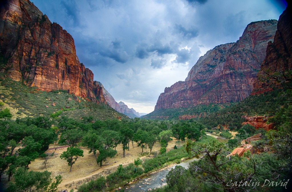
While at the entrance in the Canyon, the valley is open and buses can easily fit sideways, as you get deeper into the canyon, the walls come closer and closer together. In the top right corner in the picture above you can see a peak – it’s called Angel’s Landing. It is a 4 hour hike in which the last portion of the hike (about 1h each way) you have to use chains and pull yourself to get to the top – pretty fun. Since I was with my parents, I did not attempt it this time, but the last time I was here, I went all the way to the top (pictures to come).
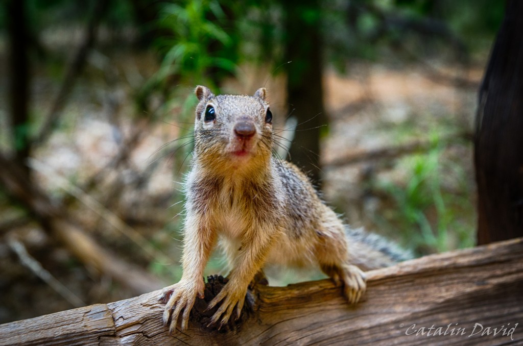
Instead, we took an easier trip that involves walking around through a forest filled with hungry squirrels.

Example 1. What are you looking at?
As you go deeper into the Canyon, you get to the entrance in what is called “The Narrows”. This is a long hike (couple of hours at least) that takes you deep into the canyon (and deep into the water) and through parts of the canyon that, you guessed it, are very narrow.
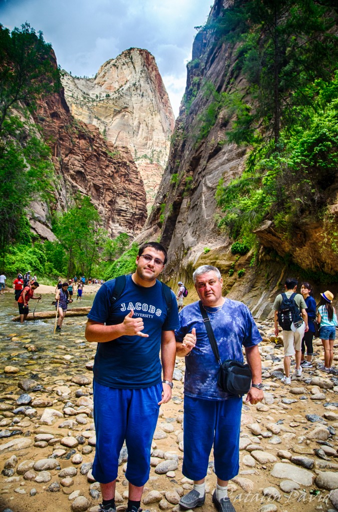
We did not do the narrows hike, but we jumped the pond and took a couple of pictures. Here, bringing some culture from Hawaii – the Shaka sign.
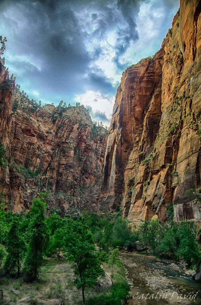
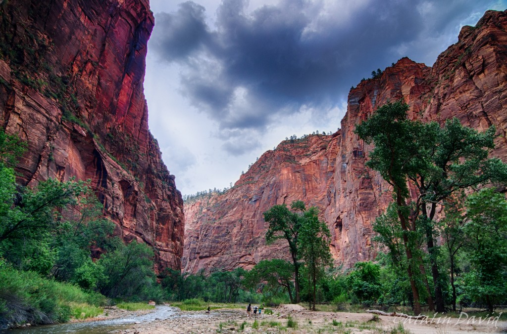
Nearing sunset time, the colors were very nice on those walls.
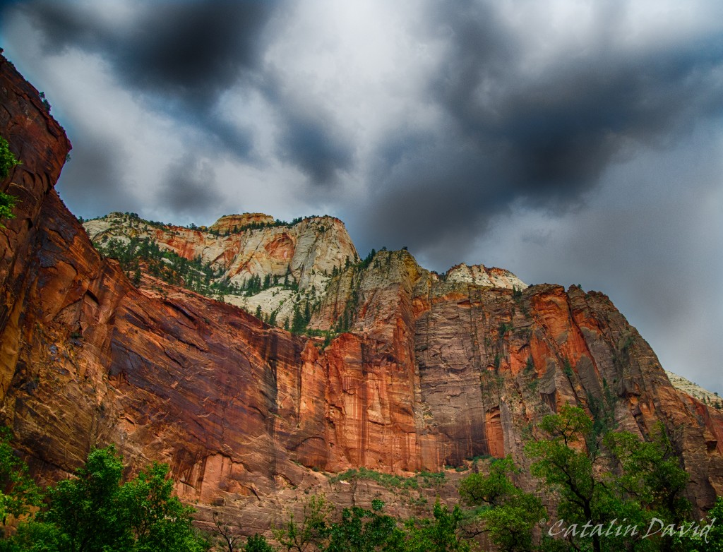
And these other walls.
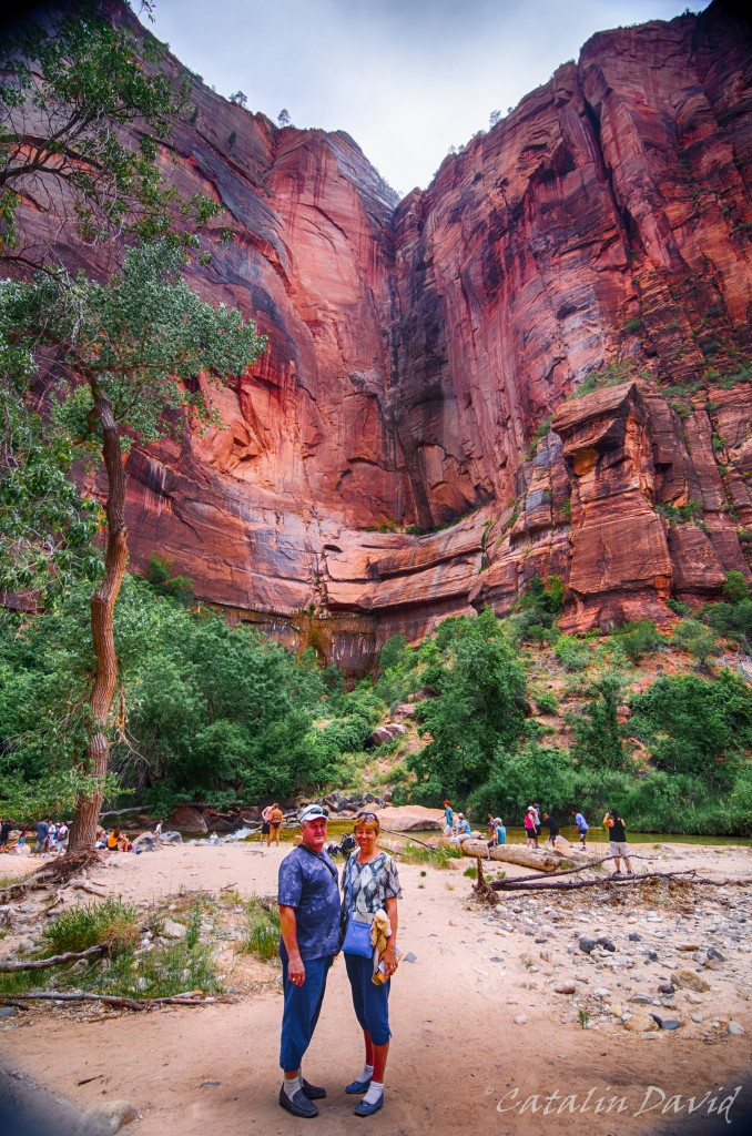
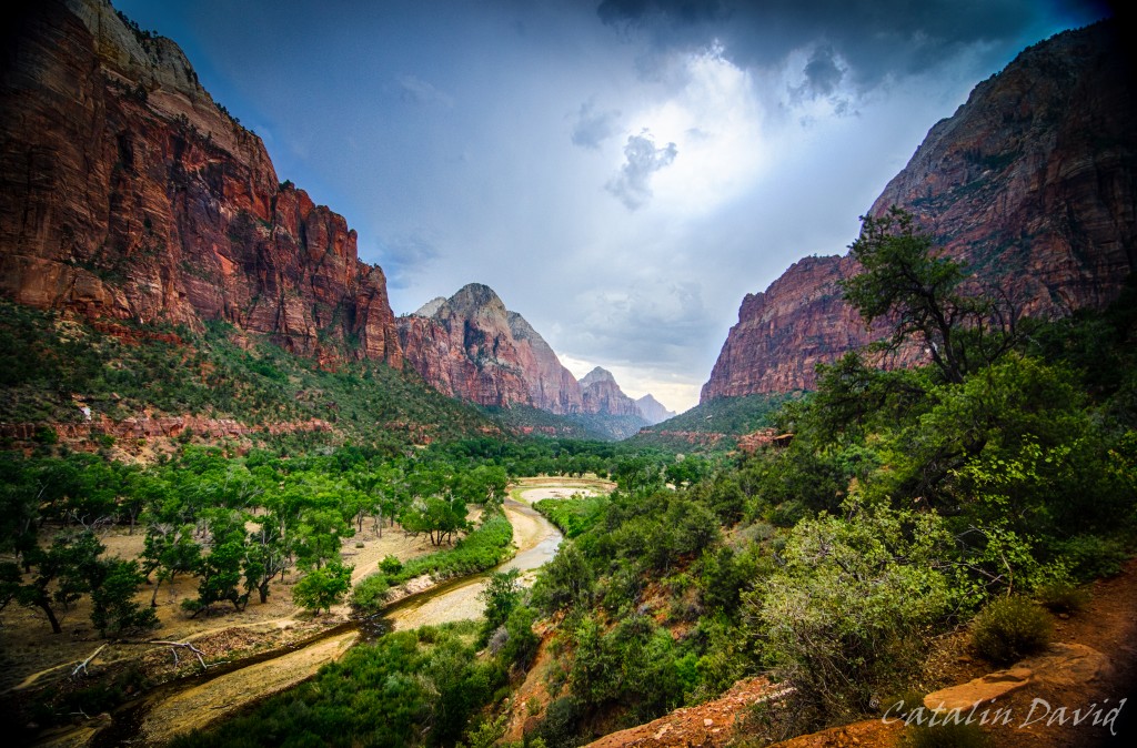
Although the weather was not the best – it was cloudy most of the time, I can’t complain. A day at 100F (35C) would not have been great at all. The sun came out near sunset and I was able to snap some cool pictures. Inside the canyon, we took a short hike – called the Emerald Pools. The hike is really easy, but it’s worth it for the view towards the exit of the canyon:
From different heights – one a bit above the trees so you can see the rest of the canyon, one closer to the nature and to the walls.
An interesting part of this hike is this narrow path – it’s not that long, but it makes for great pictures.

I think I have some better pics since the last trip there – I will check.
Finally, lack of sleep and walking all day long in a desert set in, so we had to head to St George for a night sleep and the trip on the next day.
Just around that time, sunset set in.
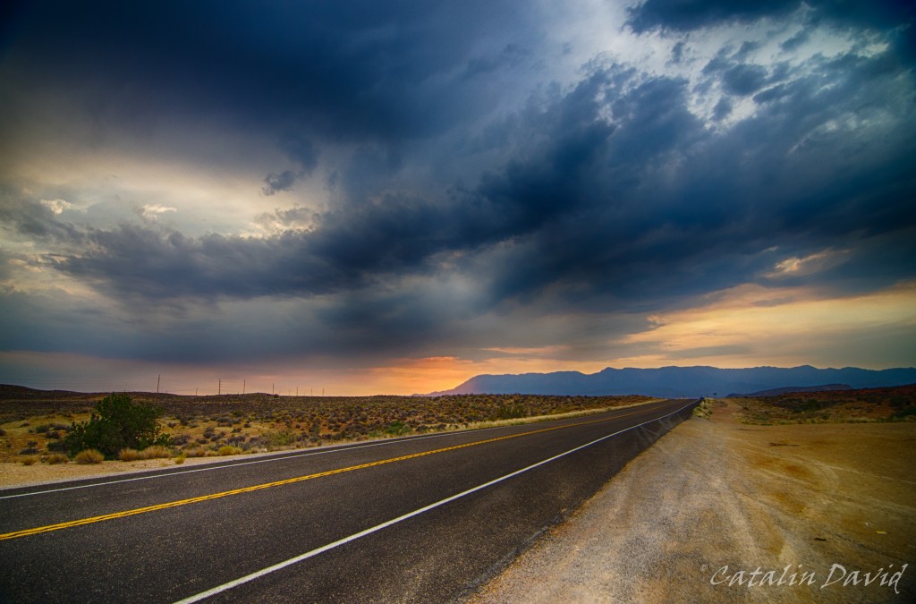
Dark clouds, a mountain, an empty road and a sunset make for a nice picture, I think, right?
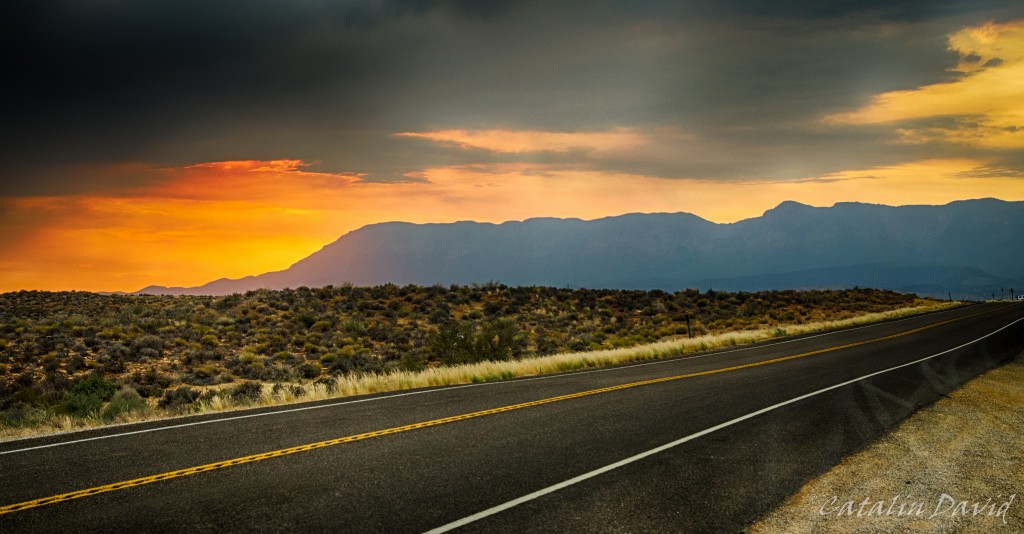
Especially with the sun hiding behind those mountains.
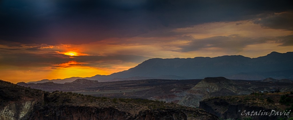
Or behind the clouds.
That was one true epic sunset 🙂 Kinda made up for the missed ones in Hawaii.
Off to bed and a new day,
/cd
P.S.: just changed the design of the website, looks a bit better for photo sharing. The WordPress theme name is Fontfolio.

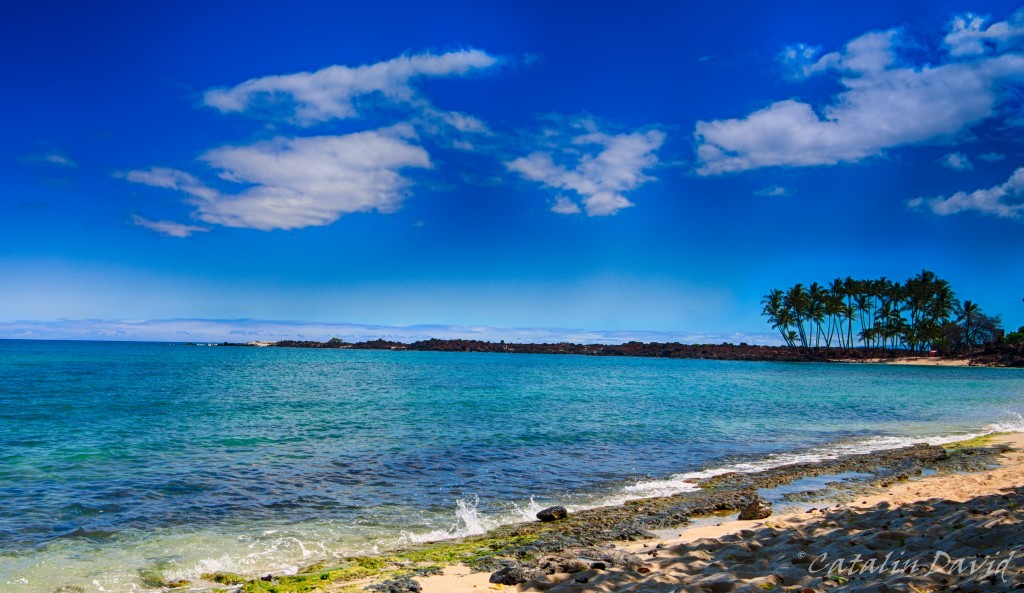
After two intense days of running around the Big Island, we decided to take some time off and do what “normal” people do – beach, sun and bathing. We talked to some of the locals and they directed us to a local beach nearby – a very nice one. Unfortunately, the access road was not that great, but this is exactly what made the beach even better – there was almost nobody there. Plus, it had shade from a couple of trees just on the edge of the water… Paradise.
Unfortunately, with every good thing (most likely) comes a bad thing. So, I fell asleep on the beach and… the shade moved. So after about 1h of sitting in the sun at noon time, my feet felt like they were melting. Plus, they were extremely red. Oh, well, we’ll have lotion at home, just stay hydrated and work through the burns.
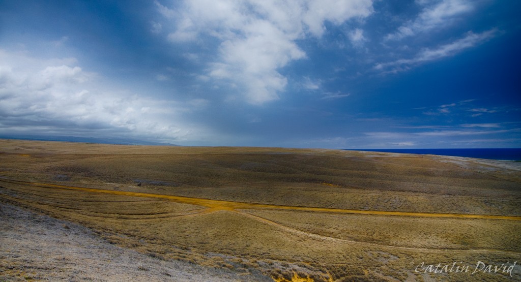
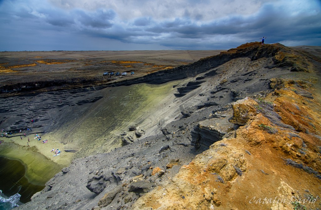
On another day, we took a trip to the “Green Sand Beach” – this is a beach in the Southern part of the Big Island that has … green sand. After seeing black sand beaches and “normal” beaches, green sand felt a bit of a stretch and exotic. Unfortunately, like any well-guarded secret, the road to the Green Sand Beach is … not paved. You can get within 3 miles of the beach on a public paved road, but the rest of the road requires a 4×4 car and some experience with the area. Why? Well, first of all, there is not only one road – there are about 10 roads that start from where you leave your car and get to the beach, all intersecting each other. Some of them have 1m high rocks in the middle of them over which your car needs to climb, some are smooth. One thing is certain – all of them are dusty, so this is a big problem if driving slow. Of course, some local drivers were kind enough to take us there for a small donation of $15/person. But once you get there… once you get there, it gets interesting. You are confronted with this:
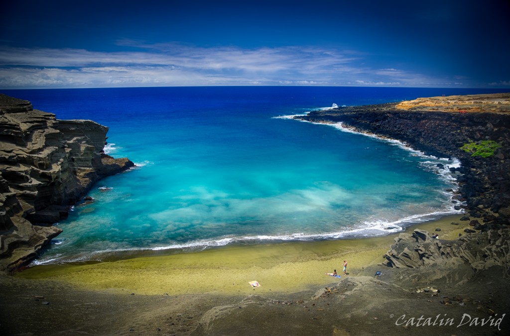
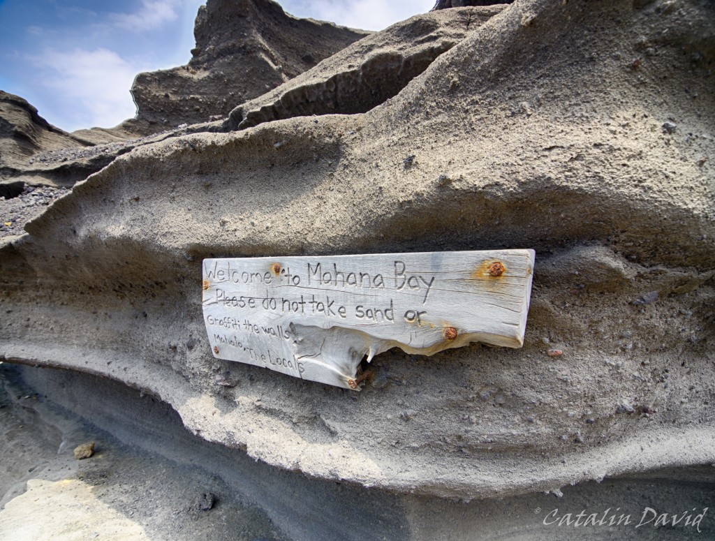
You are sitting on the edge of a cliff, with nothing underneath you for 30 meters. And the green sand beach awaits you at the bottom, contrasting with the blue of the ocean and the sky. There are some not-trivial-to-go-down-on steps that will take you to the beach, but, as soon as you start descending, a message from the locals:
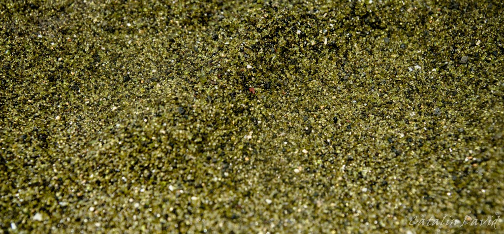
So, why is the sand green? Or at least somewhat greener… ? The source is, of course, Mother Nature – the sand is actually not sand, at least not from a chemical perspective. Due to the volcanoes on the island, high pressure and different minerals, a mineral named olivine has surfaced. The green sand is actually a bunch of small crystals that were eroded by the water and waves over many many many many years. The problem is that the crystals are not very resistant to the weather, so nobody knows for how long this beach will still have its green color. Here is the detail of the sand – once you zoom in, you can actually see the crystals there.
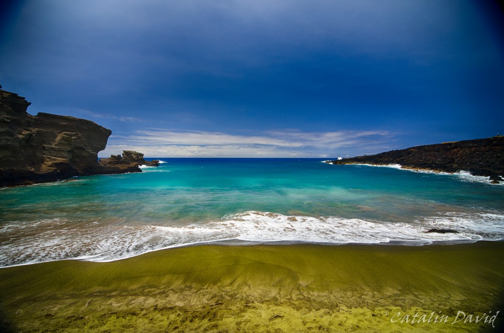
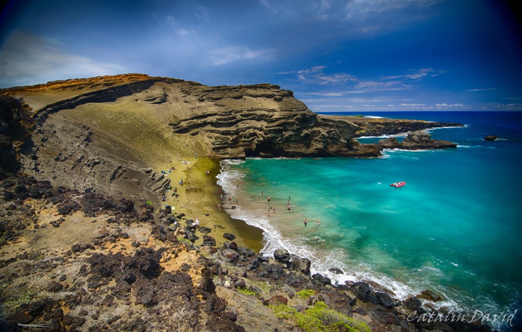
We safely got to the bottom, near the beach … and decided to take a dip in this beautiful place. The beach is not big, see pictures below, about 10-15 meters wide at high tide, but the fact that it’s secluded and in this awesome bay … makes up for everything.
Before we left – and believe me, we were trying not to, we decided to hike on the nearby coast for a bit. While cars could have made those signs, I still think that aliens came and X marks the spot where they will land.
On a more serious note, I really enjoyed the contrast between the dust and the dry atmosphere that the ground inspired and the blue of the ocean and the sky. Still, restless as I am, I went on the very edge of the cliff… About 20-30 meters above water, on the edge of the cliff and snapped this picture. And that is mom, hand waving in the top right corner.
In these pictures, you can see where the olivine actually comes from – the very top and with the help of rain / wind / gravity, it makes its way to the bottom, on the beach. We had a bit of time to spare, so I went to the other side of the golf and snapped a picture from the other side, to see where I was standing when I took the picture above.
When we finally left we saw that there was a sign that said “South Point”. I had read a bit about it, but since we were already there… we decided to go. Apparently, this is the Southern-most point of the United States of America (therefore, South Point). Not much going on here, just a bunch of locals fishing…
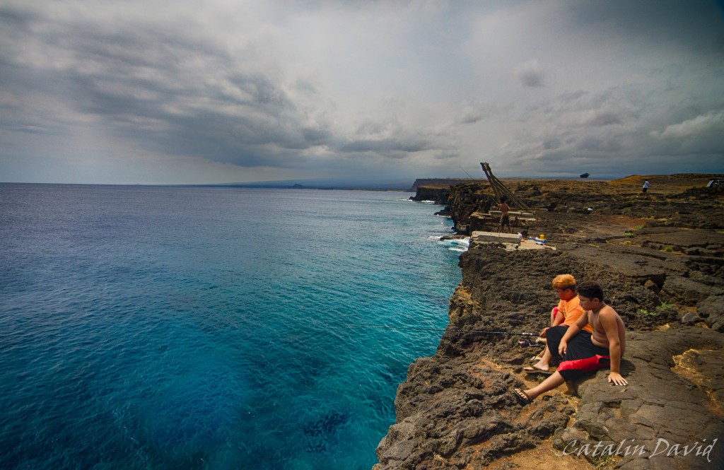
and jumping into the clear water. You wouldn’t believe it, but the water in the picture above is about 5m deep near the edge of the cliff and we saw a couple of people jumping in. Unfortunately, I was too jaw-dropped to take pictures.
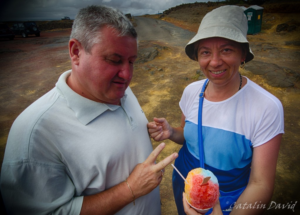
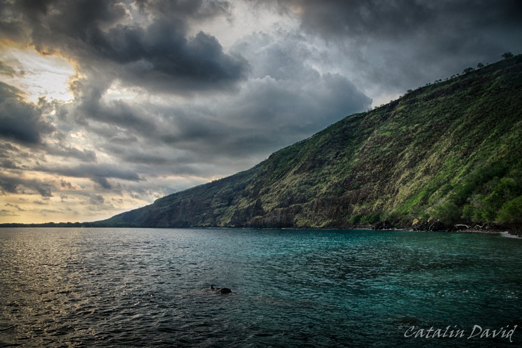
Strolling around for a bit, we got to a shaved ice stand and mom and dad had a bit of rainbow-flavored shaved ice. On our way back from the southern part of the island, we stopped at Kealakekua bay – this is where the British explorer, Captain Cook was the first documented European to step on the island. This is also the place where he died, killed by the locals.
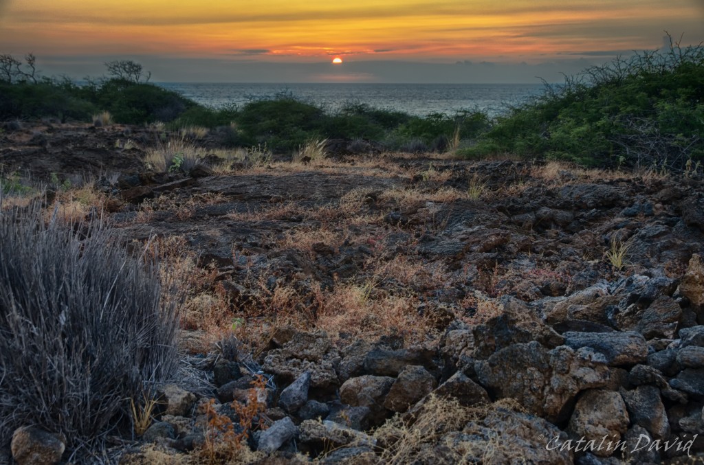
A trip to Hawaii is not a trip to Hawaii without a picture of a sunset. This is one that I snapped on a day, coming back from the beach. The clouds at the horizon usually make it so you can’t get a good picture of the sun setting into the water, but you play with what cards you are dealt 🙂
Next up, the rest of our trip (done with Hawaii, but not with the trip). Over and out,
/cd
I just came back from a pseudo-pub-crawl, so take all my words and wording with a grain of salt (and a bit of lime afterwards, just like a tequila shot). Anyway…
Secret of the trade: presentations should start with a joke or something to get the people hooked. My take on it: Europeans think that 200km is a long distance and Americans think that 200 years is a history (managed to insult about 3/4 billion people with this). Yet, the fact that amazed me most on this trip that I took was the amount of stuff that was built in the United States while many things that should have damaged the economy were happening (e.g.: WW1, financial crysis, WW2). And then, you take a look at Romania and you take a look at the United States and realize that Romania suffered throughout the 20th century, while the United States have (almost) continuously flourished. That made me realize that most of the great “achievements” of Romania either were done before the 20th century or, if in the 20th century, they were not that great. As for the US, you can win wars by funneling just the right amount of resource at the appropriate time and keep your economy stable. Anyway…
The story is in part about my experience of Seattle and also of my parents’ visit which starts in Seattle, where they arrived after their first inter-continental journey. Of course they were tired and had lots of luggage, but I was happy to see them and they were happy to see me. I was even more excited to see them when we got at home and they pulled out a bottle of TUICA (or RAKIA or plum brandy) out of their bags and we got to celebrate with Romanian goodies. After that, we took a stroll around Seattle by car. Of course, I forgot to take my camera with me, so the picture taking was reduced to my phone (which, honestly, did a pretty good job). First we went to Kerry Park. This is, in my opinion, one of the first places that you should see such that you can capture all the breadth of Seattle, from Queen Anne and Capitol Hill all the way to Alki Beach. While you are here, you can get a view of where things are in the city and it will help you get a better understanding of where the Space Needle is, where the Columbia tower is and pretty much what’s in between. If you are really lucky, you can also see Mt. Rainier there in the background (unfortunately, I was not that lucky on that day). The view is impressive and it’s not just my opinion – the price of a 1-bedroom facing the city is very high in this area. Just take a look here – I would love to wake up to this view every morning (please remember to click on the image for a bigger size):

We then took a trip to Alki Beach (furthest to the right in the picture above). This provides a whole new, contrasting perspective on the city. While at Kerry Park you can experience views of the city from above, Alki Beach is actually at the sea level and you can see the skyscrapers and the city from afar. The view is particularly spectacular at night when the whole city is lighted up (this is a picture from February – it took a bit of shivering on my side to get such an exposure, but well worth it, as always).

One last perspective of Seattle is from on top of I-90 (Interstate highway), at the top of Rizal Park. The view of the skyline is similar to Alki Beach, but you are now on top of a hill again (like Kerry Park). The difference that I feel is that you are now more “engaged” into Seattle, you can see the people driving, you can almost feel the heart of the city beating.

Time is creeping in on me and I have to get up in 6 hours, so I will stop here.
Out for now,
/cd