Month: May 2014

After the day in Zion National Park – which was awesome, BTW – we took a detour and spent the night in St. George (funny thing – Romania has a city with that name as well).
The plan for the next day was to visit the North Rim of the Grand Canyon, go further East and then go over the Colorado river (which is to blame for all of this), head back west, stop at the South Rim just in time for sunset and drive further West to Las Vegas. Well, that didn’t quite turned out as planned, but it was fun.
So, we woke up around 8, left St. George around 9 and drove to North Rim. North Rim is about 150 miles or 3 hours away from St. George. The road is really interesting – unfortunately I have no pictures as I was driving. There are a couple of straight lines, with nothing in sight for miles and a speed limit of 60 mph. For the most part, we stayed around that limit, but sometimes it really feels like in the movies, going through the desert at 90+F (32C) and getting bored. Luckily, only parts of the road were straight lines in the desert.
So, what is North Rim? Well, as the name says, it is the North rim of the Grand Canyon (thank you Captain Obvious). The Grand Canyon is actually so wide in some places that they needed to make a difference in where you are. The main difference between the northern rim and the southern rim is that the North Rim is at a higher altitude and is more “foresty” while the South Rim is at a lower altitude and drier. Most of the pictures that you will see of the sunset are actually taken at the South Rim, as that is closer to the Colorado river. As I was saying, the Colorado river is the main thing to blame for this huge natural attraction (and I do mean huge), alongside with the rocks and the relief inside the canyon. In fact, the Grand Canyon is so big that to get from the North Rim to the South Rim – which is about 5 miles in SLD (straight line distance) – you need about 4 hours worth of driving (even better, when we were there some of the roads were closed, so it would have been a 5+h drive).
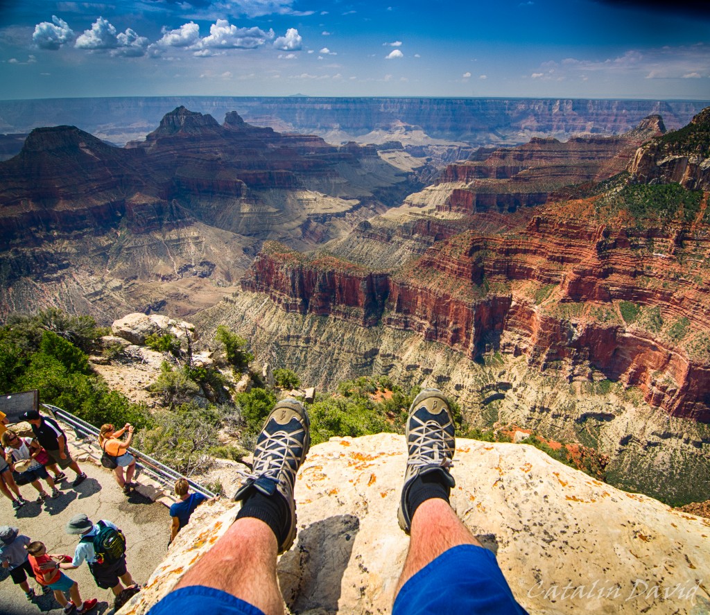
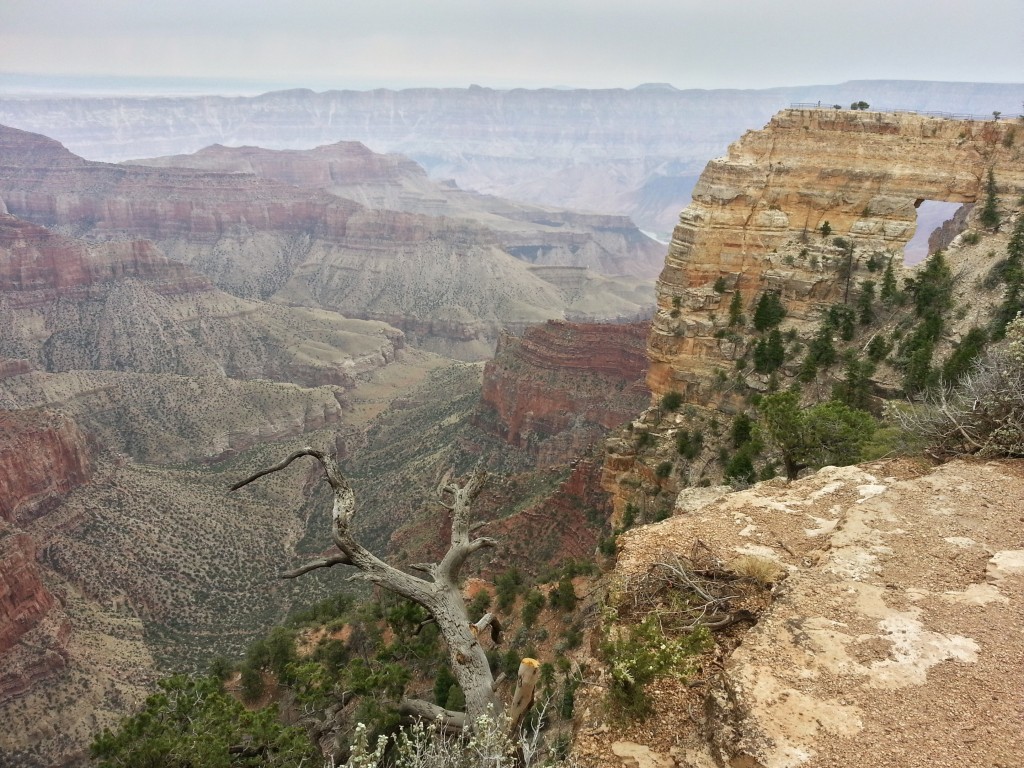
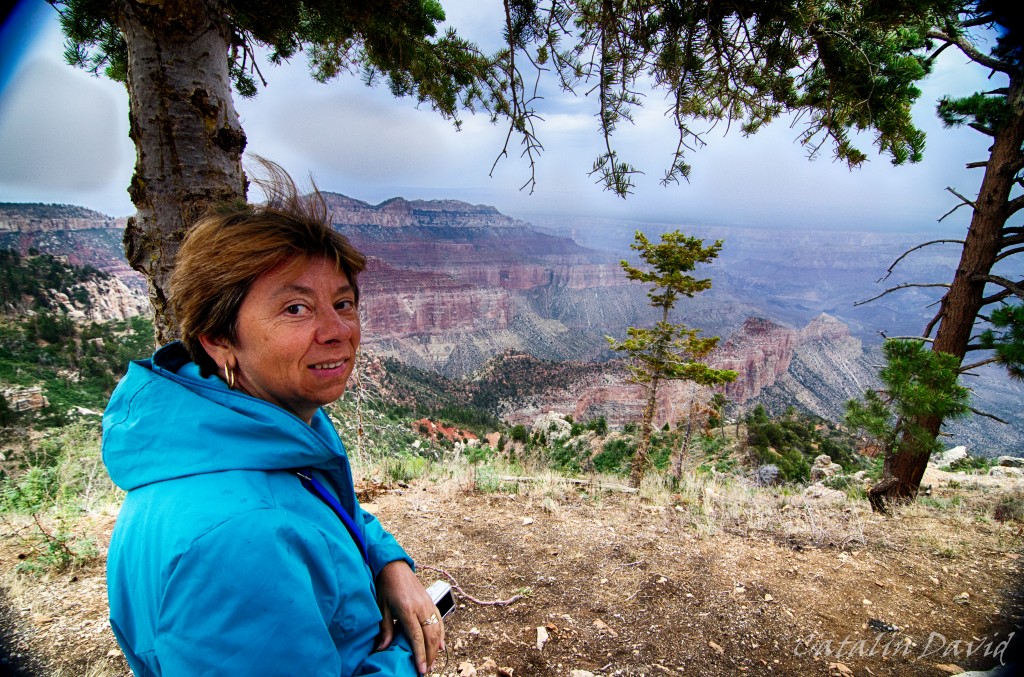
Anyway, too much talking… we got there at 12 and started visiting. This is one of the first sights that we got of the Grand Canyon. And boy, is it steep.
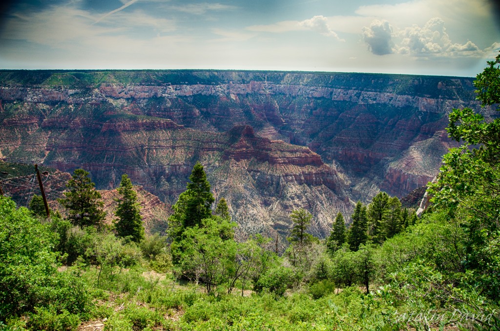
I am in general not very afraid of heights – but here, I had to keep away from the edge quite a bit. This was facing East and you can already see that there are quite a bit of trees around. After 20 minutes, we got to a southern lookout:
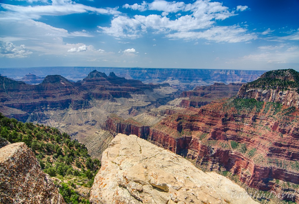
Again, you can see that I am not too close to the edge here either – I am not that crazy. Still the view was nothing short of impressive. It was one of those things that you see them on TV, you see it in the pictures… but unless you are there, you can’t quite get the full experience. Being able to see every detail of the mountain, so many curvatures, so many lines going in different directions, so much 3D (that you can’t actually get on camera) – this is the experience that I got from the Grand Canyon.
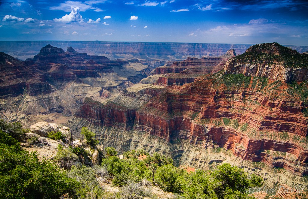
A bit closer to the eeeeeedgeeee.
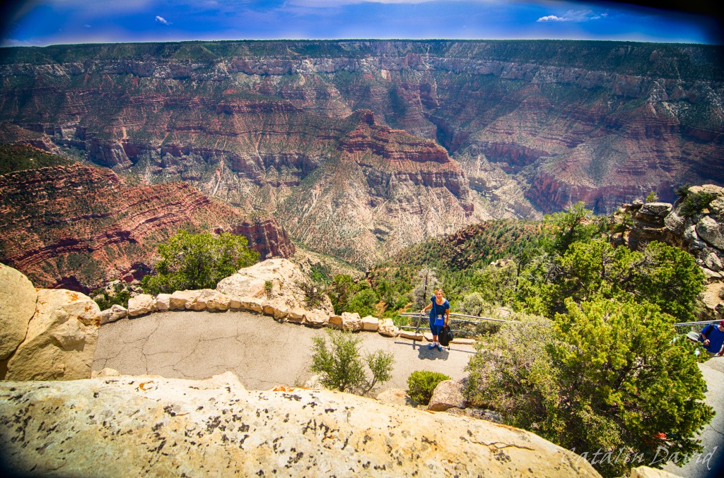
And then there was a top-of-the-rock that you could climb (name is Bright Angel Point). Looking East towards the foresty part and mom in the foreground.
And then, switching towards South, putting my sexy, beautiful, burn from Hawaiian sun legs in the picture (also on top of Bright Angel Point).
What? No? I don’t have sexy legs?
We walked around a bit more and decided to be hipsters – got a selfie of the 3 of us (hipsters because this is from last year, before selfies were cool – if in doubt, search for “ellen degeneres oscars selfie 2014”).
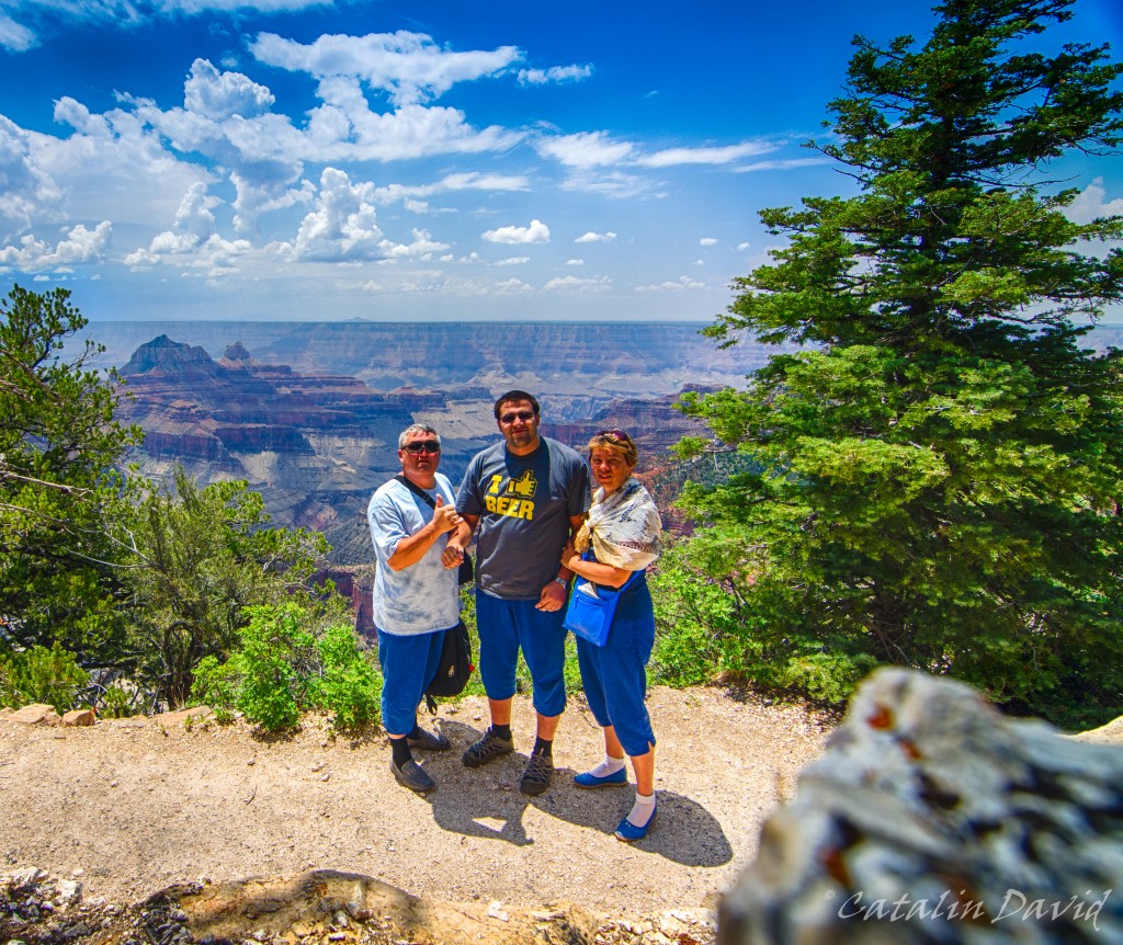
Of course, the rock is there for artistic composition. At this point, it was around 2PM and we had a choice to make – drive 5-6h to the South Rim, watch the sunset and another 3-4h to Las Vegas or visit most of the stuff in the North Rim and head back the same way to St. George and to Vegas. We chose the second option, as it would allow us to see more rather than just go to the more touristy, most likely crowded South Rim (reference: this is on Saturday, the 6th of July, on the 4th of July long weekend, so we expected South Rim to be really crowded).
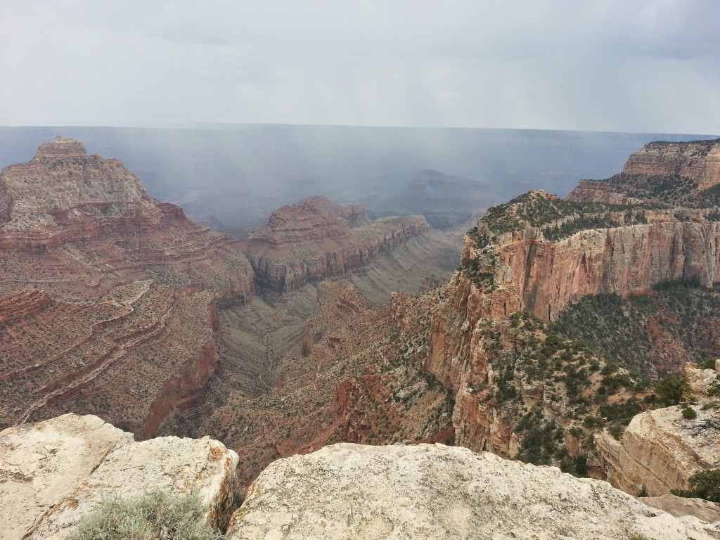
So, we made our way to the other two viewpoints: Point Imperial and Cape Royal. Cape Royal was the first one.
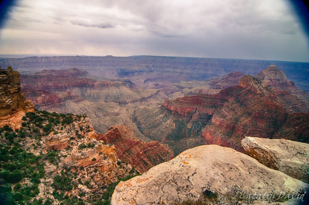
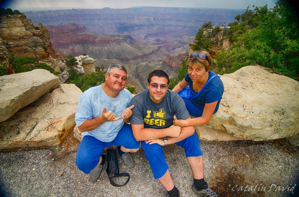
This place provides a more in-depth view of the Grand Canyon. As you can see, the weather also turned quite a bit, but it was not raining – so we got to take a picture. Another selfie:
Then I decided to take some pictures with the phone – I am not quite sure why and I am pretty sorry for the quality (they could use a bit of work).
Nearby, it started raining – you can see in the picture below and we witnessed some lightning strikes that went down in the canyon. Come to think of it, I believe it was safety that made me decide not to use the camera – afraid to put the camera on the metal tripod or on the railing.
Some of us were pretty … electric.
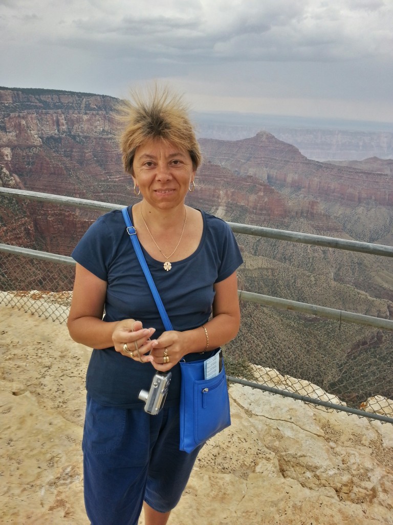
Apparently, the bad weather was creating a lot of static energy at this place, causing my mom’s hair to go … cuckoo!
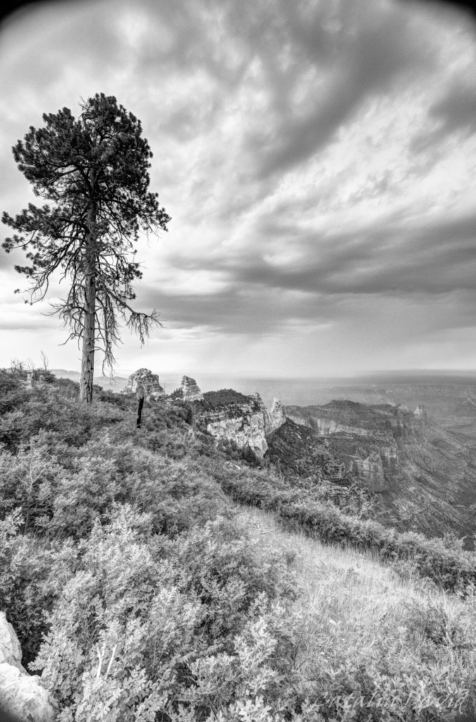
Then my artistic experiment thingie went off and decided that a lonely tree on the edge of the Grand Canyon would be a worthy shot. I think it looks pretty cool in black-and-white, but I think that there are a conditions and a subject requirements to take a b&w picture. The requirements would be a cloudy sky and a solitary subject – but again, this is one of the few b&w pictures.
We stopped a couple of times no the way between the Cape Royal and Imperial Point and took more pictures. The field of view already got smaller and smaller due to the rain that was far away and less light. That actually benefited some of the contrasts between the red of the canyon and the dark of the sky:

We finally got to Point Imperial…

And the outlook was pretty nice.
We strolled around the park for a bit and then headed back to the car and drove to St. George and further to Las Vegas.
/cd
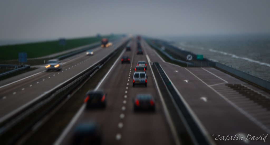
I am beginning to like this …
The power of perspective change seems to be a bit addictive and the fact that you can take normal images with life-size objects and turn them into your little toys in your imagination and project that via a photo seems like a very powerful tool.

About the photo – still in the Netherlands, on the same trip as the previous one. If memory serves me right, this is on highway A7, between the cities of Den Oever and Kornwerderzand – Bing Maps tells me it’s called Breezanddijk.
Over and out,
/cd

Inspired by the image of the day on Bing today… http://500px.com/photo/36677568/arc-de-triomphe-paris-by-sebastian-helmke
I decided to give it a try as well, see what happens.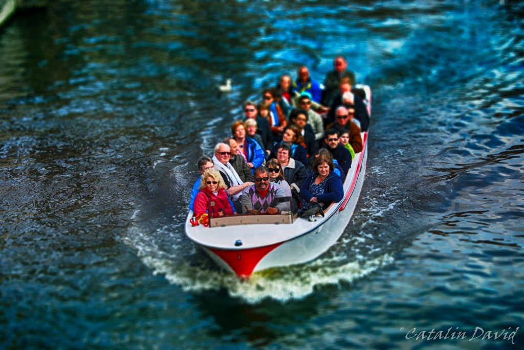
I think it looks pretty cool and you just want to pick them up and take them home…
About the photo – it is taken a couple of years ago, in Amsterdam, on one of the water channels inside the city.
/cd
Yes, I know – long time, no pictures.
Why? Life caught up with me. First, I bought a house. Yes, I am an owner – or almost, 29 years and a half to pay for mortgage, but still (pictures to come). Then, things happened, my girlfriend came to visit, we went to places, I moved from the apartment to the house etc.
Getting back to the story though 🙂
Last you heard we were in Hawaii and heading to another destination. This was on 4th of July – we flew Kona – San Francisco (again, 5 hour flight with nothing but water underneath) and then we boarded on a flight to the middle of the desert: Las Vegas. We got to Vegas around midnight and we finally made it to a bed on the strip around 2AM (“the strip” is the main street in Las Vegas where all the casinos and hotels are). At 2AM, the temperature outside was 85F (about 30 C). Unfortunately, we didn’t have a lot of time to spare since we had quite a travel planned for the next day.
What trip? About 300km (160 miles) NE of Las Vegas is Zion National Park with its Zion Canyon. The Zion Canyon is impressive due to its color (see above – pretty much everything is reddish) and its design (see more below). I have been in Zion some time earlier and liked it a lot – more pictures and details to come.
So, after about 3 hours of me driving and mom sitting in the front seat paying attention so I don’t fall asleep, we reached the Canyon. The national park is really nice, you drive into it and then you park your car and hop on a bus that goes around the accessible part of the park. Like this, everyone is happy – you don’t have to spend time searching for a parking spot near the hike you want to take, no traffic on those narrow roads.
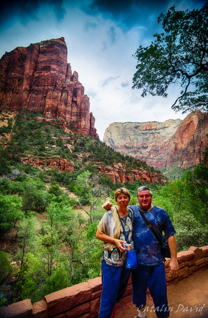
One of the things I liked most about Zion National Park is the perspective it gives you on the Canyon. Unlike the Grand Canyon (we’ll get there, no worries) where you are at the top of the cliff and look down upon … pretty much nothing, in Zion Canyon, you are the nothing and you have very tall (red) walls creeping up on you both to your left and to your right. Here, you can see my parents (a bit distorted by my 11-16 lens) and one of these walls.
While at the entrance in the Canyon, the valley is open and buses can easily fit sideways, as you get deeper into the canyon, the walls come closer and closer together. In the top right corner in the picture above you can see a peak – it’s called Angel’s Landing. It is a 4 hour hike in which the last portion of the hike (about 1h each way) you have to use chains and pull yourself to get to the top – pretty fun. Since I was with my parents, I did not attempt it this time, but the last time I was here, I went all the way to the top (pictures to come).
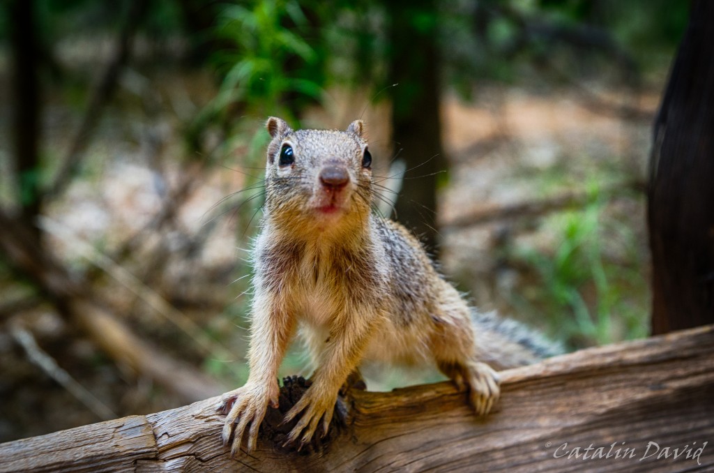
Instead, we took an easier trip that involves walking around through a forest filled with hungry squirrels.

Example 1. What are you looking at?
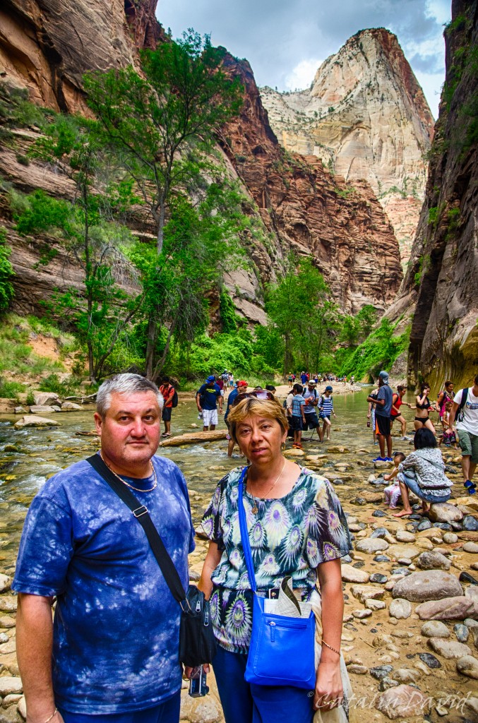
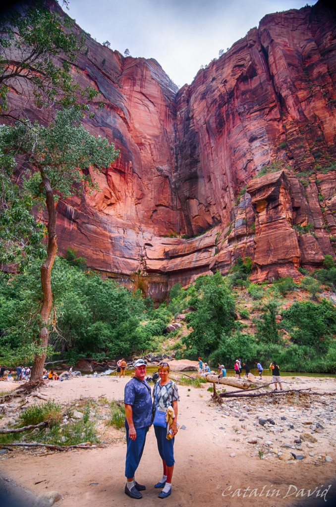
As you go deeper into the Canyon, you get to the entrance in what is called “The Narrows”. This is a long hike (couple of hours at least) that takes you deep into the canyon (and deep into the water) and through parts of the canyon that, you guessed it, are very narrow.
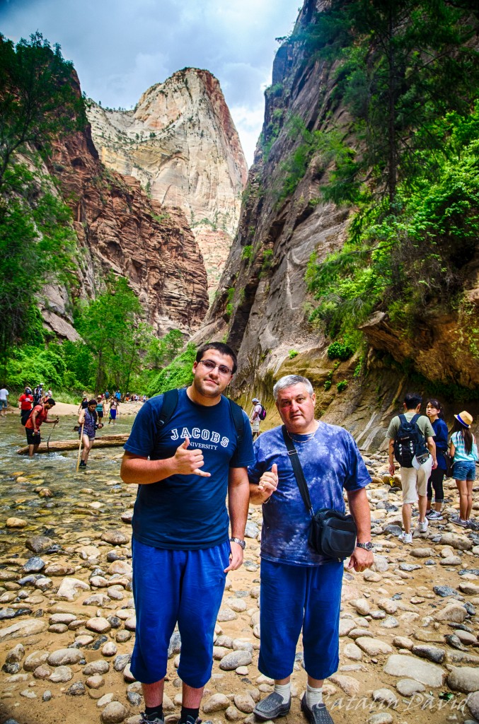
We did not do the narrows hike, but we jumped the pond and took a couple of pictures. Here, bringing some culture from Hawaii – the Shaka sign.
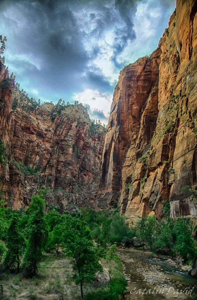
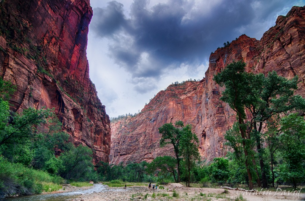
Nearing sunset time, the colors were very nice on those walls.
And these other walls.
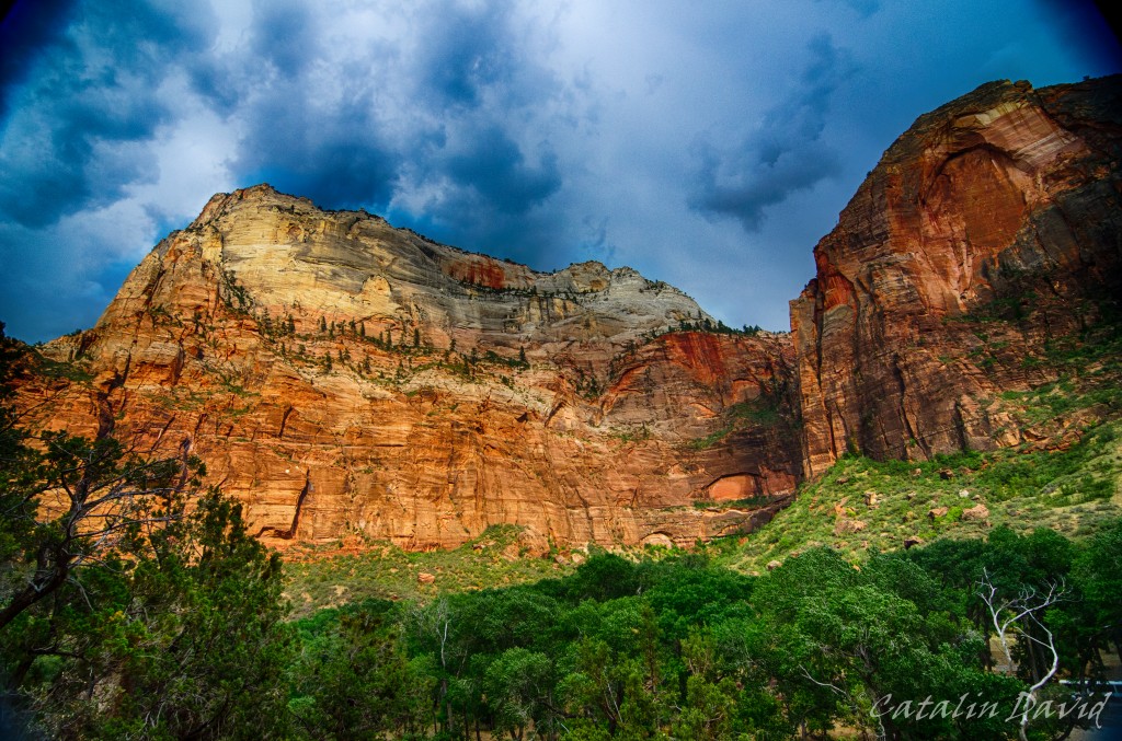
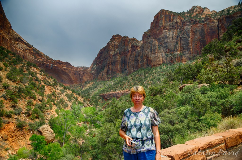
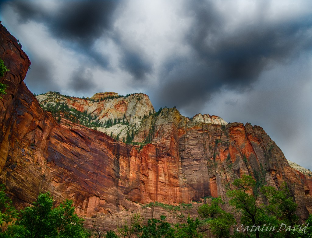
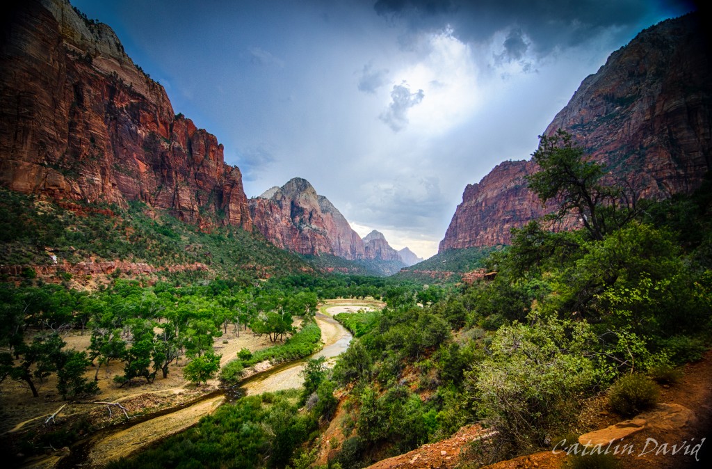
Although the weather was not the best – it was cloudy most of the time, I can’t complain. A day at 100F (35C) would not have been great at all. The sun came out near sunset and I was able to snap some cool pictures. Inside the canyon, we took a short hike – called the Emerald Pools. The hike is really easy, but it’s worth it for the view towards the exit of the canyon:
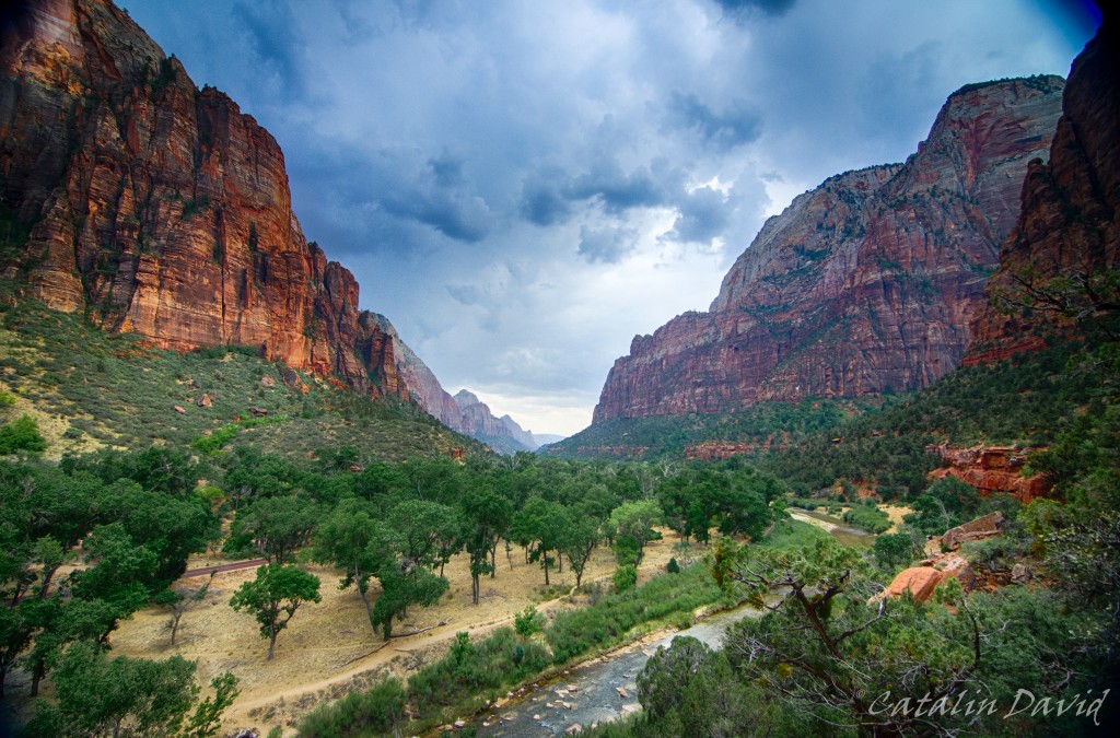
From different heights – one a bit above the trees so you can see the rest of the canyon, one closer to the nature and to the walls.
An interesting part of this hike is this narrow path – it’s not that long, but it makes for great pictures.

I think I have some better pics since the last trip there – I will check.
Finally, lack of sleep and walking all day long in a desert set in, so we had to head to St George for a night sleep and the trip on the next day.
Just around that time, sunset set in.
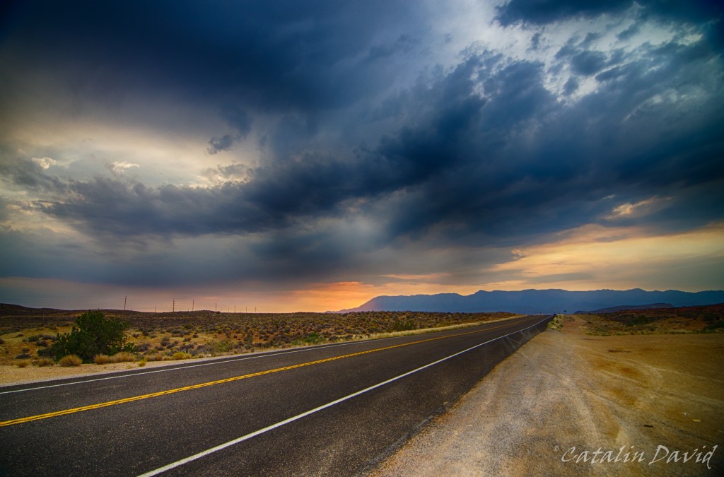
Dark clouds, a mountain, an empty road and a sunset make for a nice picture, I think, right?
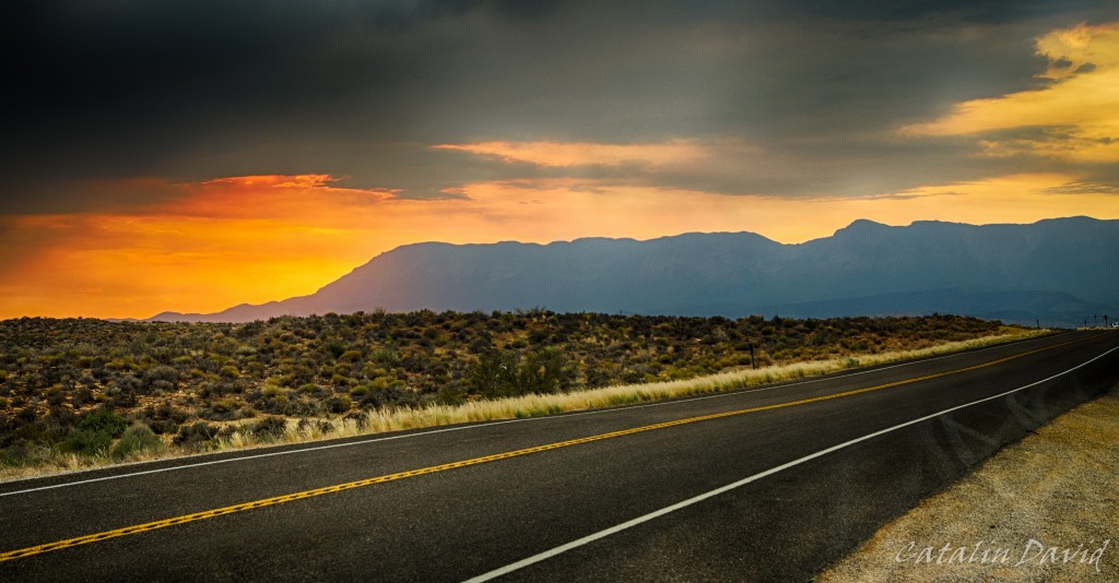
Especially with the sun hiding behind those mountains.
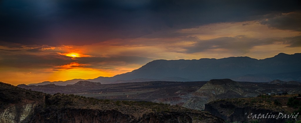
Or behind the clouds.
That was one true epic sunset 🙂 Kinda made up for the missed ones in Hawaii.
Off to bed and a new day,
/cd
P.S.: just changed the design of the website, looks a bit better for photo sharing. The WordPress theme name is Fontfolio.