Hawaii – day 1

Well, this took a while… I took the pictures about 6 months ago, I started processing them about 3 months ago, had them ready about 1 month ago and since then they have been sitting on my computer, waiting to be published… Also, Happy New Year! Also, don’t forget to click on the pictures to see them better.
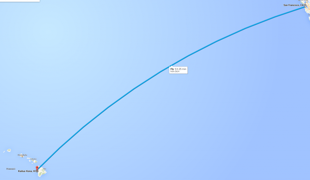
If you want me to be technical, this is not day 1, but day 2. On day 1, we (my parents and me) caught a flight from Seattle to San Francisco and then to Kona, Hawaii (on the Big Island – more on that later). About the flight – for me, it always is a bit of a scary feeling when the flight is 5h and it’s a straight line over the Pacific, making water landing the only possibility for survival in case of a disaster (credits to Google Maps for the pic).
This was my second visit to Hawaii – i was at a conference there a couple of years back and the flight experience that I had then was not the best. Then, I was flying Hamburg – London – Los Angeles – Hawaii and on the London – Los Angeles leg of the trip, one of my ears went pretty deaf due to the change in pressure. I had lots of fun at the airport in Los Angeles when, for every question that the TSA / Customs had to ask me, I had to turn my head and usually ask “Can you please repeat that?”. I finally got on to the Hawaii flight, my ears came back to normal once the cabin was pressurized and I was able to get a bit of sleep on that long day. About 2-3 hours into the flight, I can hear one of the flight attendants calling out “Code Blue!!!!” on the intercom and shortly after, 2 other flight attendants rushing to the front of the plane. One of them comes back, with almost a smile on her face and asks “Is anyone here a doctor?”. Luckily, I guess there was a medical conference in Kona on that week since 5 people around me raised their hands. The old lady sitting next to me later on informed me that she found out from one of her friends in first class (word goes around quickly, even on a plane) that someone has had a heart attack and that they had to shock his heart with adrenaline. 45 minutes before landing, the pilot informs us that due to a medical emergency on board, we will descend into Kona faster than usual, leading to my ear blockage again. The rest of the story is fun, but I’ll save it for some other time.
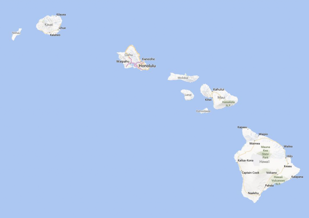
As I was saying, this is the second time that I have been to Hawaii, the second time to the Big Island and the second time in Kona. Looking above (credits to Bing Maps for the pic), you can see the Hawaii islands and the biggest one is “The Big Island” – pretty straightforward right? The other big ones are Maui, Kauai and Oahu – I haven’t researched them that much. All I know is that Oahu is the island that has the capital of the state – Honolulu and that is where Pearl Harbor is and that is where they filmed parts of the Lost TV series. The islands are pretty far away from each other, so for island-hopping, you need to board a plane and take an 1h flight to get to another island (150-200$ return trip).
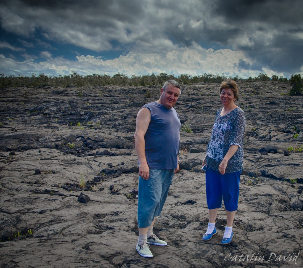
Anyway, back to the trip. Day 1 was pretty much a long flight SEA – SF – KOA and then we reached Kona in the afternoon and just drove to the hotel, walked around the beach just outside, had dinner and went on to prepare for the next day. We were at a little hotel just in downtown Kona and we had ocean view – a pretty nice place. Also, for the sake of photography – I was travelling light (no checked in luggage for the 3 of us), so I couldn’t take ALL my lenses with me. I ended up taking my Tamron 17-50 f/2.8 and my Tokina 11-16 f/2.8 (and boy, did that come in handy – you will see later) and the tripod. All the photos have been slightly postprocessed using Nik Software (in particular HDR Efex Pro 2) and Lightroom 5. So, second day.
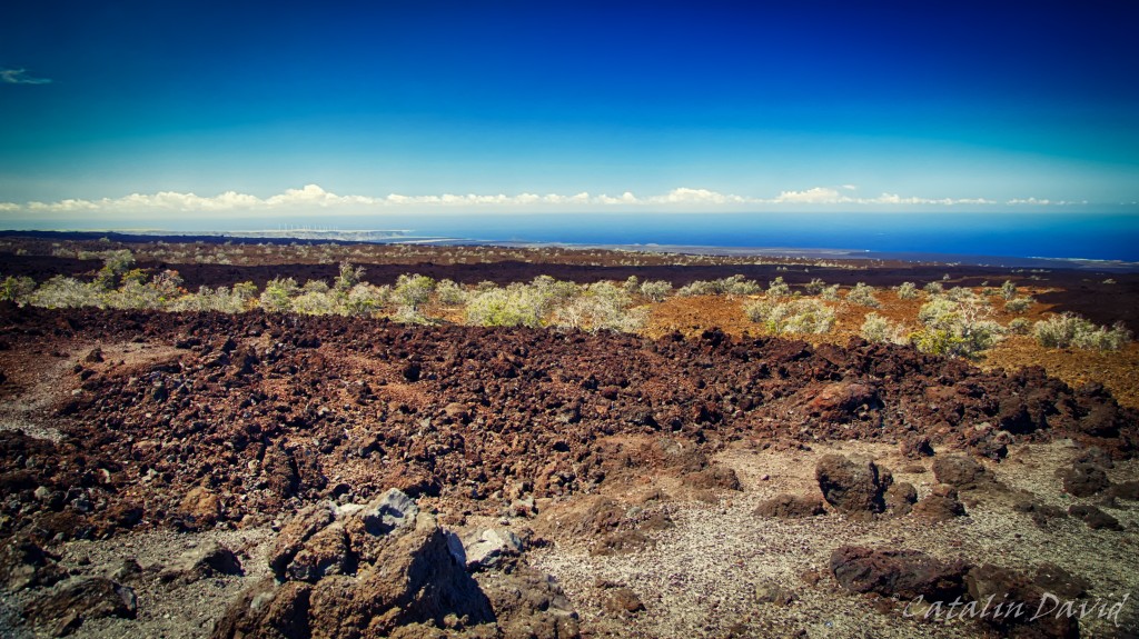
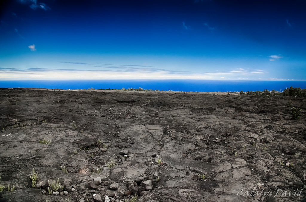
Since I had already been to the Big Island and had researched it 2 times already, I had a pretty good idea of what to visit, the amount of time it would take to get there and back and what to see. For today, the plan was – get up, have breakfast and go see the volcanoes and on the way back, the Black Sand beach and get back to Kona before sunset. And off we went 🙂 . One thing I should mention is that the Big Island is really interesting and varied – it has different climatic zones and different vegetation around the island. It has parts where it almost never rains (see picture above), parts where it rains at least once a day and is mostly cloudy (on the Eastern side of the island, near Hilo), it has 4000+m tall mountains (Mauna Kea and Mauna Loa), it has an area where coffee is farmed (coffee is pretty picky about the climate and Kona coffee is pretty well known) and it has tropical forests. The view above is characteristic to the Western side of the island, North of Kona – you can see solidified lava that was broken down by rain, the blue ocean and all clouds heading avoiding you.
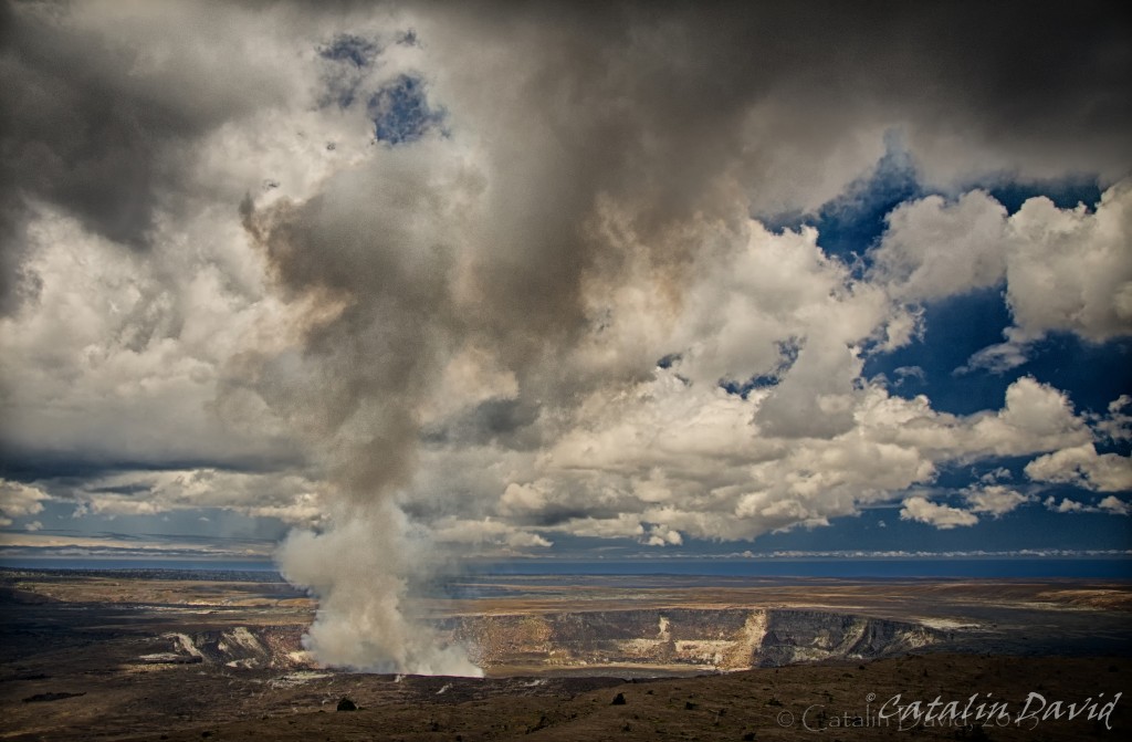
The volcanoes are in the SouthEastern part of the island, in the Hawaii Volcanoes National Park. No, you can not see flowing lava (just to get that out of the way, it’s very unlikely but you might be lucky). Here, in the park you have a tourist information center where you can learn more about the volcanoes, about the area and about what to see while you are visiting. The picture above is of the Kilauea Caldera volcano. To be specific, you are actually looking at 3 volcanoes in this picture (though they are not very clearly defined). The rim of the first volcano can be traced from the lower left corner to just above the double watermark on the photo (yes, I see it now, no I will not fix it). This is the oldest volcano (Kilauea Caldera). In the center of the picture, you can see the smaller rim of the second volcano. This is the Halema’uma’u volcano. This is an active volcano that is solidified at the surface, but 70-150 meters below the surface, there is hot, spewing lava. It has been erupting almost continuously through a single vent, producing the sulfurous cloud that you see in the picture (which will kill you if you breathe it). That single vent started as a 1m wide vent and is now about 300 meters wide. And looking down in it, at 70+ meters, you would see lava. Unfortunately, for reasons of your own safety, your access is not allowed closer to the actual volcano and there is a constant wind taking this sulfur out to the ocean. This shot is taken from the Jagger Museum, west of the tourist information center. Inside, you can learn more about the lava, the volcanoes here and around the world. Pro tip: listen to the local guides telling the stories of Pele and volcanoes.
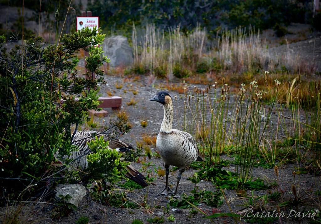
Walking around the island, you are most likely going to see these weird goose-like birds. They are called “nene” (or Hawaiian Goose) and are the rarest geese in the world and an endangered species. Look, take a picture, but don’t feed them and be sure not to run them over when driving like a maniac around the island.
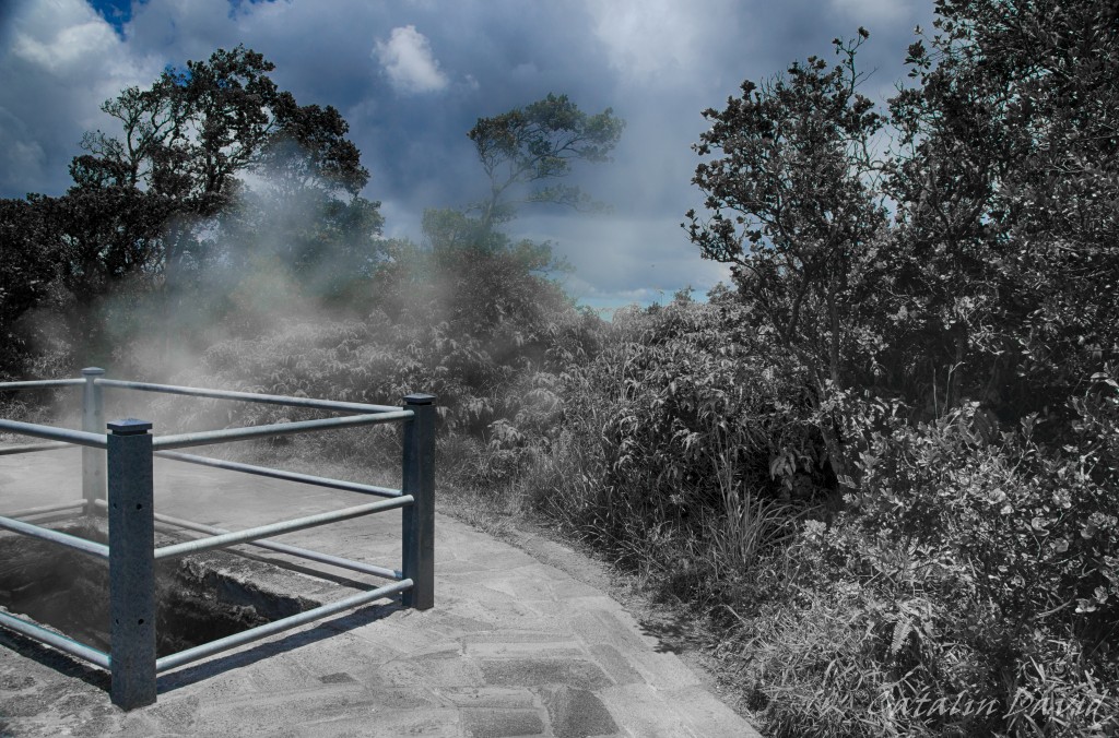
Between the Jaggar museum and the Tourist Information center, on the side of the road, you will find these holes in the ground with steam coming out of them. Unlike the steam from the volcanoes above (which contains sulfur, highly toxic for you), this is harmless – this is rainwater that is naturally heated up by the lava and evaporates all the way to the surface. The way this works is that the soil is mostly lava – which is very porous (see picture below for a detail). This means that water can infiltrate easily through it, get close to the lava, get transformed to steam and come back up to the surface. The picture is partially decolorized because this is the best I could do to highlight the steam on a bright, sunny day. But I do like the dead-nature aspect that it gives to the foreground bushes.
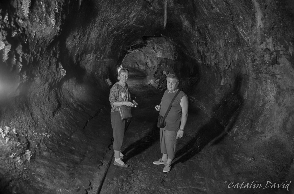
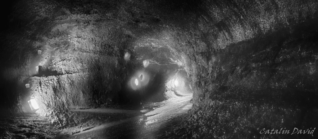
Next up is the Thurston lava tube. A lava tube is some sort of a cave through which lava flowed many years ago. The characteristics are that it is rather smooth on the inside (not many stalactites) and that it is relatively circular (therefore the name of tube). This lava tube is easily accessible, it is a 30 minute walk through a rain forest. The lighting is kinda bad inside (therefore the need for black and white pictures), but it is a fun walk and definitely an interesting experience to picture that lava flowed through where you are standing. Also, meet my parents 🙂 .
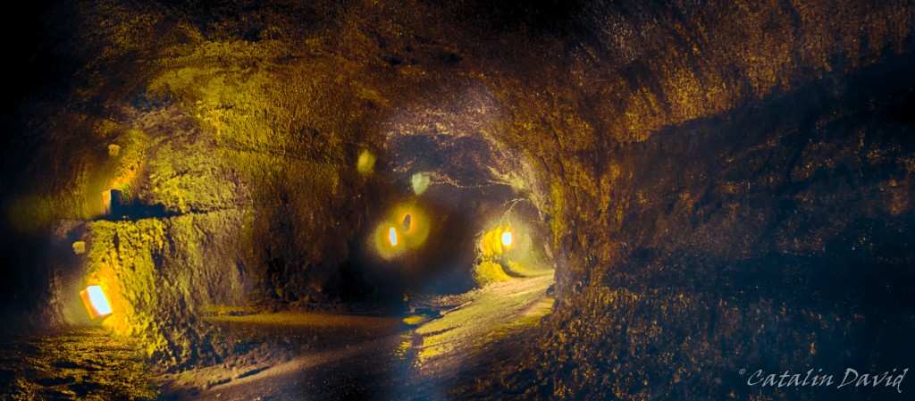
The lighting on the Bis Island is done using low pressure sodium lights (this is the yellow light that shines across the island) – this is because of the observatories on top of Mauna Kea. The sodium light has a lower intensity and is in a different spectrum than normal light and it will influence the astronomic observatories a lot less. Big respect for the science being done there, at the top of the mountain. I still think that black and white looks better – therefore I put Nik Silver Efex to a bit of work to create this.
Once out of the tube, we headed South on the Chain of Craters Road. Down this road, you can see inactive craters (though not as big as Caldera) and walk all the way to the edge of them. Of course, I didn’t want to risk my camera, so I decided to just walk to the edge without taking pictures. Also along the way, you can see different signs with years on them – those signs represent from when the lava that you see on the side of the road has been solidified. As far as I remember, this ranged from 1800 till 1980s. Moving on, we get closer and closer to the ocean and the view is pretty much amazing: desert and water in one picture. The drive is really nice and is worth stopping for a couple of photos and taking everything in.
And you don’t have to be walking on sunshine to have fun – you can be walking on lava!
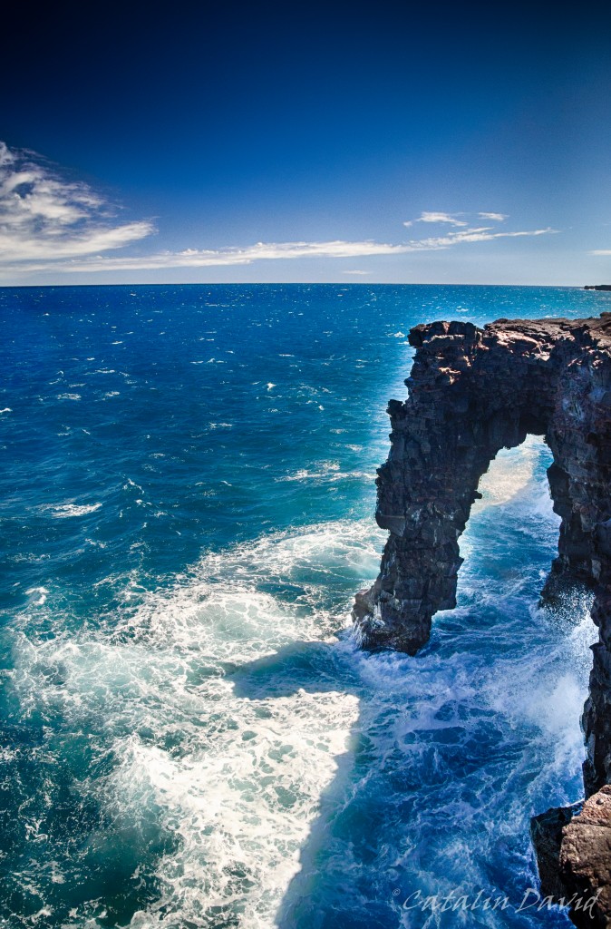
As we get to the ocean, we can see the Holei Arch – where lava and ocean meet. Or, if you are getting to close to the edge, where ocean and you meet – yes, the cliffs are 10 meters high, but the waves here are pretty big and can always surprise you and take you up for an early bath on your trip. The Holei Arch is actually the endpoint of the drive down the Chain of Craters Road. Still, it is not our end destination inside the Volcanoes National Park. By walking for 10-20 minutes on the closed-for-vehicles road, you will get to the place of one of the latest, easily reachable lava flows.
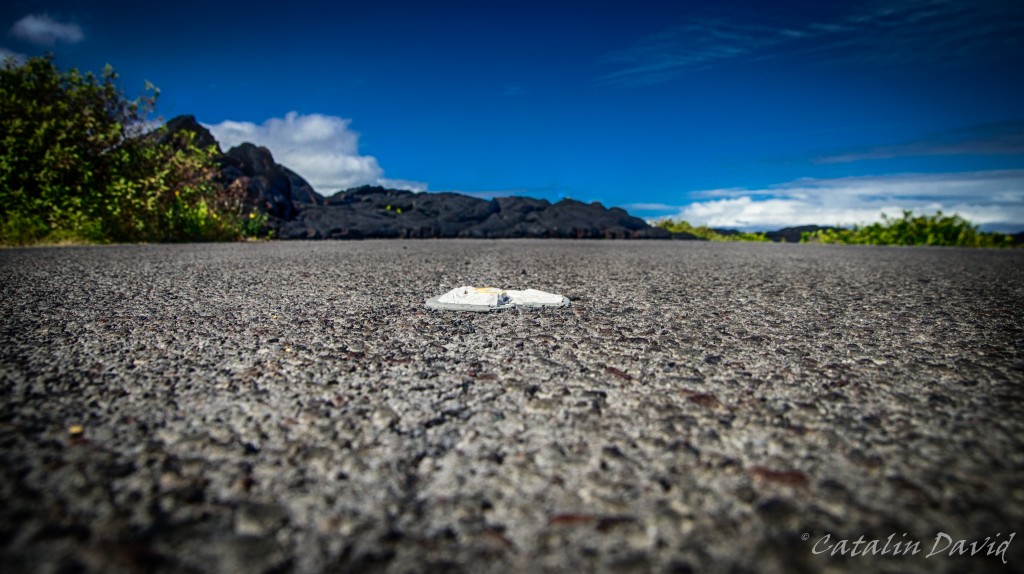
Road, meet lava. A couple of years ago, there has been an eruption and the lava slowly drifted from the hill nearby and covered 8.7 miles (14km) of the road uniting two villages. One village was partially destroyed, but if I remember correctly, nobody was killed since lava can only travel so fast. The white spot in the middle of the picture is a lane separator for the road and you can see the solidified lava flow in the background.
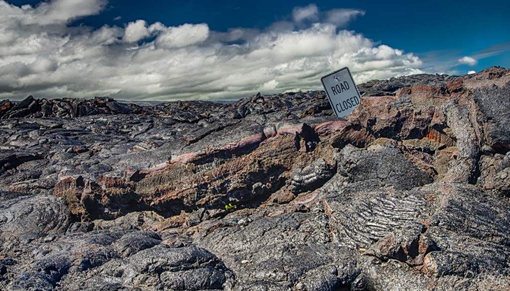
No s**t, Sherlock! That is where the road should have been. Apparently, they had time to evacuate everyone and put a sign that that the road is closed. Lava did not care for road closures, though…
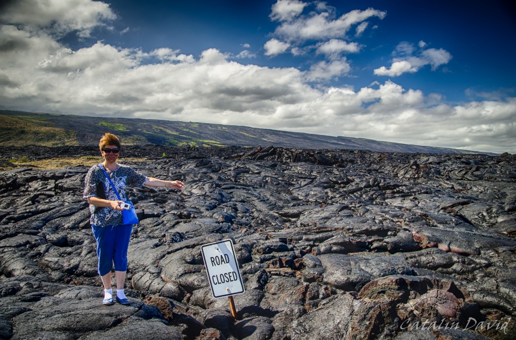
It gets a bit windy out there. Also, in the background you can see the hills covered with lava as well and you can trace where lava is coming from. Pretty neat.
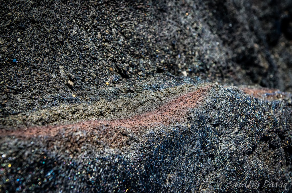
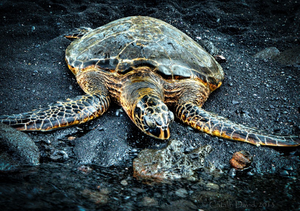
This is a detail of the lava. I like the sparkling and the different layering of the materials inside. This was our extreme point for the day, so we started heading back towards Kona. On the way back, we stopped at Punalu`u Beach – this is a black sand beach. And it just feels weird – every time I look down and expect to see the golden sand between my toes, I find my foot in a black pile of sand. The sand is pretty rough (though you can find some really nice white / gold sand beaches on the Big Island). One interesting thing about this beach – this is where green turtles come to shore during the day – either to get away from the warm water or to plant their eggs. The one below seemed really tired and for the half hour that we were waiting there, it barely moved (side note: one of the best kind of subjects for photography) even though it was 10 centimeters away from the shore.
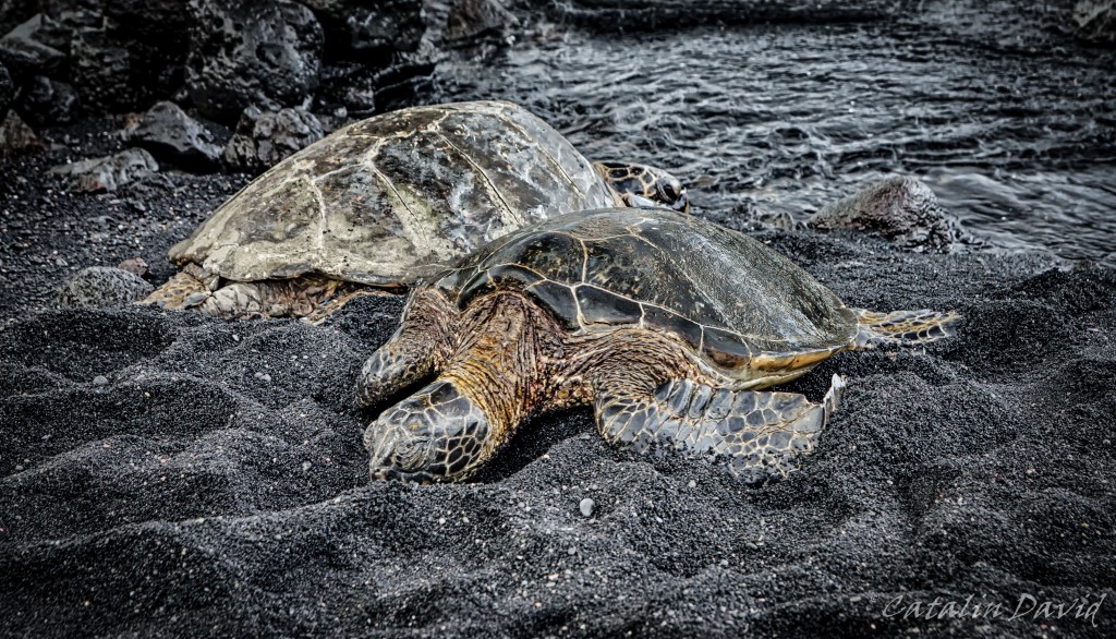
Howdy neighbor! I really like the expression of the turtle in the back of this picture (it is the same turtle in the picture above, so proof it was alive) – what’cha lookin’ at, punk?
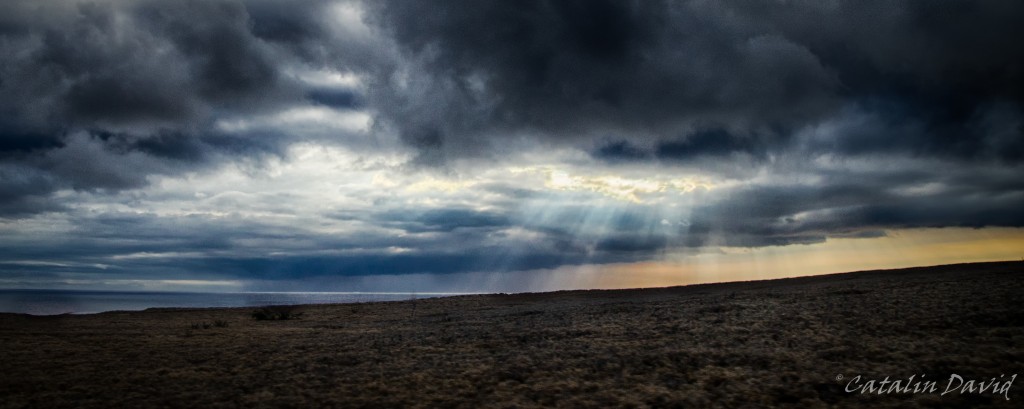
On our way back to Kona, we were treated with some clouds, making watching the sunset impossible to watch – but at least this picture of the rays of light going through the clouds was possible.
Over and out (and off to processing day 2),
/cd
Leave a Reply
You must be logged in to post a comment.
There are no comments