Category: Travel
After the North Rim, on the same day, we got to Las Vegas in the evening. So, around 10 PM we walked a bit outside to walk on the Strip and see the show. At 10pm, the temperature was still upwards of 90*F (30+*C). Luckily enough, pretty much the entire city runs on air conditioning, so as long as you are inside, you are comfortable.
We walked on the strip left and right, trying to avoid all the drunk people – remember, this is around 4th of July weekend, so the city was pretty full. Besides the drunk people, also trying to avoid the shady guys that give away “business cards” for strippers / hookers. Impressions for the night: hot, drunk people, dirty people, party people (the age average must have been around 30) and, last but not least, opulent people – everybody wants to show off that they have money. One other thing that I did not like was that this place is a bachelor / bachelorette go-to and this is something I don’t get, it’s like a custom to come here and the people that come here for this event seem imagination-less (booze, strippers, maybe gambling and go crazy). Seems like pre-defined “fun” to me (yes, I know I am a rebel and extremist). Anyway…
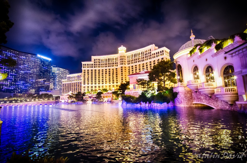
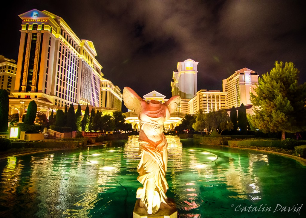
The Strip – it’s the main street in the city and it hosts all the big casinos in Las Vegas. And again, this is the epitome of opulence – in the middle of the desert, build an entire city (based on A/C), with artificial pools (I have to agree that the fountain in front of the Bellagio is nice and impressive):

And yes, things are impressive because they are there and they are special, but after a while, all of this is getting to me and in my eye. The strip is full of all types of casinos and hotels and entertainment places (the hotel in the background is where we were for our stay).
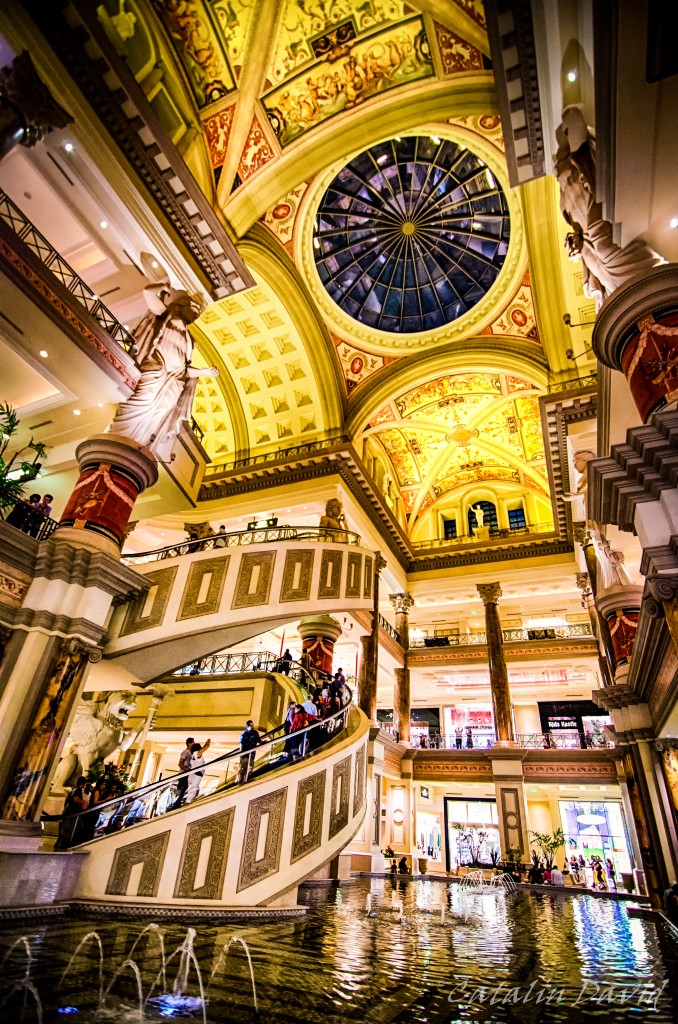
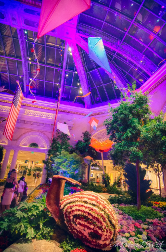
There’s architecture everywhere, there are paintings, but … at least to me, they seem out of place – the styles, patterns are mixed and in the end I think that the whole concept of insert of ancient architecture in everyday life (like in the picture below, inside a shopping mall) is just … kitsch.
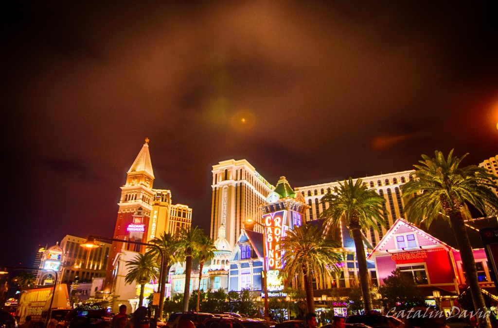
Also on the strip are some highlights from other cities – there is an Eiffel Tower replica (smaller size, see below) that hosts some restaurants, a Brooklyn bridge, a Pyramid hotel and others that I don’t remember. The city, the people and the constant distraction and stress to my senses (skin, eyes, ears – did I mention it was loud?) took their toll on my memory.

The casions are not disappointing, though – I liked the mix of technology and games and it was everything that I saw in the movies (and imagined). And the casino floor spreads for thousands of square feet / meters. An interesting interior was in the Bellagio:
This is a picture taken around 1-2 AM. How come? Well, the ceiling of the shopping alley is painted and lighted in (quite realistic) sky colors. At some point I lost track of time and was wondering why I was so tired in the middle of the day – took me a second to realize it’s the middle of the night and that I’ve been driving all day.
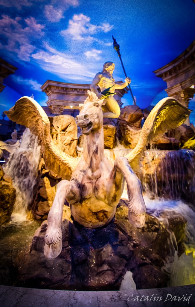
We walked around some more until late in the night up and down the strip and enjoyed the “cooling down” of the city. Next picture is outside the Caesar’s Palace casino:
And this one is in a botanical garden arranged inside the Bellagio casino.
Overall, Vegas is an interesting city, definitely worth visiting for a couple of days – but not the kind of place I would go back to except for the activitiesspecifically (they have lots of shows, you can drive sports cars in the desert and other fun activities) or for photography (drunk people usually make for interesting subjects).
This was my Vegas adventure, one day left.
Catalin

After the day in Zion National Park – which was awesome, BTW – we took a detour and spent the night in St. George (funny thing – Romania has a city with that name as well).
The plan for the next day was to visit the North Rim of the Grand Canyon, go further East and then go over the Colorado river (which is to blame for all of this), head back west, stop at the South Rim just in time for sunset and drive further West to Las Vegas. Well, that didn’t quite turned out as planned, but it was fun.
So, we woke up around 8, left St. George around 9 and drove to North Rim. North Rim is about 150 miles or 3 hours away from St. George. The road is really interesting – unfortunately I have no pictures as I was driving. There are a couple of straight lines, with nothing in sight for miles and a speed limit of 60 mph. For the most part, we stayed around that limit, but sometimes it really feels like in the movies, going through the desert at 90+F (32C) and getting bored. Luckily, only parts of the road were straight lines in the desert.
So, what is North Rim? Well, as the name says, it is the North rim of the Grand Canyon (thank you Captain Obvious). The Grand Canyon is actually so wide in some places that they needed to make a difference in where you are. The main difference between the northern rim and the southern rim is that the North Rim is at a higher altitude and is more “foresty” while the South Rim is at a lower altitude and drier. Most of the pictures that you will see of the sunset are actually taken at the South Rim, as that is closer to the Colorado river. As I was saying, the Colorado river is the main thing to blame for this huge natural attraction (and I do mean huge), alongside with the rocks and the relief inside the canyon. In fact, the Grand Canyon is so big that to get from the North Rim to the South Rim – which is about 5 miles in SLD (straight line distance) – you need about 4 hours worth of driving (even better, when we were there some of the roads were closed, so it would have been a 5+h drive).
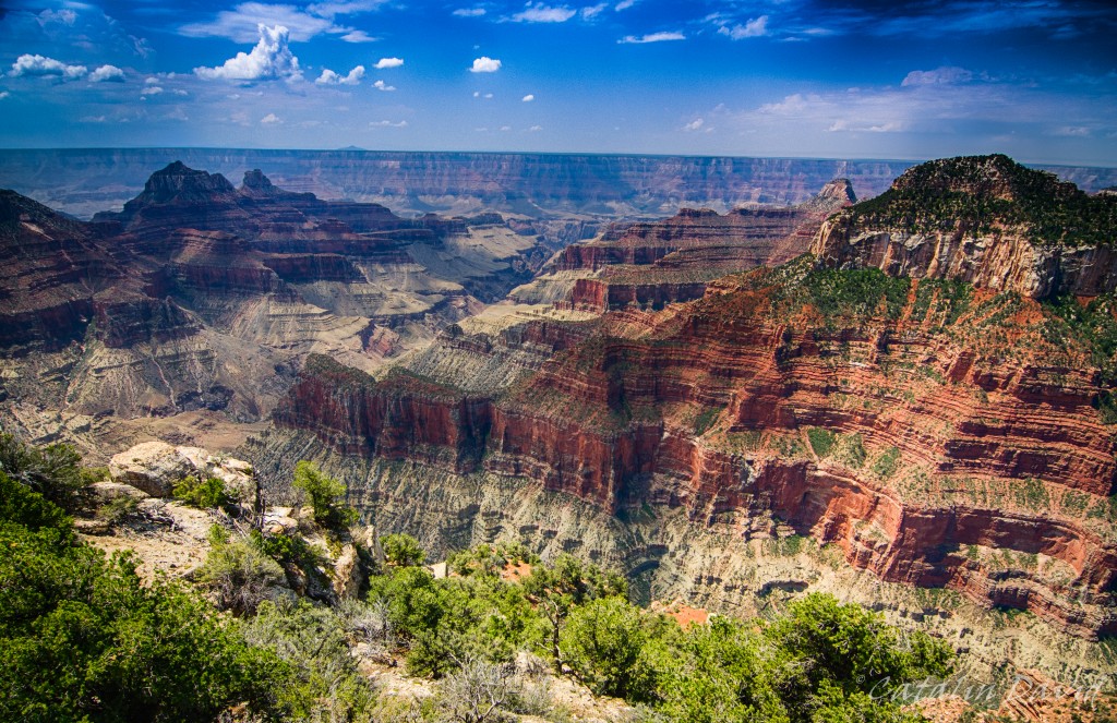
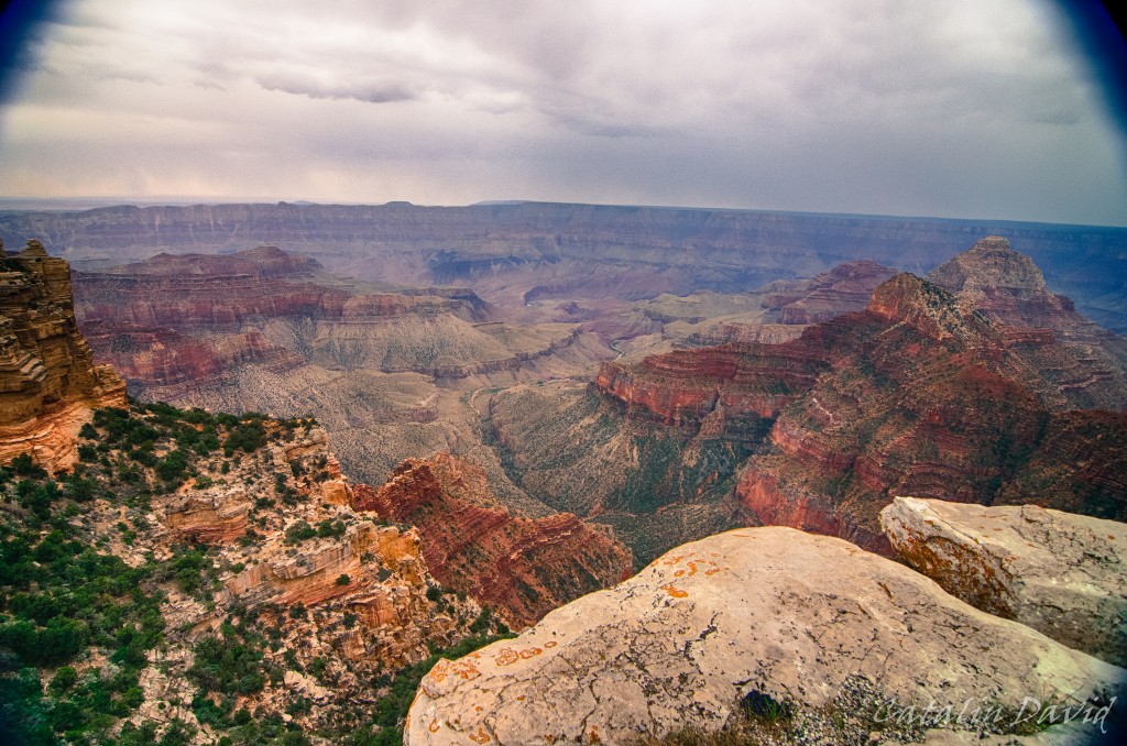
Anyway, too much talking… we got there at 12 and started visiting. This is one of the first sights that we got of the Grand Canyon. And boy, is it steep.
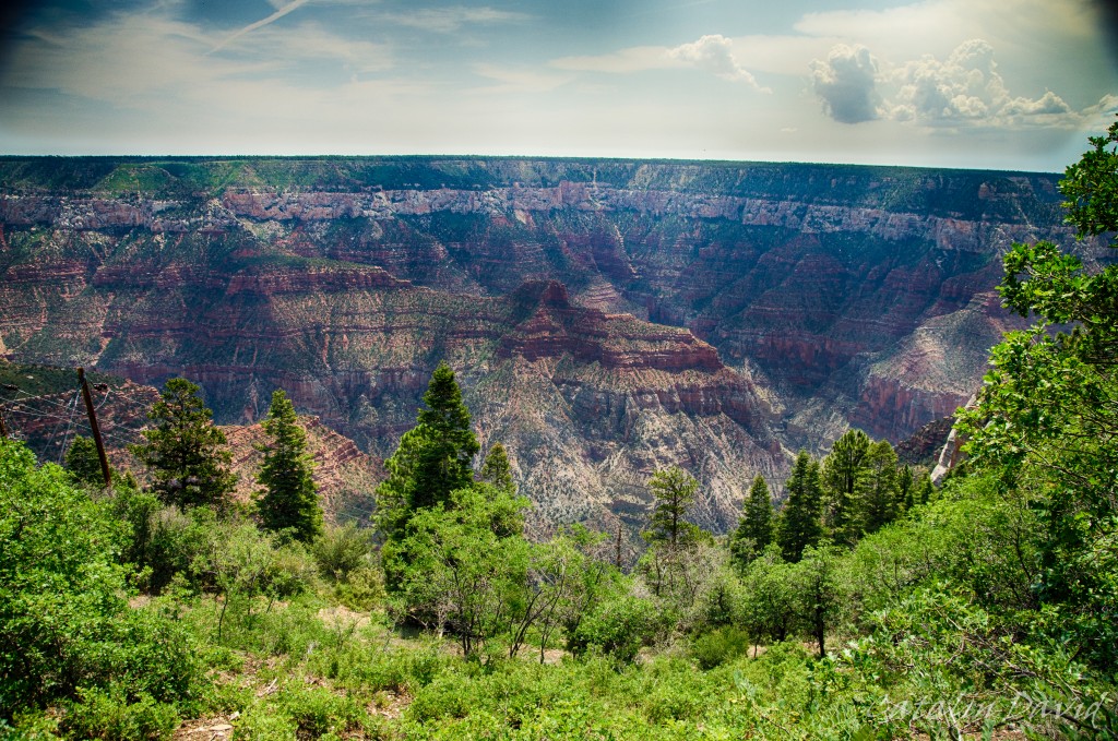
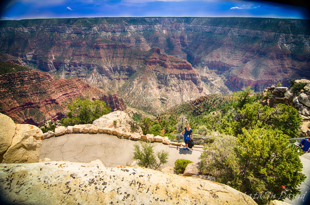
I am in general not very afraid of heights – but here, I had to keep away from the edge quite a bit. This was facing East and you can already see that there are quite a bit of trees around. After 20 minutes, we got to a southern lookout:
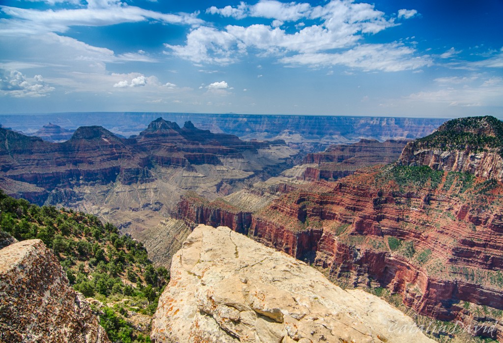
Again, you can see that I am not too close to the edge here either – I am not that crazy. Still the view was nothing short of impressive. It was one of those things that you see them on TV, you see it in the pictures… but unless you are there, you can’t quite get the full experience. Being able to see every detail of the mountain, so many curvatures, so many lines going in different directions, so much 3D (that you can’t actually get on camera) – this is the experience that I got from the Grand Canyon.
A bit closer to the eeeeeedgeeee.
And then there was a top-of-the-rock that you could climb (name is Bright Angel Point). Looking East towards the foresty part and mom in the foreground.
And then, switching towards South, putting my sexy, beautiful, burn from Hawaiian sun legs in the picture (also on top of Bright Angel Point).
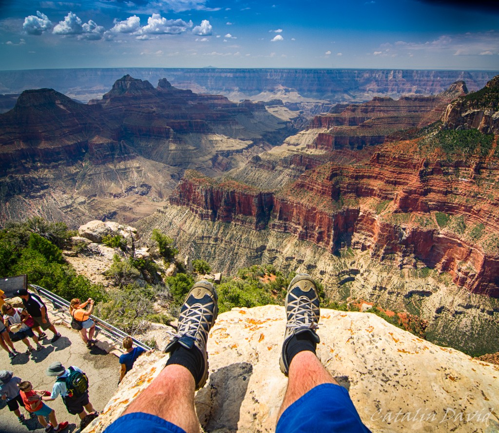
What? No? I don’t have sexy legs?
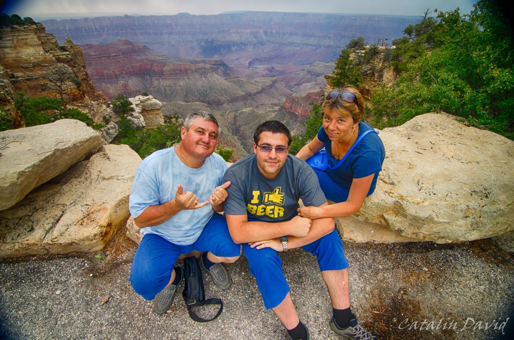
We walked around a bit more and decided to be hipsters – got a selfie of the 3 of us (hipsters because this is from last year, before selfies were cool – if in doubt, search for “ellen degeneres oscars selfie 2014”).
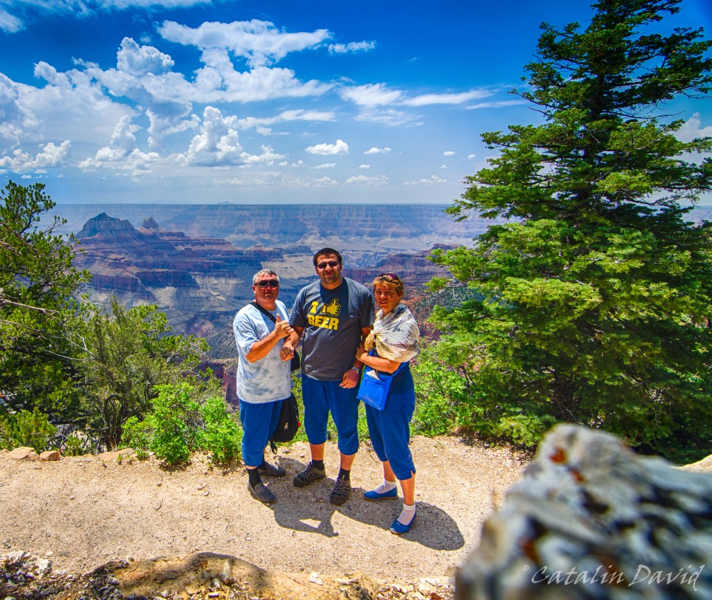
Of course, the rock is there for artistic composition. At this point, it was around 2PM and we had a choice to make – drive 5-6h to the South Rim, watch the sunset and another 3-4h to Las Vegas or visit most of the stuff in the North Rim and head back the same way to St. George and to Vegas. We chose the second option, as it would allow us to see more rather than just go to the more touristy, most likely crowded South Rim (reference: this is on Saturday, the 6th of July, on the 4th of July long weekend, so we expected South Rim to be really crowded).
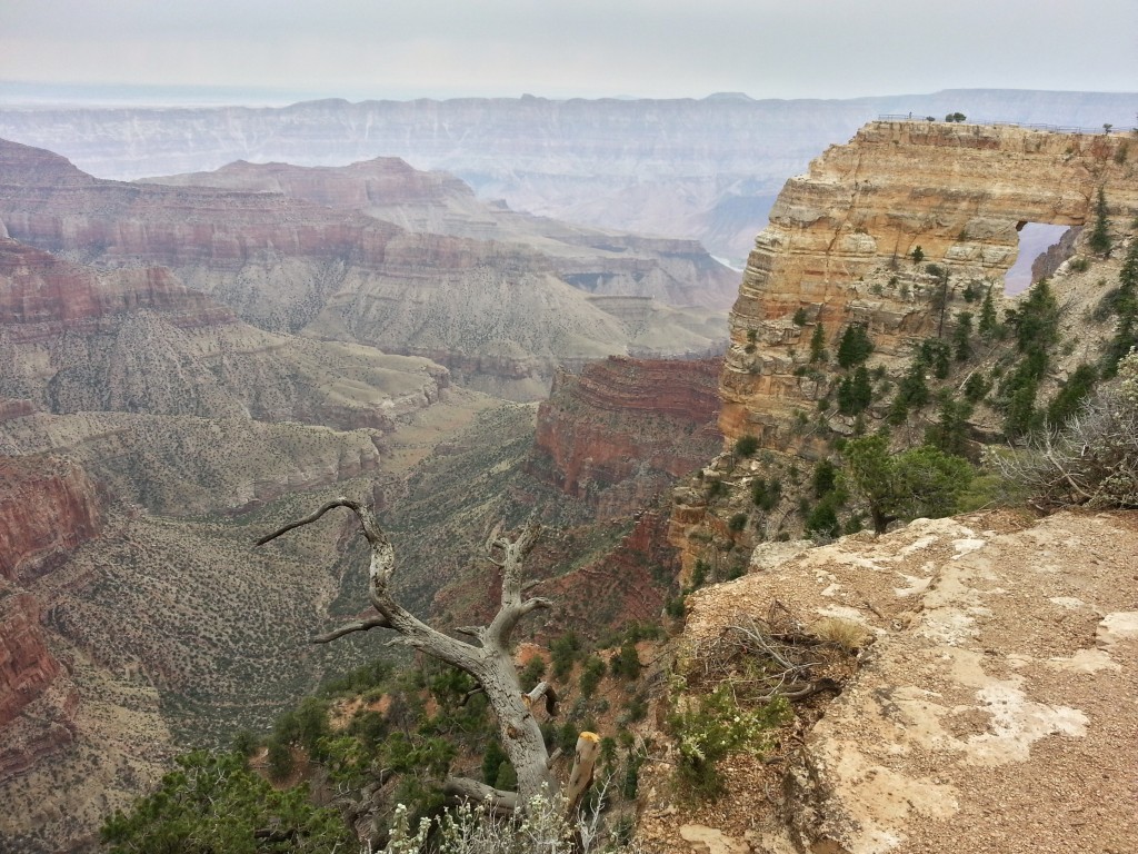
So, we made our way to the other two viewpoints: Point Imperial and Cape Royal. Cape Royal was the first one.
This place provides a more in-depth view of the Grand Canyon. As you can see, the weather also turned quite a bit, but it was not raining – so we got to take a picture. Another selfie:
Then I decided to take some pictures with the phone – I am not quite sure why and I am pretty sorry for the quality (they could use a bit of work).
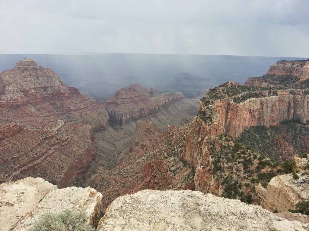
Nearby, it started raining – you can see in the picture below and we witnessed some lightning strikes that went down in the canyon. Come to think of it, I believe it was safety that made me decide not to use the camera – afraid to put the camera on the metal tripod or on the railing.
Some of us were pretty … electric.
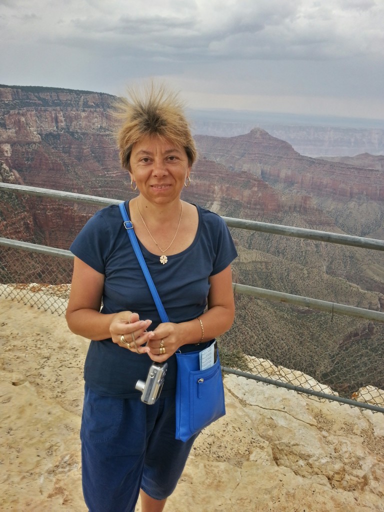
Apparently, the bad weather was creating a lot of static energy at this place, causing my mom’s hair to go … cuckoo!
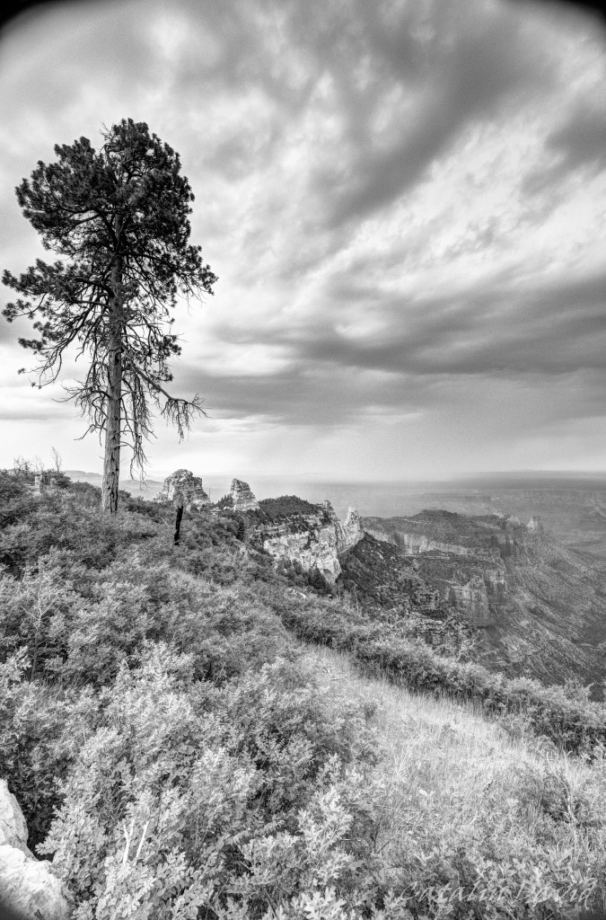
Then my artistic experiment thingie went off and decided that a lonely tree on the edge of the Grand Canyon would be a worthy shot. I think it looks pretty cool in black-and-white, but I think that there are a conditions and a subject requirements to take a b&w picture. The requirements would be a cloudy sky and a solitary subject – but again, this is one of the few b&w pictures.
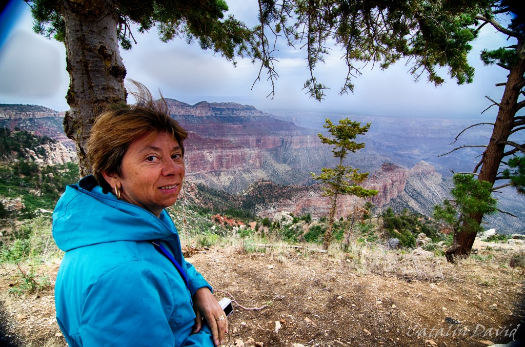
We stopped a couple of times no the way between the Cape Royal and Imperial Point and took more pictures. The field of view already got smaller and smaller due to the rain that was far away and less light. That actually benefited some of the contrasts between the red of the canyon and the dark of the sky:

We finally got to Point Imperial…

And the outlook was pretty nice.
We strolled around the park for a bit and then headed back to the car and drove to St. George and further to Las Vegas.
/cd
I am beginning to like this …
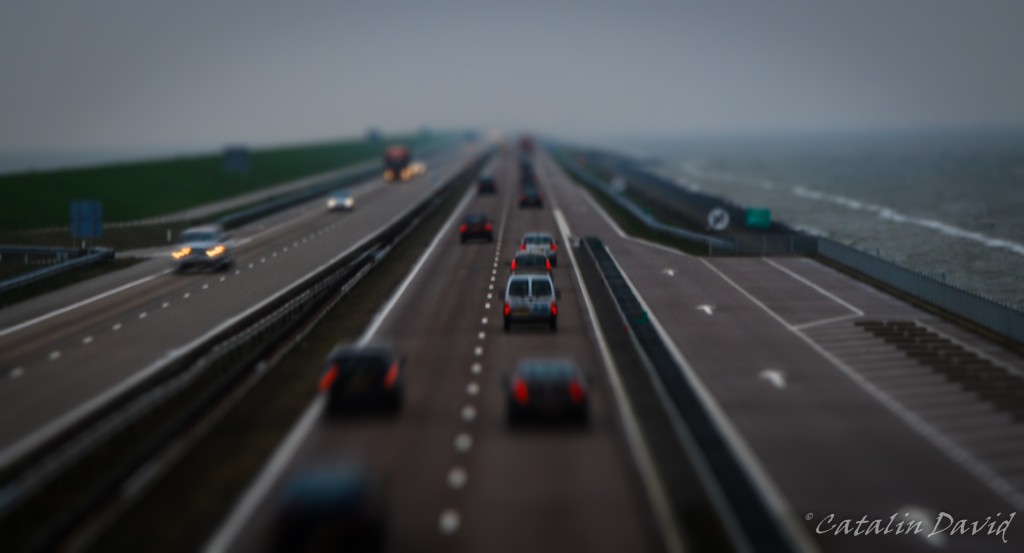
The power of perspective change seems to be a bit addictive and the fact that you can take normal images with life-size objects and turn them into your little toys in your imagination and project that via a photo seems like a very powerful tool.

About the photo – still in the Netherlands, on the same trip as the previous one. If memory serves me right, this is on highway A7, between the cities of Den Oever and Kornwerderzand – Bing Maps tells me it’s called Breezanddijk.
Over and out,
/cd

Inspired by the image of the day on Bing today… http://500px.com/photo/36677568/arc-de-triomphe-paris-by-sebastian-helmke
I decided to give it a try as well, see what happens.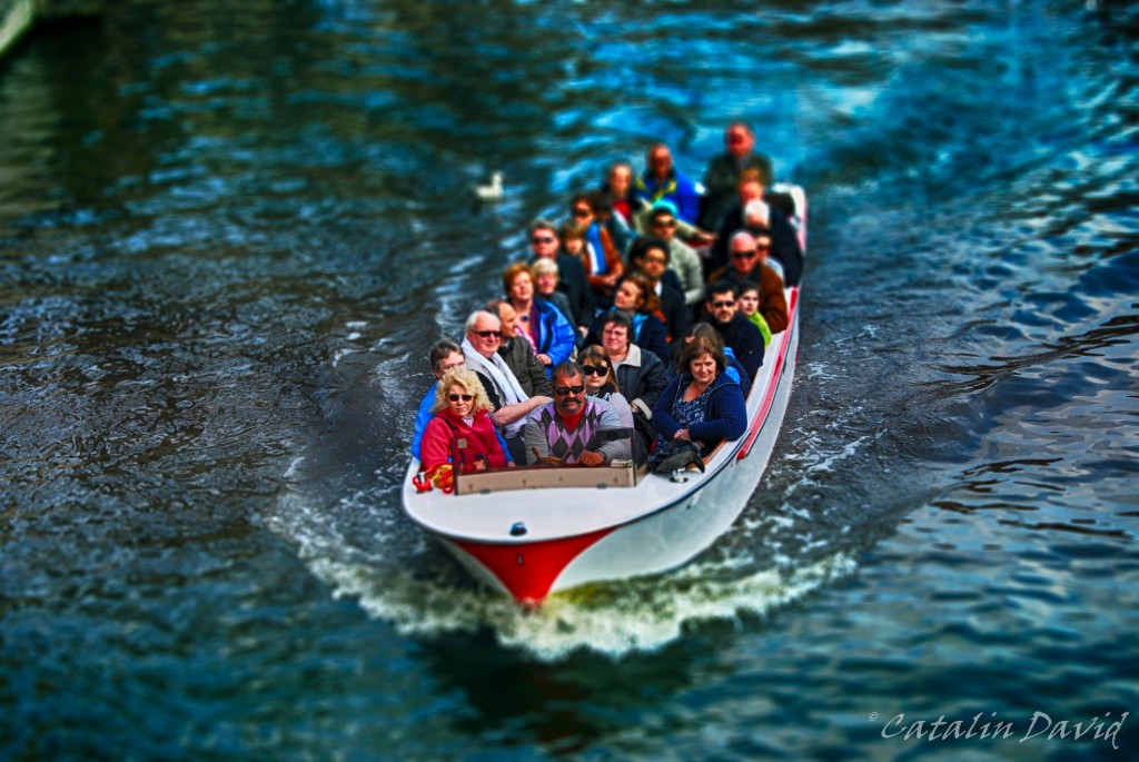
I think it looks pretty cool and you just want to pick them up and take them home…
About the photo – it is taken a couple of years ago, in Amsterdam, on one of the water channels inside the city.
/cd
Yes, I know – long time, no pictures.
Why? Life caught up with me. First, I bought a house. Yes, I am an owner – or almost, 29 years and a half to pay for mortgage, but still (pictures to come). Then, things happened, my girlfriend came to visit, we went to places, I moved from the apartment to the house etc.
Getting back to the story though 🙂
Last you heard we were in Hawaii and heading to another destination. This was on 4th of July – we flew Kona – San Francisco (again, 5 hour flight with nothing but water underneath) and then we boarded on a flight to the middle of the desert: Las Vegas. We got to Vegas around midnight and we finally made it to a bed on the strip around 2AM (“the strip” is the main street in Las Vegas where all the casinos and hotels are). At 2AM, the temperature outside was 85F (about 30 C). Unfortunately, we didn’t have a lot of time to spare since we had quite a travel planned for the next day.
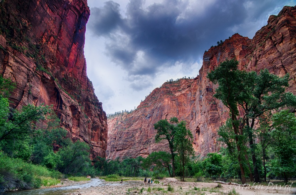
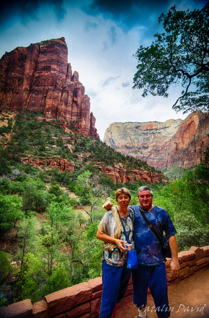
What trip? About 300km (160 miles) NE of Las Vegas is Zion National Park with its Zion Canyon. The Zion Canyon is impressive due to its color (see above – pretty much everything is reddish) and its design (see more below). I have been in Zion some time earlier and liked it a lot – more pictures and details to come.
So, after about 3 hours of me driving and mom sitting in the front seat paying attention so I don’t fall asleep, we reached the Canyon. The national park is really nice, you drive into it and then you park your car and hop on a bus that goes around the accessible part of the park. Like this, everyone is happy – you don’t have to spend time searching for a parking spot near the hike you want to take, no traffic on those narrow roads.
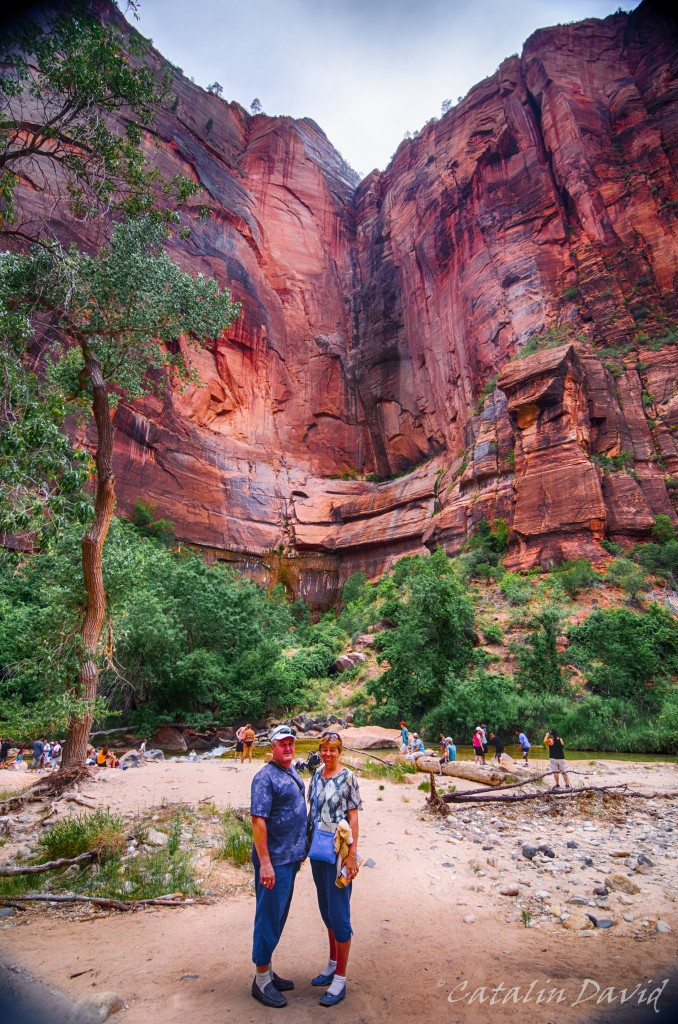
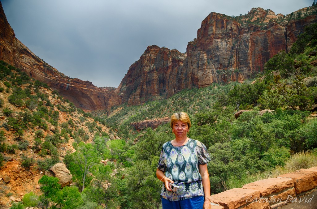
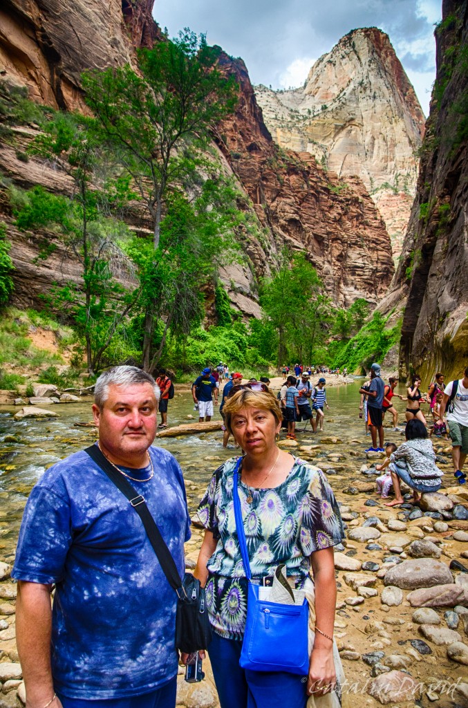
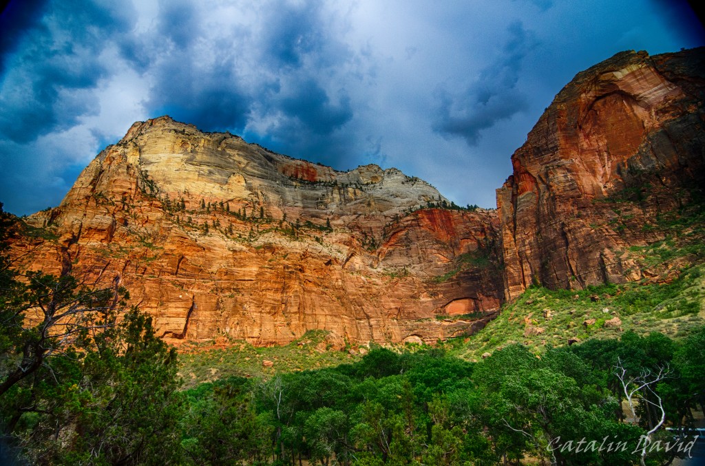
One of the things I liked most about Zion National Park is the perspective it gives you on the Canyon. Unlike the Grand Canyon (we’ll get there, no worries) where you are at the top of the cliff and look down upon … pretty much nothing, in Zion Canyon, you are the nothing and you have very tall (red) walls creeping up on you both to your left and to your right. Here, you can see my parents (a bit distorted by my 11-16 lens) and one of these walls.
While at the entrance in the Canyon, the valley is open and buses can easily fit sideways, as you get deeper into the canyon, the walls come closer and closer together. In the top right corner in the picture above you can see a peak – it’s called Angel’s Landing. It is a 4 hour hike in which the last portion of the hike (about 1h each way) you have to use chains and pull yourself to get to the top – pretty fun. Since I was with my parents, I did not attempt it this time, but the last time I was here, I went all the way to the top (pictures to come).
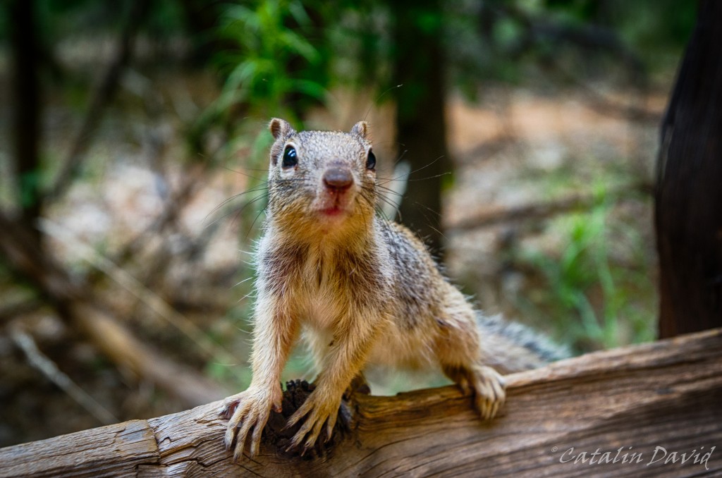
Instead, we took an easier trip that involves walking around through a forest filled with hungry squirrels.

Example 1. What are you looking at?
As you go deeper into the Canyon, you get to the entrance in what is called “The Narrows”. This is a long hike (couple of hours at least) that takes you deep into the canyon (and deep into the water) and through parts of the canyon that, you guessed it, are very narrow.
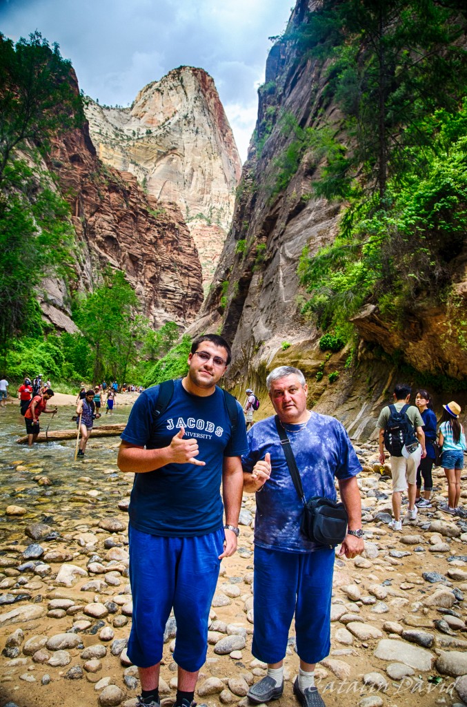
We did not do the narrows hike, but we jumped the pond and took a couple of pictures. Here, bringing some culture from Hawaii – the Shaka sign.
Nearing sunset time, the colors were very nice on those walls.
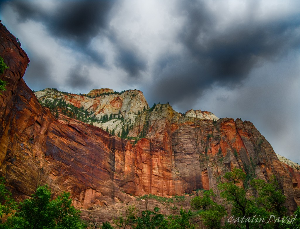
And these other walls.
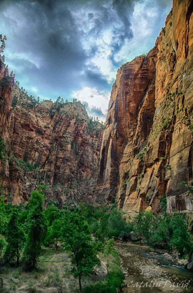
Although the weather was not the best – it was cloudy most of the time, I can’t complain. A day at 100F (35C) would not have been great at all. The sun came out near sunset and I was able to snap some cool pictures. Inside the canyon, we took a short hike – called the Emerald Pools. The hike is really easy, but it’s worth it for the view towards the exit of the canyon:
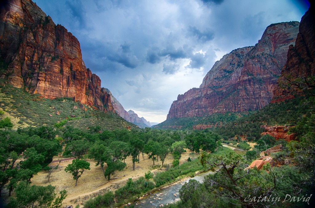
From different heights – one a bit above the trees so you can see the rest of the canyon, one closer to the nature and to the walls.
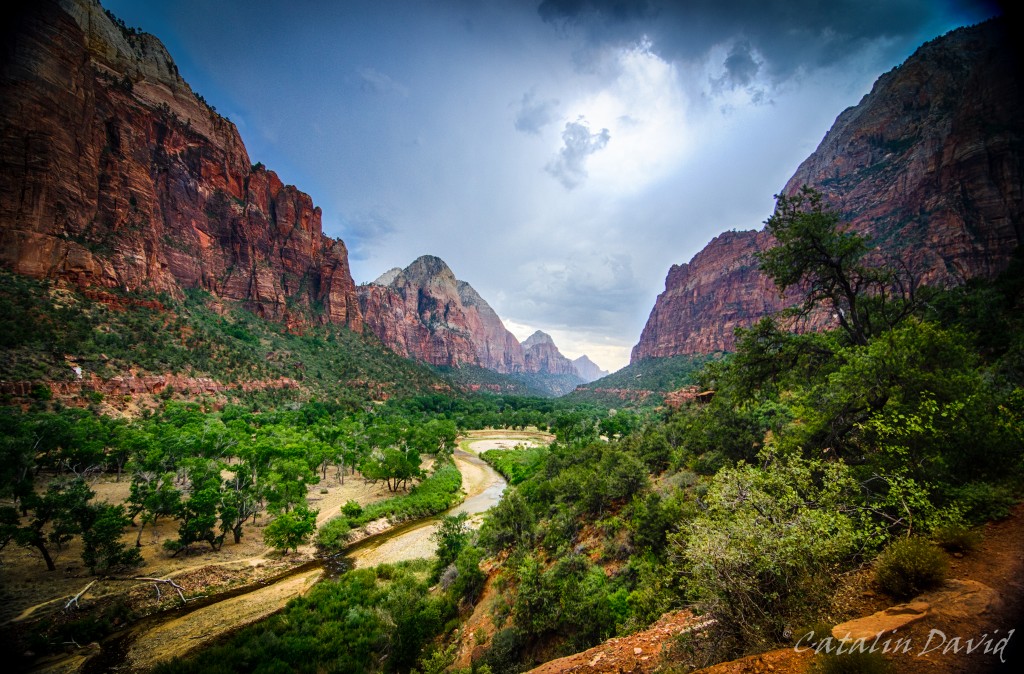
An interesting part of this hike is this narrow path – it’s not that long, but it makes for great pictures.

I think I have some better pics since the last trip there – I will check.
Finally, lack of sleep and walking all day long in a desert set in, so we had to head to St George for a night sleep and the trip on the next day.
Just around that time, sunset set in.
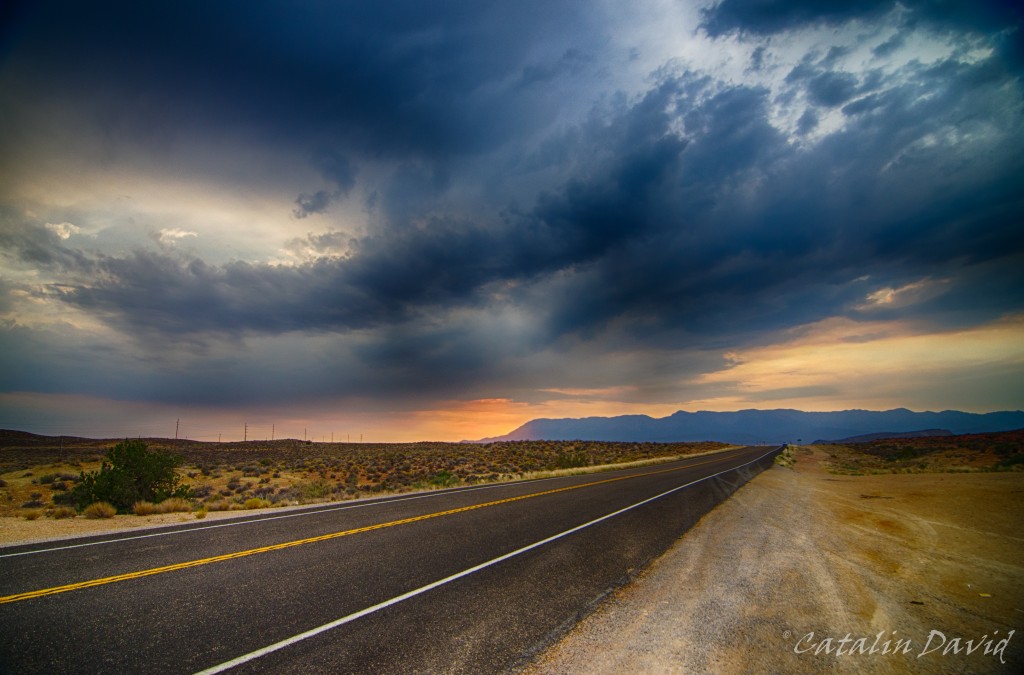
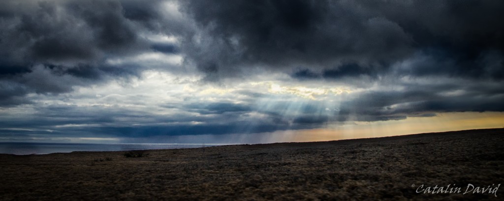
Dark clouds, a mountain, an empty road and a sunset make for a nice picture, I think, right?
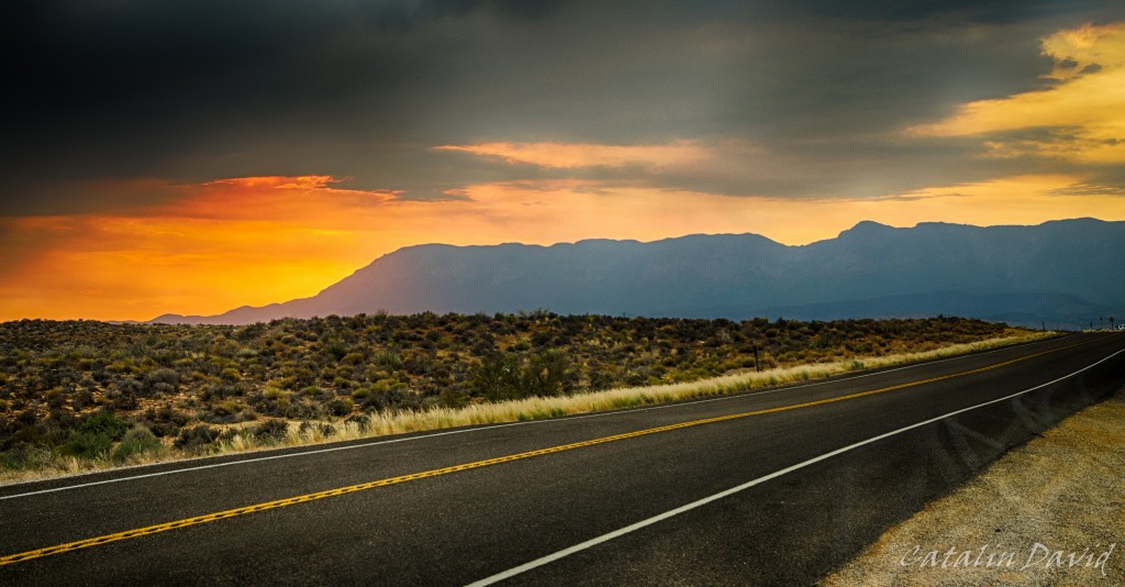
Especially with the sun hiding behind those mountains.
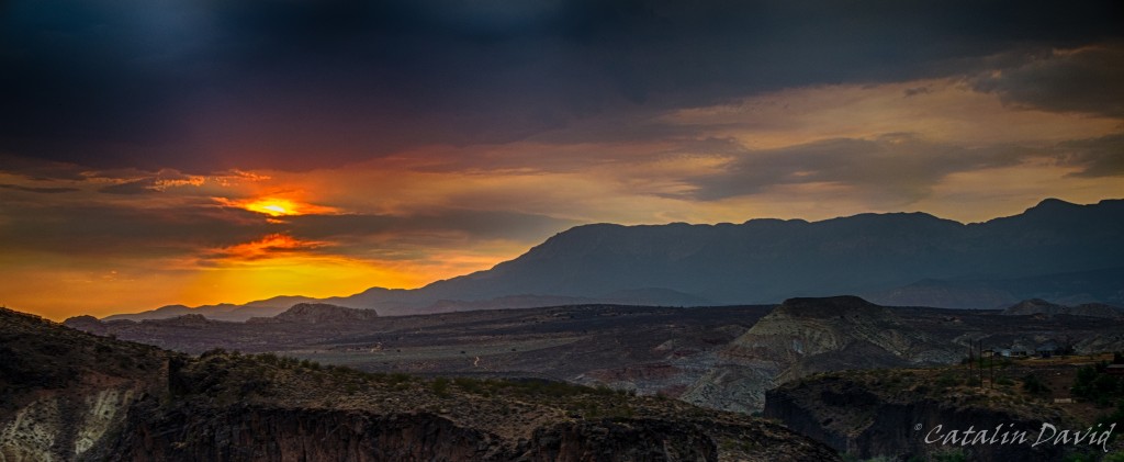
Or behind the clouds.
That was one true epic sunset 🙂 Kinda made up for the missed ones in Hawaii.
Off to bed and a new day,
/cd
P.S.: just changed the design of the website, looks a bit better for photo sharing. The WordPress theme name is Fontfolio.

After two intense days of running around the Big Island, we decided to take some time off and do what “normal” people do – beach, sun and bathing. We talked to some of the locals and they directed us to a local beach nearby – a very nice one. Unfortunately, the access road was not that great, but this is exactly what made the beach even better – there was almost nobody there. Plus, it had shade from a couple of trees just on the edge of the water… Paradise.
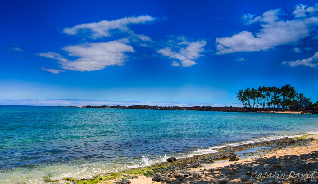
Unfortunately, with every good thing (most likely) comes a bad thing. So, I fell asleep on the beach and… the shade moved. So after about 1h of sitting in the sun at noon time, my feet felt like they were melting. Plus, they were extremely red. Oh, well, we’ll have lotion at home, just stay hydrated and work through the burns.
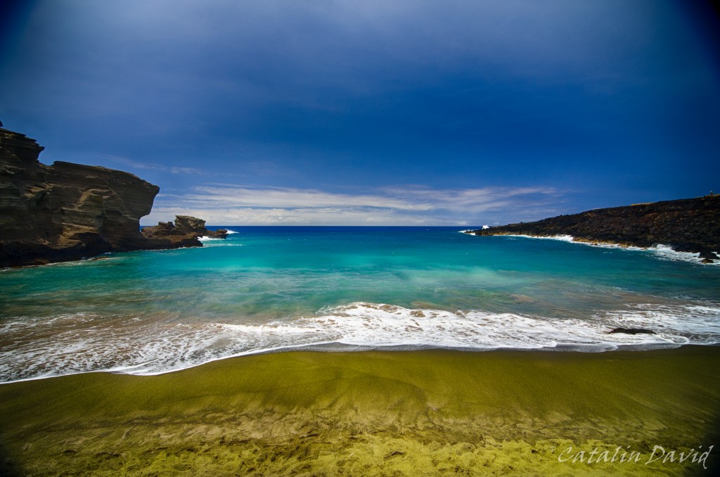
On another day, we took a trip to the “Green Sand Beach” – this is a beach in the Southern part of the Big Island that has … green sand. After seeing black sand beaches and “normal” beaches, green sand felt a bit of a stretch and exotic. Unfortunately, like any well-guarded secret, the road to the Green Sand Beach is … not paved. You can get within 3 miles of the beach on a public paved road, but the rest of the road requires a 4×4 car and some experience with the area. Why? Well, first of all, there is not only one road – there are about 10 roads that start from where you leave your car and get to the beach, all intersecting each other. Some of them have 1m high rocks in the middle of them over which your car needs to climb, some are smooth. One thing is certain – all of them are dusty, so this is a big problem if driving slow. Of course, some local drivers were kind enough to take us there for a small donation of $15/person. But once you get there… once you get there, it gets interesting. You are confronted with this:
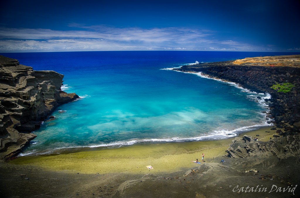
You are sitting on the edge of a cliff, with nothing underneath you for 30 meters. And the green sand beach awaits you at the bottom, contrasting with the blue of the ocean and the sky. There are some not-trivial-to-go-down-on steps that will take you to the beach, but, as soon as you start descending, a message from the locals:
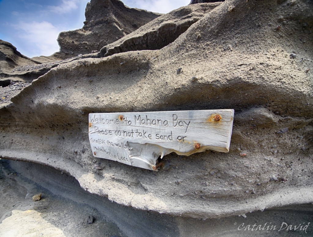
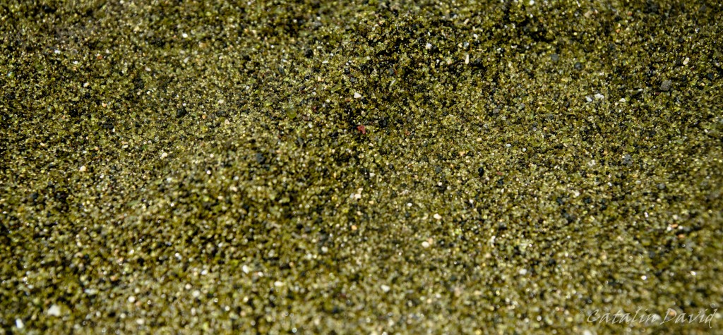
So, why is the sand green? Or at least somewhat greener… ? The source is, of course, Mother Nature – the sand is actually not sand, at least not from a chemical perspective. Due to the volcanoes on the island, high pressure and different minerals, a mineral named olivine has surfaced. The green sand is actually a bunch of small crystals that were eroded by the water and waves over many many many many years. The problem is that the crystals are not very resistant to the weather, so nobody knows for how long this beach will still have its green color. Here is the detail of the sand – once you zoom in, you can actually see the crystals there.
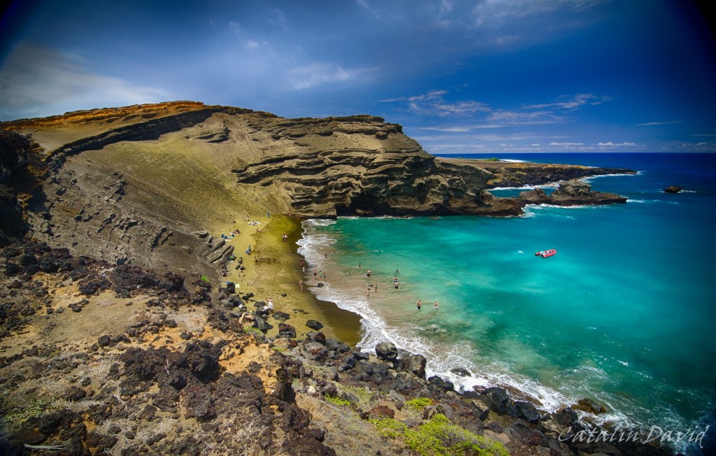
We safely got to the bottom, near the beach … and decided to take a dip in this beautiful place. The beach is not big, see pictures below, about 10-15 meters wide at high tide, but the fact that it’s secluded and in this awesome bay … makes up for everything.
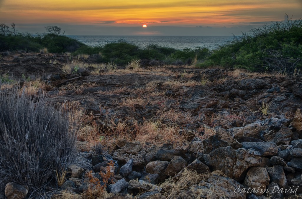
Before we left – and believe me, we were trying not to, we decided to hike on the nearby coast for a bit. While cars could have made those signs, I still think that aliens came and X marks the spot where they will land.
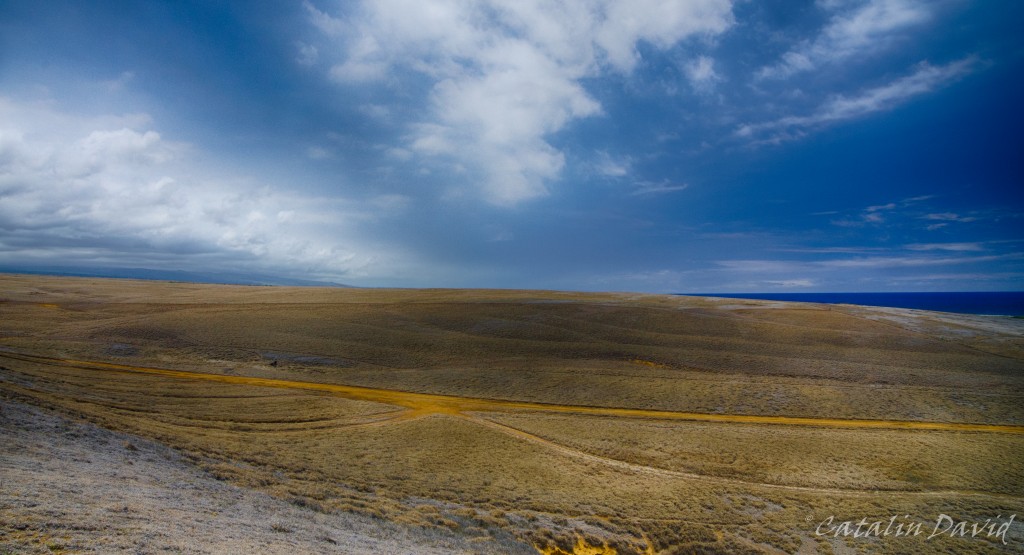
On a more serious note, I really enjoyed the contrast between the dust and the dry atmosphere that the ground inspired and the blue of the ocean and the sky. Still, restless as I am, I went on the very edge of the cliff… About 20-30 meters above water, on the edge of the cliff and snapped this picture. And that is mom, hand waving in the top right corner.
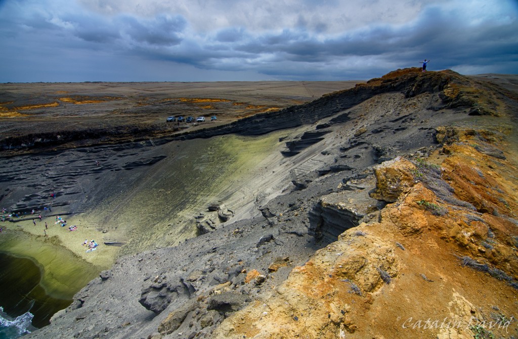
In these pictures, you can see where the olivine actually comes from – the very top and with the help of rain / wind / gravity, it makes its way to the bottom, on the beach. We had a bit of time to spare, so I went to the other side of the golf and snapped a picture from the other side, to see where I was standing when I took the picture above.
When we finally left we saw that there was a sign that said “South Point”. I had read a bit about it, but since we were already there… we decided to go. Apparently, this is the Southern-most point of the United States of America (therefore, South Point). Not much going on here, just a bunch of locals fishing…
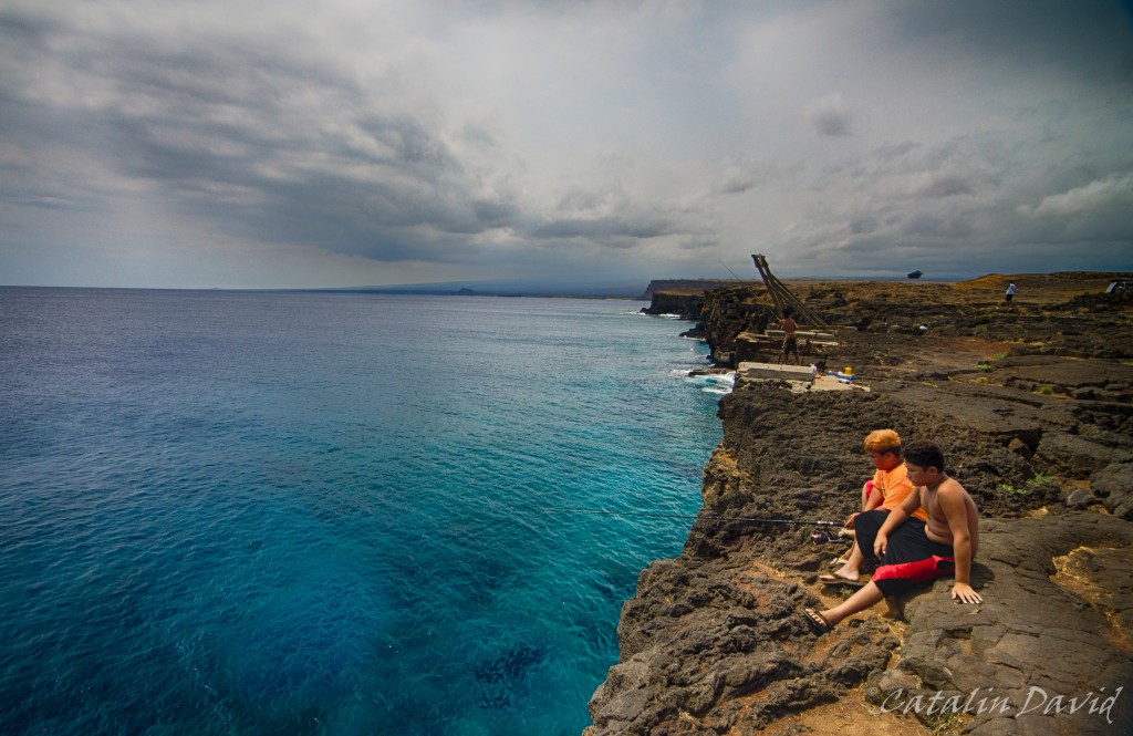
and jumping into the clear water. You wouldn’t believe it, but the water in the picture above is about 5m deep near the edge of the cliff and we saw a couple of people jumping in. Unfortunately, I was too jaw-dropped to take pictures.
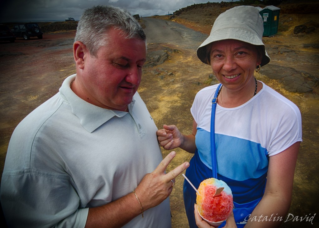
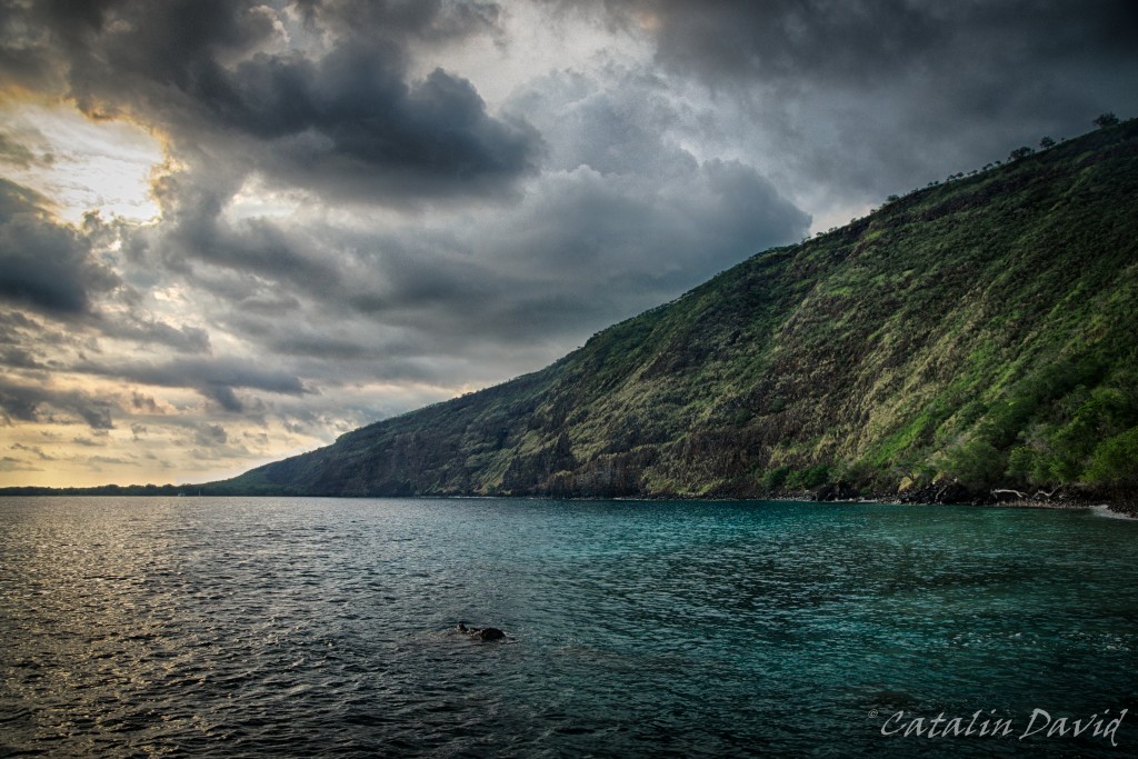
Strolling around for a bit, we got to a shaved ice stand and mom and dad had a bit of rainbow-flavored shaved ice. On our way back from the southern part of the island, we stopped at Kealakekua bay – this is where the British explorer, Captain Cook was the first documented European to step on the island. This is also the place where he died, killed by the locals.
A trip to Hawaii is not a trip to Hawaii without a picture of a sunset. This is one that I snapped on a day, coming back from the beach. The clouds at the horizon usually make it so you can’t get a good picture of the sun setting into the water, but you play with what cards you are dealt 🙂
Next up, the rest of our trip (done with Hawaii, but not with the trip). Over and out,
/cd

Hi and welcome to the last part of day 2 in Hawaii! Remember to click on the pictures for full resolution – welcome and let’s go!
It’s been a fun day and it had to just end in a great way. So? On our way from Hilo to Kona, we decided to take a small detour and go to Mauna Kea – the Onizuka Center for International Astronomy. Mauna Kea is the tallest mountain in the world measured from base to top – it is about 10000m tall, while Everest is only a bit over 4500m tall. But, most of Mauna Kea is actually under water and only its peak can be explored by foot. The peak of Mauna Kea is at over 4200m above sea level, while the Onizuka Center (visitor center) is at 2800m above sea level. At the top of Mauna Kea sit some of the world-famous telescopes – besides the high altitude, Mauna Kea benefits them by usually having no clouds at the top. The people of the Big Island are respectful of such an investment in research on the island and only use sodium-based street lamps so that they don’t pollute the darkness at the top.
We got there in the evening and we were able to see quite a few buses that would go all the way to the top to see the sunset and then admire the stars. All of them had to stop, though at the visitor center. The reason? Acclimatization. The road can take you in about 2 hours from sea level to 4200m. And if you don’t stop, your body will most likely freak out.
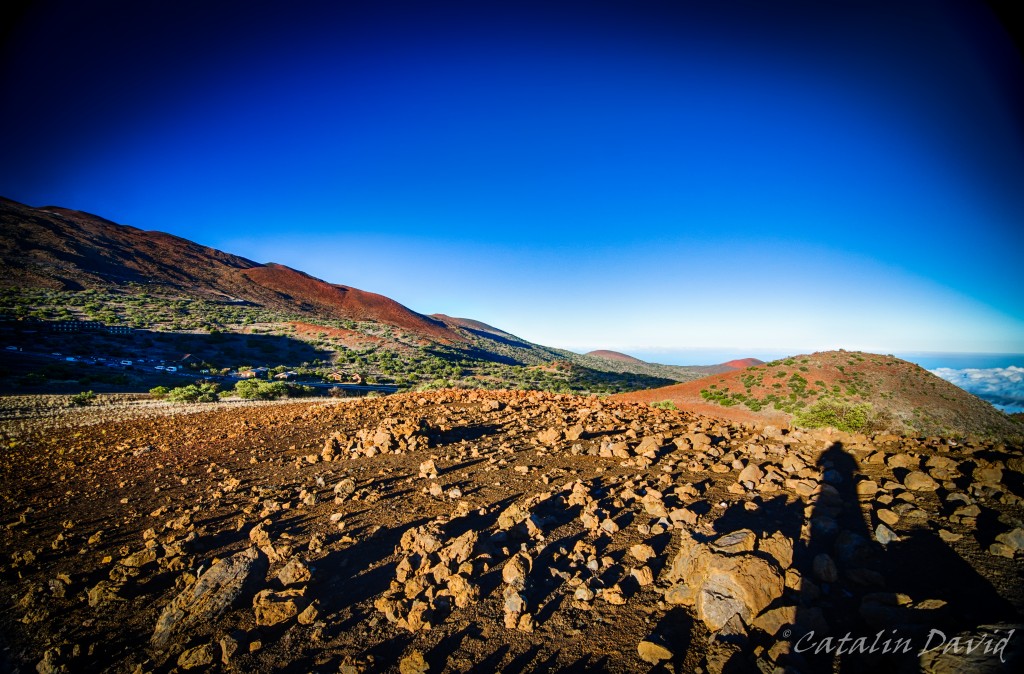
You can already see in this set of pictures the shades of blue of the sky (this is not photoshopped). This is because the air density is already lower and the air molecules are scattering less light upon us. The intensity of the blue, combined with the sunset yellow / orange are bound to create some interesting views and feelings. The soil is somewhat variable, between lava-rocks and sand (coming from lava) and it has a shade of red that would make you feel like Spirit on Mars. In the picture above, you can see the Onizuka Center for International Astronomy – we spent about 1 hour around there, learning more about the guy, the observatories at the top and what is visible from here as well as from the top. The trip to the top is interesting because you are above everything you can see around you and you get to see the telescopes from close (entrance is prohibited). once we were done with that, we decided to go hike a bit around to get a better view. We walked for a bit, I snapped some pictures. The view was good, but not great, so we had to go a bit further up.
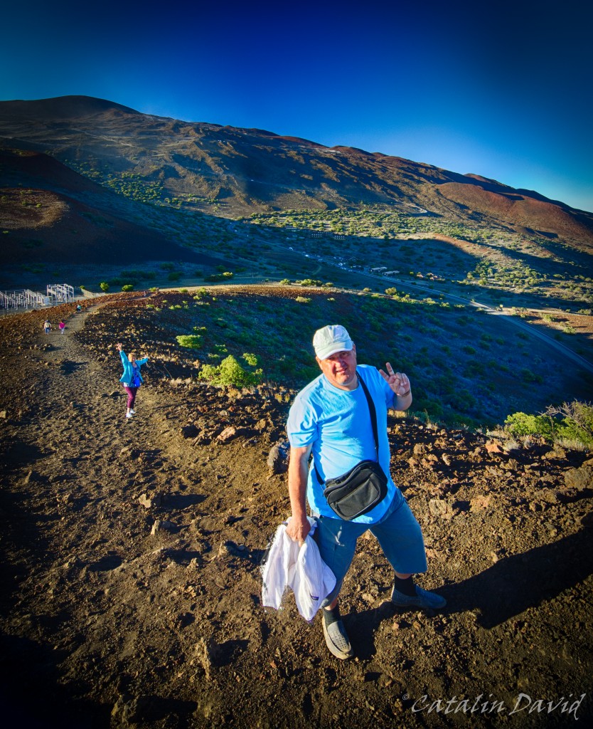
How much? Quite a bit. Especially when you feel every breath taking its toll on you and the lack of freshness in the air. Mauna Kea is actually in the background of this picture and you can see the zig-zag road that goes up the mountain (the peak is not actually visible here). There is a foot path that goes from the visitor center to the top – they say it takes about 8 hours of hiking to get up there. The foot path is rather steep, sandy and a bit of a challenge. Last time I was here … no, I did not climb by foot all the way to the top. Last time I was there, I took the foot path for about 1h, maybe 1h and a half. We were pretty beat – it was the middle of the summer, the sun was agonizing and we decided to bail out and get in the back of a truck that was coming from the top to get back to the visitor center. On our path, we encountered a funny sign: “Stay on the foot path or you risk to be shot. Private military range” – apparently the foot path goes through a US military base training land on the island – I assume that’s where they tested all their stuff for the wars in the past couple of years.
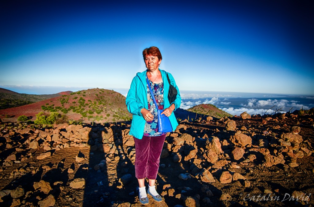
Well, that’s a better view, right?

And we finally got a picture with all of us together. Yes, those small dots in the background were where we parked our car.
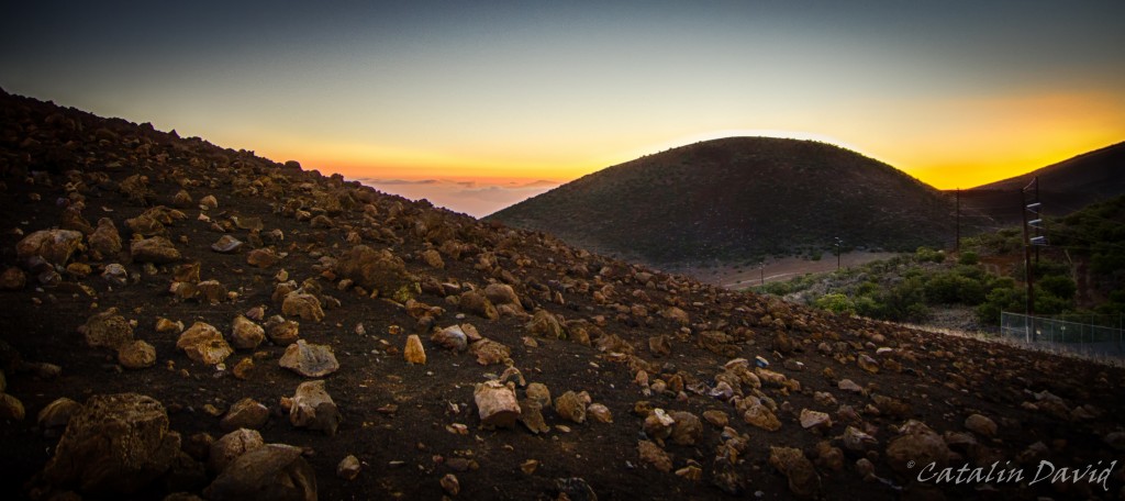
We sat around a bit for the sunset. This is actually the best sunset picture that I have from that trip (I think). And actually, one of the best ever.
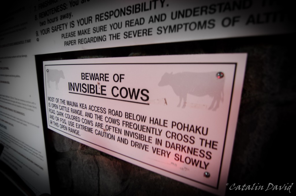
One of the coolest signs that I’ve seen.
But the main reason you go to Mauna Kea is the night sky. As I said, these are rather perfect conditions – no clouds, no light pollution, high altitude, so no air pollution. And if my camera and lens can take such pictures, imagine what they can do with more money and more technology. I present you Milky Way. The yellow patch in both the pictures is the city of Hilo (and some remote houses).
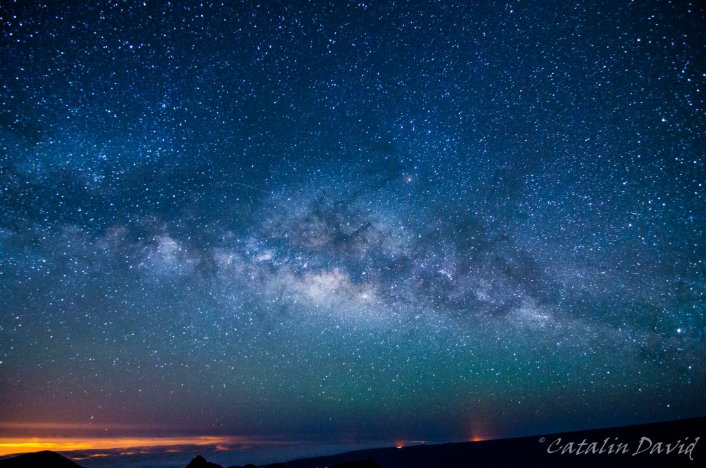
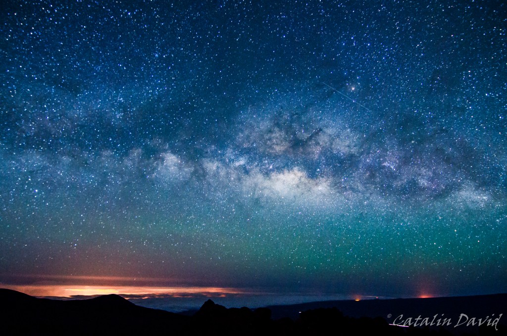
Technique? Tokina 11-16 f/2.8 @ 11mm @ f/2.8, 30s, ISO 6400. Point to the sky, make sure you don’t move either you or the camera, press the remote control button and wait. In the cold. So, in case I haven’t mentioned, it gets cold. So cold, that while I was taking pictures with my father by my side (on the hill from the pictures above) my mother was waiting outside the visitor center and got hypothermia and was shivering all the way home (2h). Some hot wine, some brandy and sleep made it better by the morning.
Good night,
/cd

After the stop at Akaka Falls, we stopped at a local fruit garden and had a taste of fresh fruit – yes, fresh coconut, fresh bananas and a couple of other fruits for which the tongue needs to twist too much to say out loud. We then headed a bit south to the Hawaii Tropical Botanical Garden.
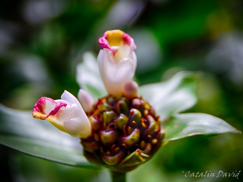
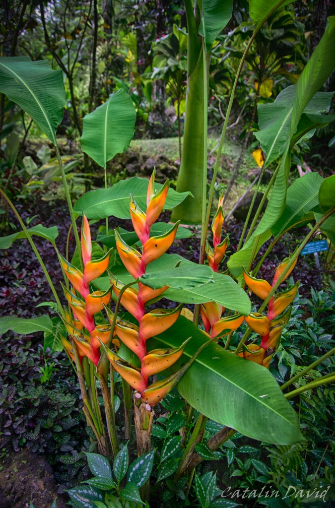
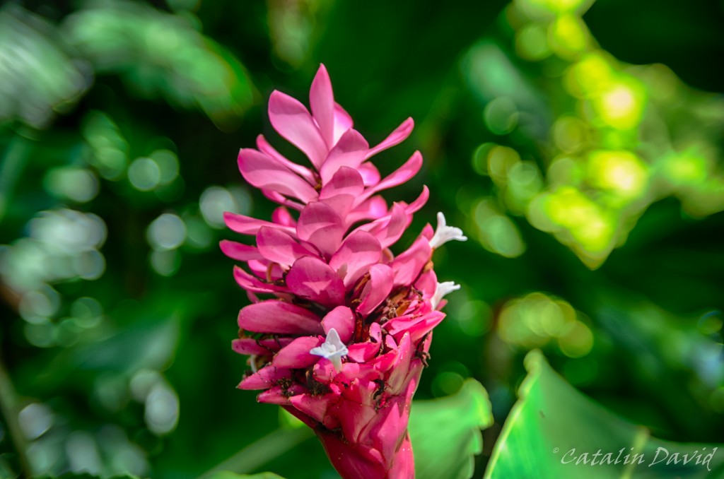
First of all, this is a botanical garden, so floooooowweeeeeer pictures (big fan). Second of all, the history of the garden is pretty interesting – one man, in 1977 was strolling around the Big Island with his wife and said “I’d like to live here”. Of course, no housing crisis back then, so he bought about 17 acres of land (now the garden occupies about 40 acres). He kinda got bored and did not want to destroy the nature on this island, so he decided, along with his wife, to start a botanical garden. So, they sold everything that they had on the main land and decided to move to the Big Island and start working on the garden. Of course, this piece of land was not at all taken care of, so they had to carve their way through the jungle and start taking care of the place. 7 years later, in 1984, the garden was open to the public. 30 years later, I present you some pictures from the garden – of course, you can’t tell they are actually taken there, but bare with me.
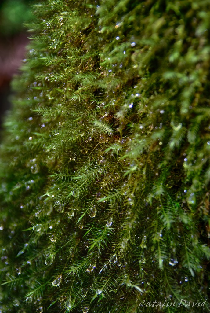
And this place is a rainforest. Here, you can see the droplets of water on a tree and my attempt at macro photography.
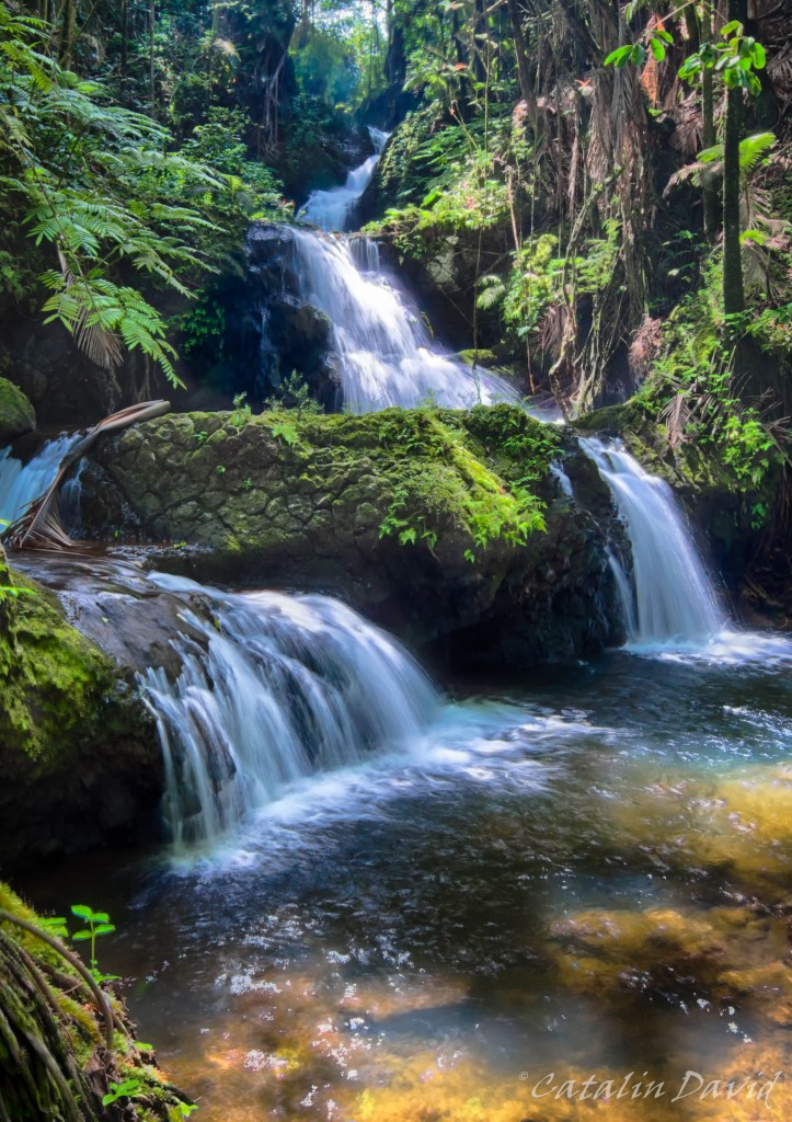
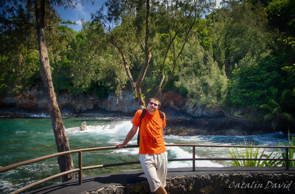
One of the places I appreciated most in the botanical garden is this waterfall – you are in the middle of the “jungle”, trees and shade all around you with patches of sunlight, all you can hear are the birds and the sound of the waterfall and there is a bench nearby so you can just lay down and wait for a couple of minutes. Of course, this is a “jungle”, so by laying down you might expose yourself to who-knows what animals/insects looking for lunch.
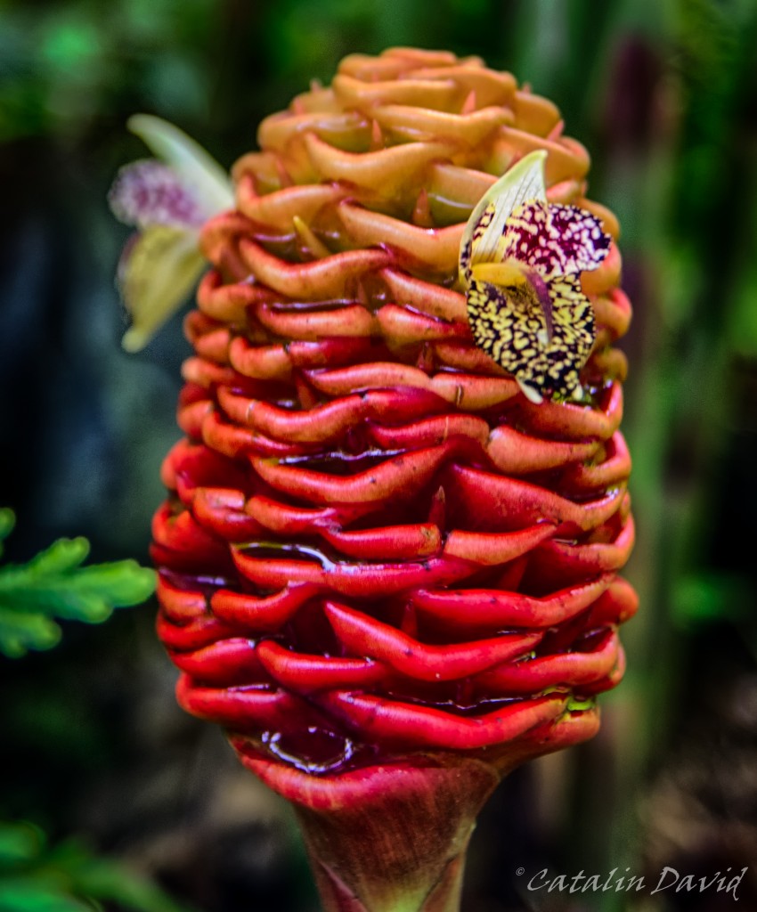
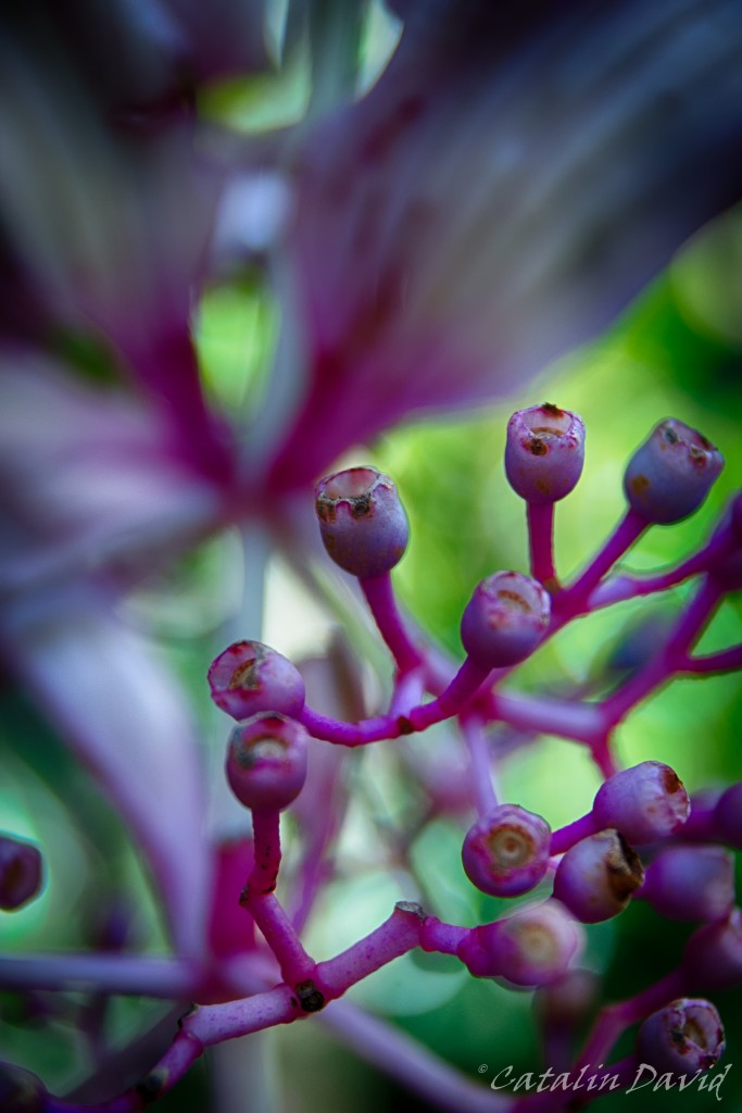
The flower is nice, but I really like the background in this picture – I never knew that my lens can take such pictures.
Oh, hi there – I almost didn’t see you because last night… “I drink I thank too much”.
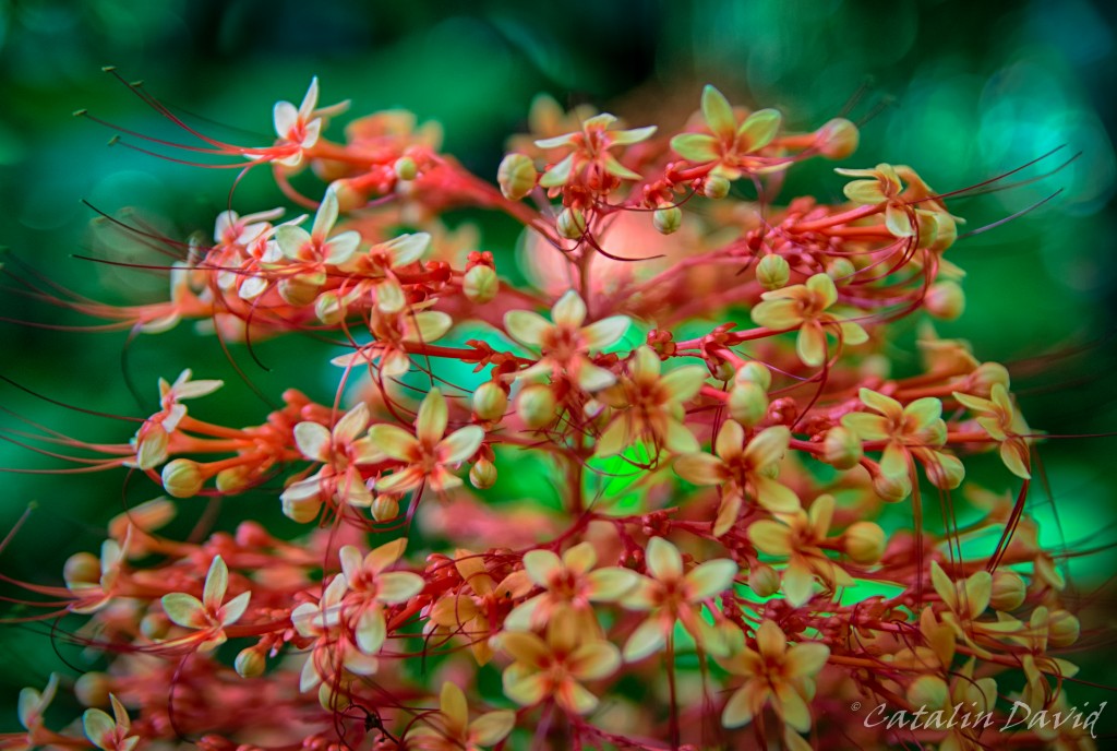
 And more flowers…
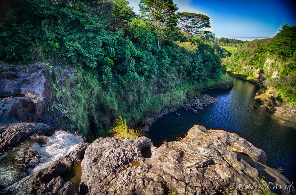
After taking millions of pictures of the flowers in the Botanical Garden, we headed south once more, towards Hilo, strolled around the city for a bit and then went to Rainbow Falls. This is a small waterfall, just outside Hilo which looks like perfect for a dip in the hot summer days. Apparently, if you get there at 10AM on a sunny day and there is some water in the waterfall (this time, there was not a lot of water. Last time I was there, even less), you will see rainbows in the mist surrounding the waterfall. Just above the waterfall, there are some ponds where the water gathers – they call these the “Boiling Pots”.
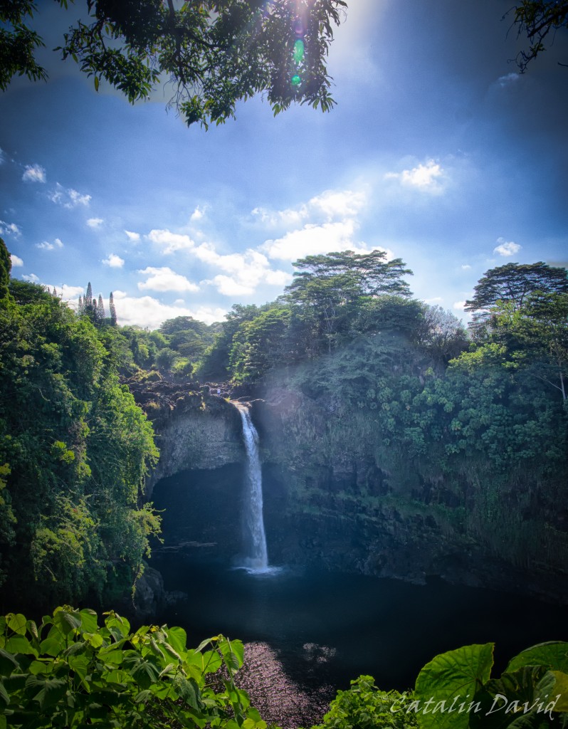
There is a slight hike you can take through the forest and across the Boiling Pots and you can get to the gorge of the waterfall and see the stream flowing. Talk about a different point of view…
This thing about being more agile with my blog posts and pictures proves to be a challenge – one that I am willing to take. Over and out, it’s Friday evening.
/cd
Waiting for 3 months to write something is a really long time. I have experienced writer’s block sometimes before – writing my theses for B.Sc. and M.Sc. – luckily in those times I had a “ritual”: win a game of Solitaire (that can prove to be challenging) or solve a Rubik’s cube. Then everything would flow a bit easier and I would be able to write for quite some time. Still, this is not something mandatory and with a deadline and there’s always “I can do this tomorrow”. Still, I am committed, so let’s get back to the story. Don’t forget to click on the pics for the high resolution version.
Disclaimer: I did some mistakes in organizing this trip – I planned 2 full days (Volcanoes in day 1 and the second day) and then left a couple of consecutive days at the beach. Needless to say, like most Software Engineers, my skin becomes “frustrated” after sun exposure. Take-homes in organizing future trips: alternate resting activities with travelling / hiking activities for a good balance.
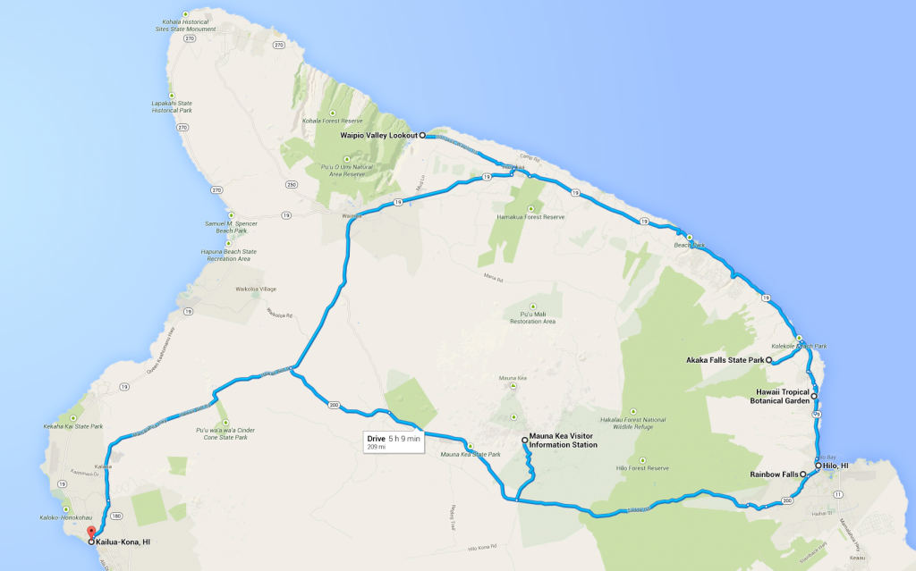
Day 2. Day 2 was a really long day, part of the reason I think about breaking it down in a couple of parts. Departure from Kailua-Kona, head North towards Waipio Valley Lookout, then head towards Akaka Falls, then the Hawaii Tropical Botanical Garden, visit a bit in the town of Hilo, see Rainbow Falls and end up at the Mauna Kea Visitor Center before sunset (I should mention – Hawaii is pretty close to the Ecuator so the sun rises around 6AM and sets at 6PM). Optionally, stay there for after-sunset and see the Milky Way. Then head back to Kona. Here’s a map to make you understand better (credits to Google Maps again) – about 200 miles @ around 40mph average speed while driving … around 6h of driving.
We woke up around 7, and had some breakfast. At the hotel where we were staying, we had a pretty cool breakfast – every morning, fresh ripe papaya (this tasted very awesome for the first couple of days – caveat: eating only this for breakfast every day is the same thing as eating the same brand of cereals for me – gets pretty boring) and toast and sweets. I was still half-asleep, so dad drove (with a bit of help from me for navigating) to Waipio Valley. Remember how I told you about the climatic areas on the Big Island? This day made us experience quite a few. The trip starts in Kona which is pretty dry, but sometimes gets rain. Heading East, we get into an area that gets rain once a week – you can see forests. Meanwhile, all the Western side of the island North of Kona is pretty much a desert-like area where it almost never rains.
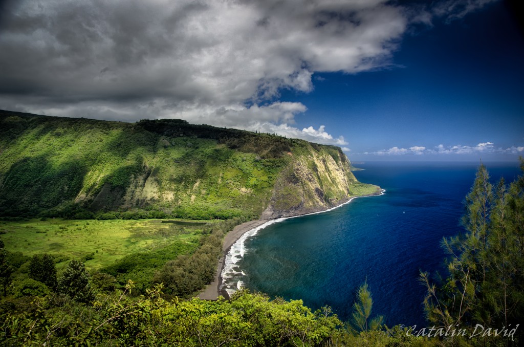
Waipio Valley is an oasis in this desert and is one of the places that are best for gardening. Waipio Valley is one of the wildest parts of the island, though – people move inside the valley for peace and relaxation and tourists are not welcome (up to the point they will get shot for trespassing). The last time I was here, I went on a horseback ride inside the valley. The access to the valley requires a 4×4 car – our tour guides had some really uncared for, old cars, but we made it safely down and back up in the car, so that was fun. Plus, they were extra nice – they allowed us to eat as many bananas and Macadamia nuts as we wanted before the trip (we were about 1h early). REAL BANANAS (not the “things” you buy in a supermarket) and unlimited Macadamia nuts. In the valley, you have a black sand beack (see picture below) and the actual horse ride. More adventurous people can choose to backpack across the valley to a camping site about 7 hours away from the outlook (from where the picture below is taken). The caveat: in case something bad does happen to you, there is no paved road, just a hiking trail, and there is no place for a helicopter to land – as I was saying, pretty adventurous people.

But the view at the lookout? Pretty amazing. I am sure everyone who has been there takes this picture, but I love it. I especially liked the colors of the ocean (a bit amplified by the polarizing filter) and the intense green that contrasted with the Kona side of the island where things were either desert yellow or pale green. We spent a couple of minutes at the outlook, admiring the nature, then headed towards Akaka falls. Just after leaving the outlook, we decided to take a stop near a farm and we observed how pomelo fruits, bananas and lemons grow in the trees – pretty cool stuff. We continued our trip towards Akaka Falls. At Akaka Falls, there is a 30-40 minute roundtrip path through the forest to get to see the actual Falls.
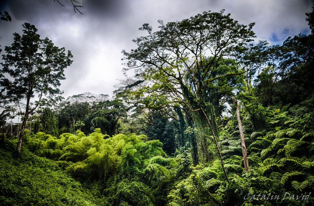
Oh, and it rains quite a bit here, so the forest gets to pretty impressive sizes… But everything is green.
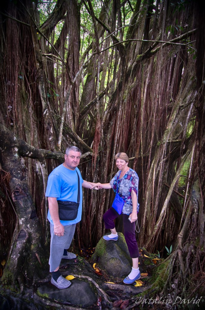
And you can pretend to be a character in TV series Lost, going around this forest, trying to avoid bamboo trees and running for your life. Or you can hold hands.
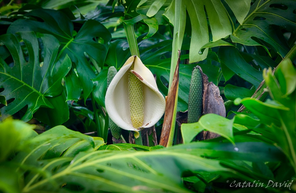
And in this rain forest, even flowers like to play “Night-time, day-time” (if you don’t know the movie clip).
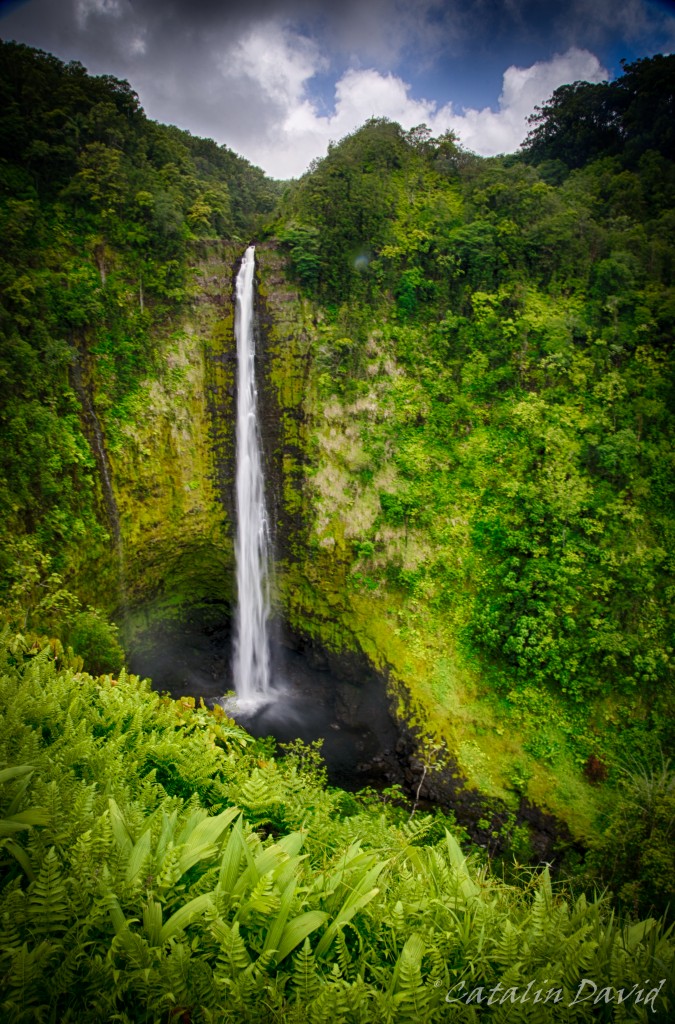
But finally we got to the falls. Akaka falls is one of the tallest, while still easy to visit, falls on the island – at a bit over 100m tall. By comparison, Niagara falls is just 50m tall, but it has a much higher debit of water. The waterfall looks interesting and secluded. But the waterfall is not the most interesting thing about this area. Apparently, there is a fish that is able to “climb” the falls – I don’t see any documentation about it online, but I read about it there. This fish is pretty special – it is born upstream, falls through the waterfall, reaches the ocean when it’s mature and starts going back upstream. And then it faces a 100m waterfall – and it manages to go past it. How, you might ask? Well, it helps quite a bit when you have a sucker on your belly. So, apparently, they are able to jump from the base of the falls, attach themselves to the rocks, breathe (WTF?), fight against the power of the water hitting them AND after a while, attempt another jump “up the falls” at the end of which they need to attach themselves to the rocks and try again. Pretty crazy and science fiction, if you ask me. Read more for yourself here.
We finished our roundtrip and ended back in the parking lot, from where you can get one last glimpse at the falls again.
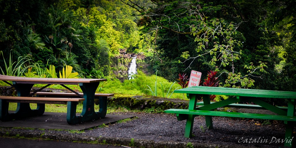
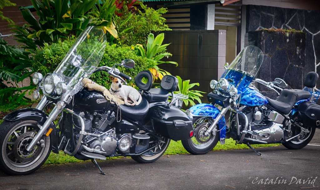
But people that come here are interesting – some of them, like the two owners with the dog below came from the mainland to just enjoy the Big Island for a month. Everybody seemed to enjoy the trip, especially the dog.
Over and out with day 2, part 1.
/cd

Well, this took a while… I took the pictures about 6 months ago, I started processing them about 3 months ago, had them ready about 1 month ago and since then they have been sitting on my computer, waiting to be published… Also, Happy New Year! Also, don’t forget to click on the pictures to see them better.
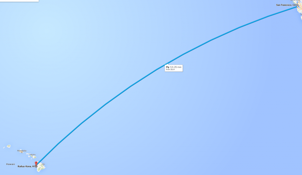
If you want me to be technical, this is not day 1, but day 2. On day 1, we (my parents and me) caught a flight from Seattle to San Francisco and then to Kona, Hawaii (on the Big Island – more on that later). About the flight – for me, it always is a bit of a scary feeling when the flight is 5h and it’s a straight line over the Pacific, making water landing the only possibility for survival in case of a disaster (credits to Google Maps for the pic).
This was my second visit to Hawaii – i was at a conference there a couple of years back and the flight experience that I had then was not the best. Then, I was flying Hamburg – London – Los Angeles – Hawaii and on the London – Los Angeles leg of the trip, one of my ears went pretty deaf due to the change in pressure. I had lots of fun at the airport in Los Angeles when, for every question that the TSA / Customs had to ask me, I had to turn my head and usually ask “Can you please repeat that?”. I finally got on to the Hawaii flight, my ears came back to normal once the cabin was pressurized and I was able to get a bit of sleep on that long day. About 2-3 hours into the flight, I can hear one of the flight attendants calling out “Code Blue!!!!” on the intercom and shortly after, 2 other flight attendants rushing to the front of the plane. One of them comes back, with almost a smile on her face and asks “Is anyone here a doctor?”. Luckily, I guess there was a medical conference in Kona on that week since 5 people around me raised their hands. The old lady sitting next to me later on informed me that she found out from one of her friends in first class (word goes around quickly, even on a plane) that someone has had a heart attack and that they had to shock his heart with adrenaline. 45 minutes before landing, the pilot informs us that due to a medical emergency on board, we will descend into Kona faster than usual, leading to my ear blockage again. The rest of the story is fun, but I’ll save it for some other time.
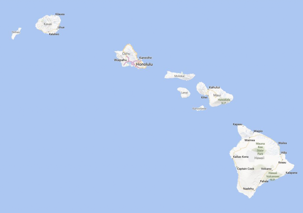
As I was saying, this is the second time that I have been to Hawaii, the second time to the Big Island and the second time in Kona. Looking above (credits to Bing Maps for the pic), you can see the Hawaii islands and the biggest one is “The Big Island” – pretty straightforward right? The other big ones are Maui, Kauai and Oahu – I haven’t researched them that much. All I know is that Oahu is the island that has the capital of the state – Honolulu and that is where Pearl Harbor is and that is where they filmed parts of the Lost TV series. The islands are pretty far away from each other, so for island-hopping, you need to board a plane and take an 1h flight to get to another island (150-200$ return trip).
Anyway, back to the trip. Day 1 was pretty much a long flight SEA – SF – KOA and then we reached Kona in the afternoon and just drove to the hotel, walked around the beach just outside, had dinner and went on to prepare for the next day. We were at a little hotel just in downtown Kona and we had ocean view – a pretty nice place. Also, for the sake of photography – I was travelling light (no checked in luggage for the 3 of us), so I couldn’t take ALL my lenses with me. I ended up taking my Tamron 17-50 f/2.8 and my Tokina 11-16 f/2.8 (and boy, did that come in handy – you will see later) and the tripod. All the photos have been slightly postprocessed using Nik Software (in particular HDR Efex Pro 2) and Lightroom 5. So, second day.
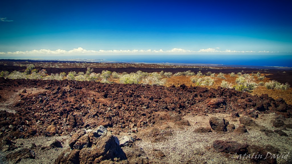
Since I had already been to the Big Island and had researched it 2 times already, I had a pretty good idea of what to visit, the amount of time it would take to get there and back and what to see. For today, the plan was – get up, have breakfast and go see the volcanoes and on the way back, the Black Sand beach and get back to Kona before sunset. And off we went 🙂 . One thing I should mention is that the Big Island is really interesting and varied – it has different climatic zones and different vegetation around the island. It has parts where it almost never rains (see picture above), parts where it rains at least once a day and is mostly cloudy (on the Eastern side of the island, near Hilo), it has 4000+m tall mountains (Mauna Kea and Mauna Loa), it has an area where coffee is farmed (coffee is pretty picky about the climate and Kona coffee is pretty well known) and it has tropical forests. The view above is characteristic to the Western side of the island, North of Kona – you can see solidified lava that was broken down by rain, the blue ocean and all clouds heading avoiding you.
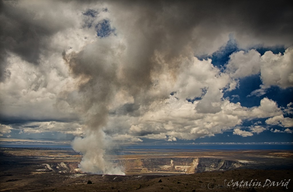
The volcanoes are in the SouthEastern part of the island, in the Hawaii Volcanoes National Park. No, you can not see flowing lava (just to get that out of the way, it’s very unlikely but you might be lucky). Here, in the park you have a tourist information center where you can learn more about the volcanoes, about the area and about what to see while you are visiting. The picture above is of the Kilauea Caldera volcano. To be specific, you are actually looking at 3 volcanoes in this picture (though they are not very clearly defined). The rim of the first volcano can be traced from the lower left corner to just above the double watermark on the photo (yes, I see it now, no I will not fix it). This is the oldest volcano (Kilauea Caldera). In the center of the picture, you can see the smaller rim of the second volcano. This is the Halema’uma’u volcano. This is an active volcano that is solidified at the surface, but 70-150 meters below the surface, there is hot, spewing lava. It has been erupting almost continuously through a single vent, producing the sulfurous cloud that you see in the picture (which will kill you if you breathe it). That single vent started as a 1m wide vent and is now about 300 meters wide. And looking down in it, at 70+ meters, you would see lava. Unfortunately, for reasons of your own safety, your access is not allowed closer to the actual volcano and there is a constant wind taking this sulfur out to the ocean. This shot is taken from the Jagger Museum, west of the tourist information center. Inside, you can learn more about the lava, the volcanoes here and around the world. Pro tip: listen to the local guides telling the stories of Pele and volcanoes.
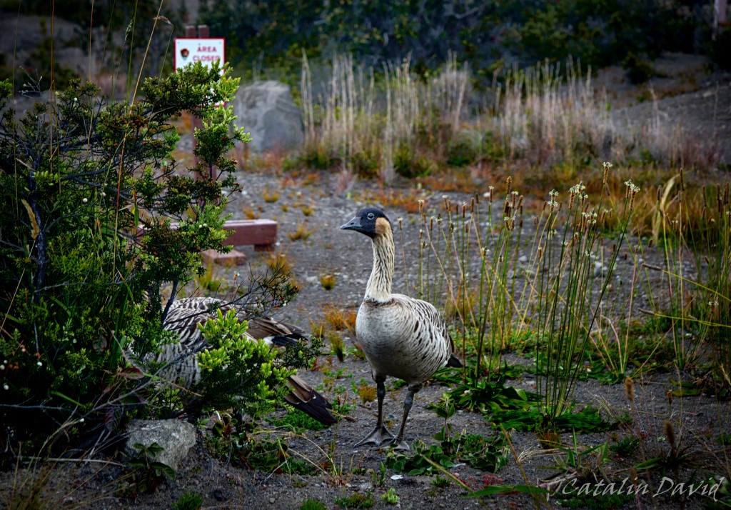
Walking around the island, you are most likely going to see these weird goose-like birds. They are called “nene” (or Hawaiian Goose) and are the rarest geese in the world and an endangered species. Look, take a picture, but don’t feed them and be sure not to run them over when driving like a maniac around the island.
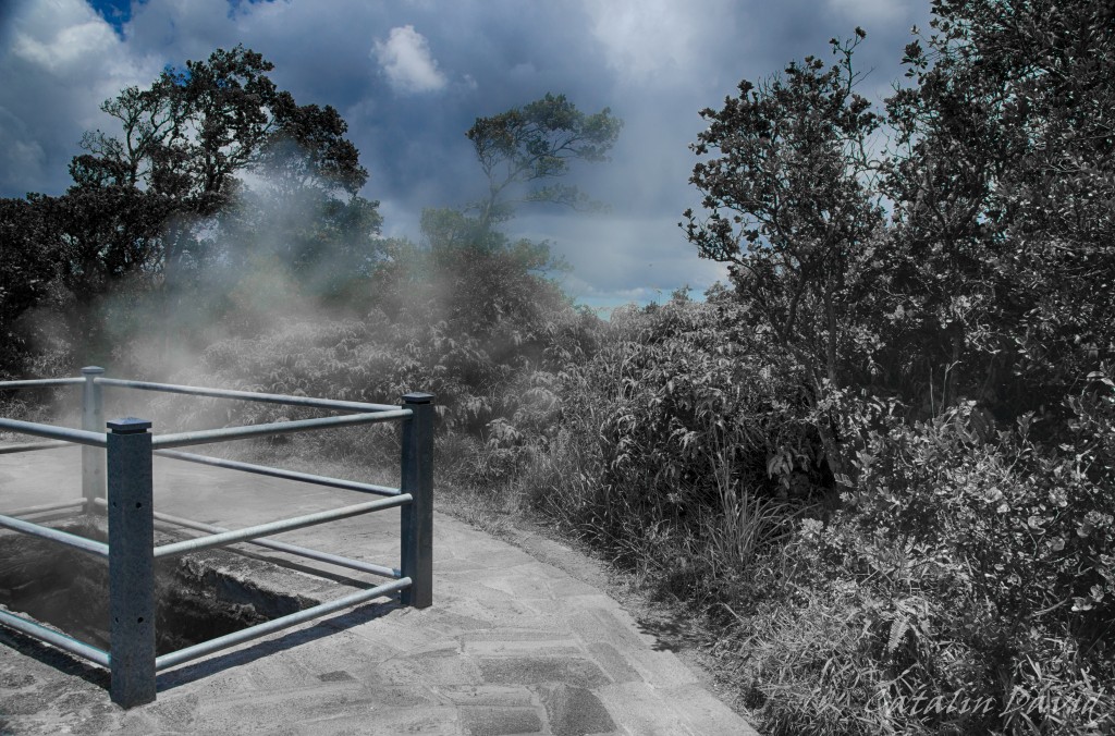
Between the Jaggar museum and the Tourist Information center, on the side of the road, you will find these holes in the ground with steam coming out of them. Unlike the steam from the volcanoes above (which contains sulfur, highly toxic for you), this is harmless – this is rainwater that is naturally heated up by the lava and evaporates all the way to the surface. The way this works is that the soil is mostly lava – which is very porous (see picture below for a detail). This means that water can infiltrate easily through it, get close to the lava, get transformed to steam and come back up to the surface. The picture is partially decolorized because this is the best I could do to highlight the steam on a bright, sunny day. But I do like the dead-nature aspect that it gives to the foreground bushes.
Next up is the Thurston lava tube. A lava tube is some sort of a cave through which lava flowed many years ago. The characteristics are that it is rather smooth on the inside (not many stalactites) and that it is relatively circular (therefore the name of tube). This lava tube is easily accessible, it is a 30 minute walk through a rain forest. The lighting is kinda bad inside (therefore the need for black and white pictures), but it is a fun walk and definitely an interesting experience to picture that lava flowed through where you are standing. Also, meet my parents 🙂 .
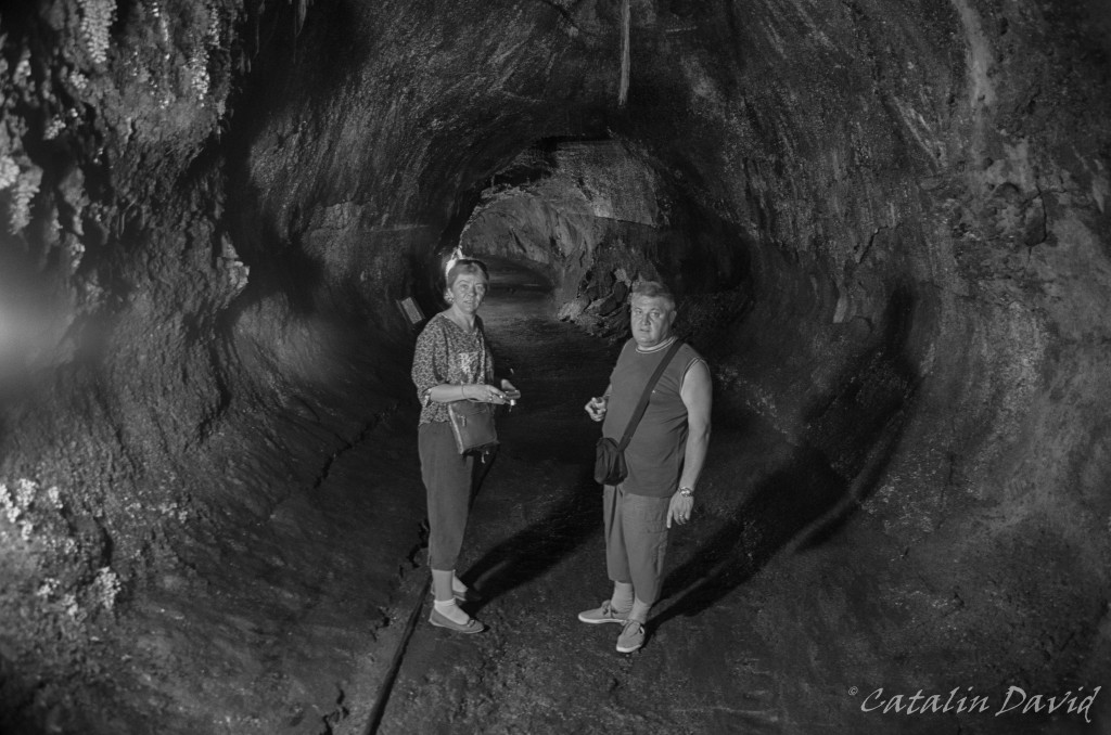
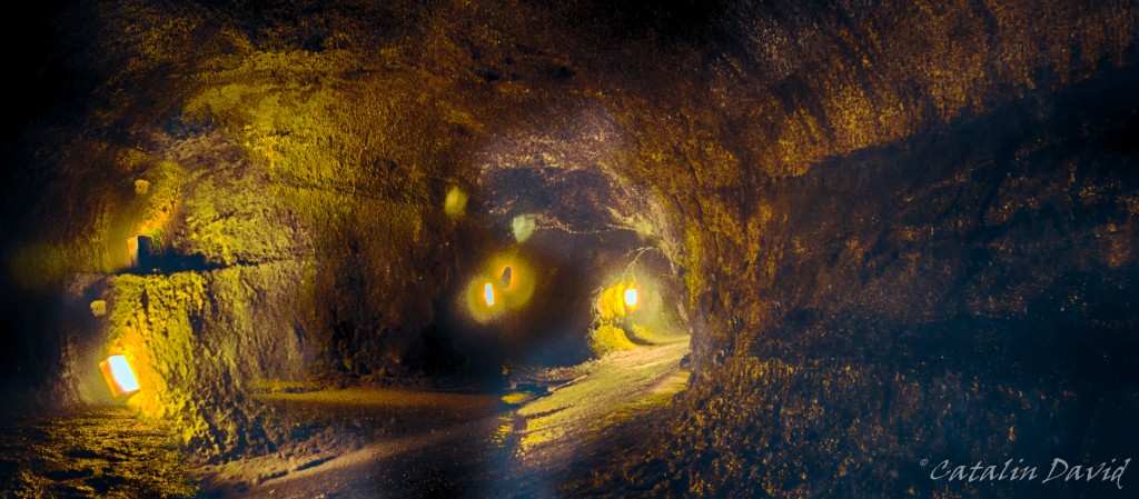
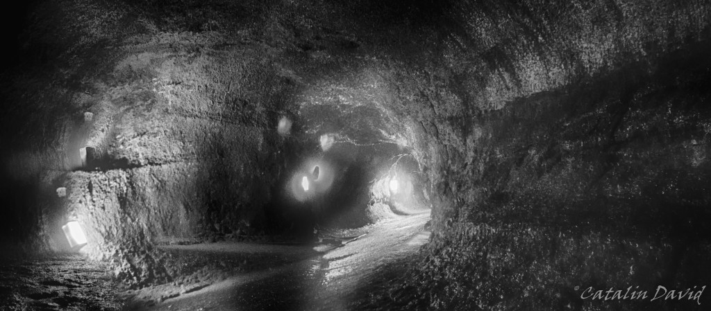
The lighting on the Bis Island is done using low pressure sodium lights (this is the yellow light that shines across the island) – this is because of the observatories on top of Mauna Kea. The sodium light has a lower intensity and is in a different spectrum than normal light and it will influence the astronomic observatories a lot less. Big respect for the science being done there, at the top of the mountain. I still think that black and white looks better – therefore I put Nik Silver Efex to a bit of work to create this.
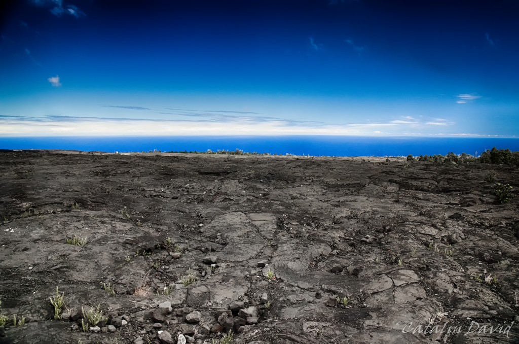
Once out of the tube, we headed South on the Chain of Craters Road. Down this road, you can see inactive craters (though not as big as Caldera) and walk all the way to the edge of them. Of course, I didn’t want to risk my camera, so I decided to just walk to the edge without taking pictures. Also along the way, you can see different signs with years on them – those signs represent from when the lava that you see on the side of the road has been solidified. As far as I remember, this ranged from 1800 till 1980s. Moving on, we get closer and closer to the ocean and the view is pretty much amazing: desert and water in one picture. The drive is really nice and is worth stopping for a couple of photos and taking everything in.
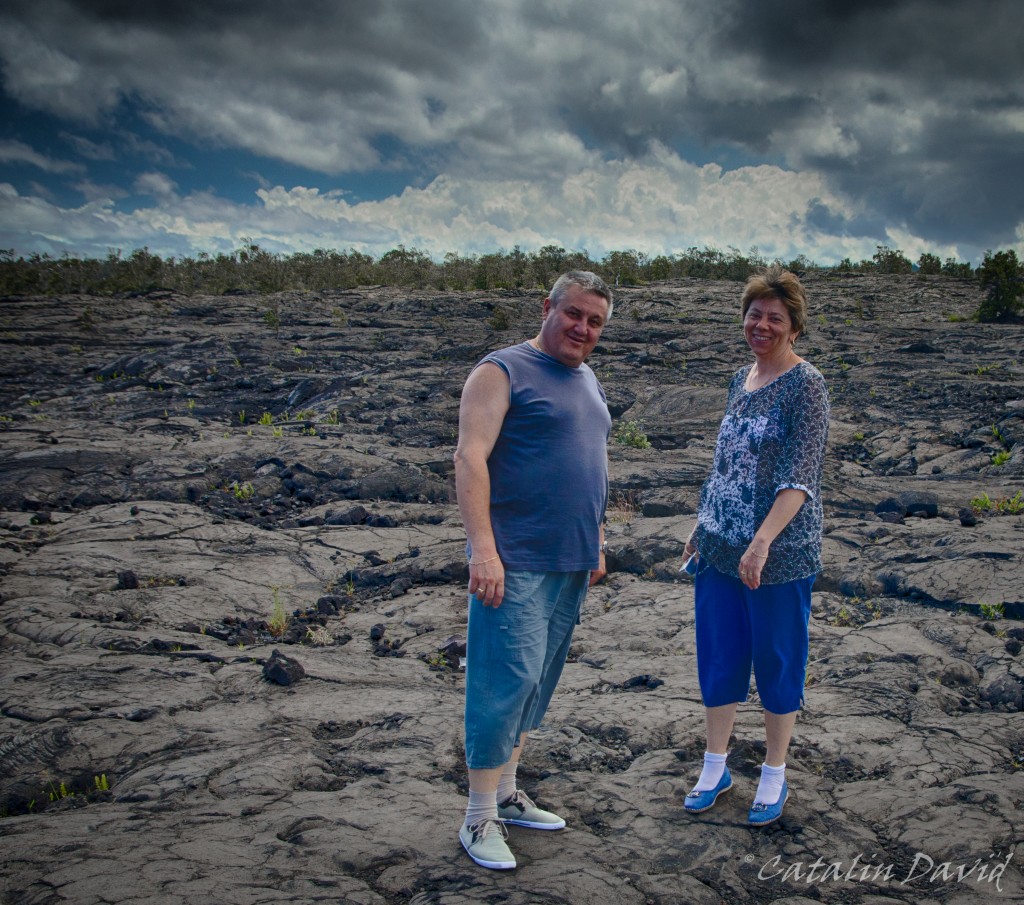
And you don’t have to be walking on sunshine to have fun – you can be walking on lava!
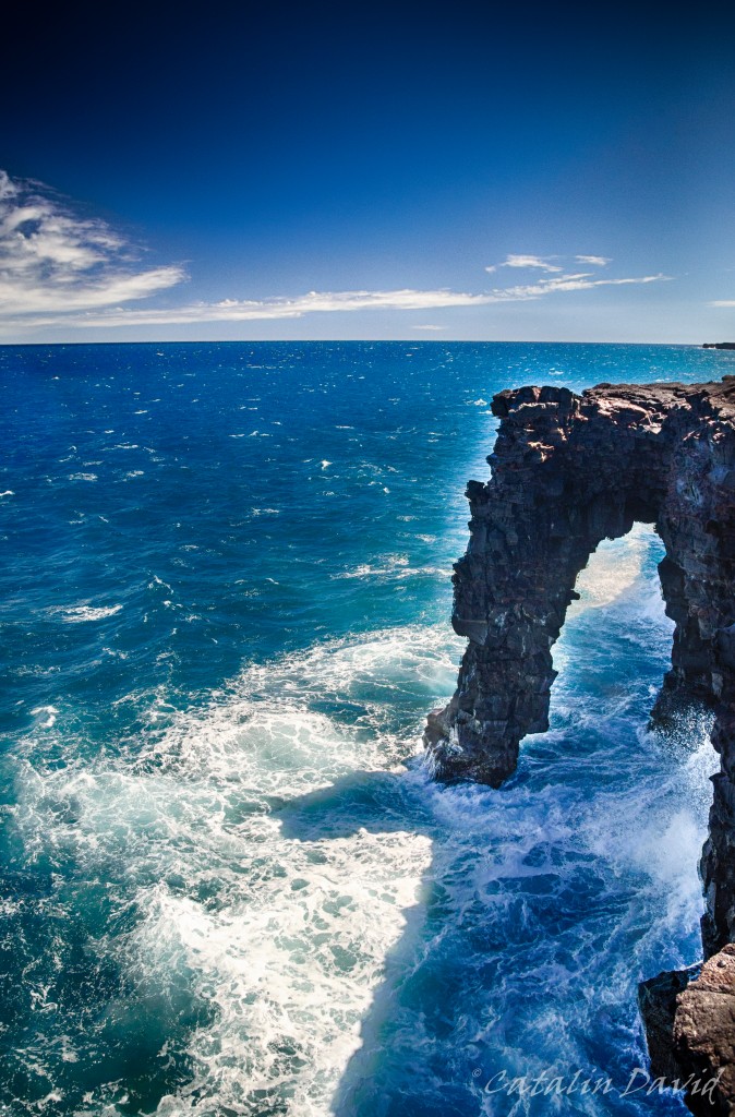
As we get to the ocean, we can see the Holei Arch – where lava and ocean meet. Or, if you are getting to close to the edge, where ocean and you meet – yes, the cliffs are 10 meters high, but the waves here are pretty big and can always surprise you and take you up for an early bath on your trip. The Holei Arch is actually the endpoint of the drive down the Chain of Craters Road. Still, it is not our end destination inside the Volcanoes National Park. By walking for 10-20 minutes on the closed-for-vehicles road, you will get to the place of one of the latest, easily reachable lava flows.
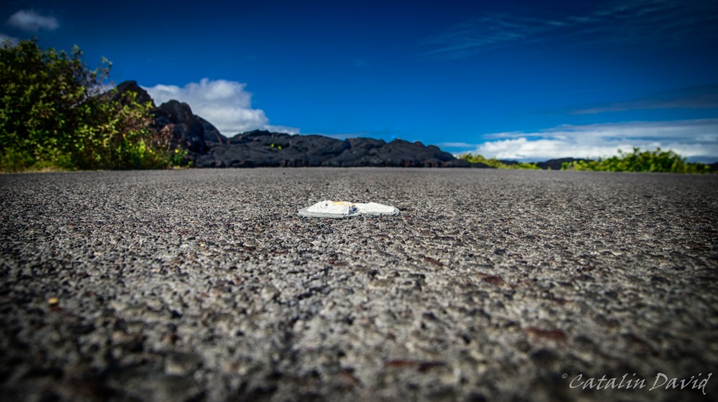
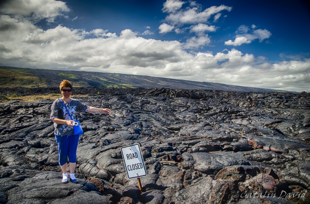
Road, meet lava. A couple of years ago, there has been an eruption and the lava slowly drifted from the hill nearby and covered 8.7 miles (14km) of the road uniting two villages. One village was partially destroyed, but if I remember correctly, nobody was killed since lava can only travel so fast. The white spot in the middle of the picture is a lane separator for the road and you can see the solidified lava flow in the background.
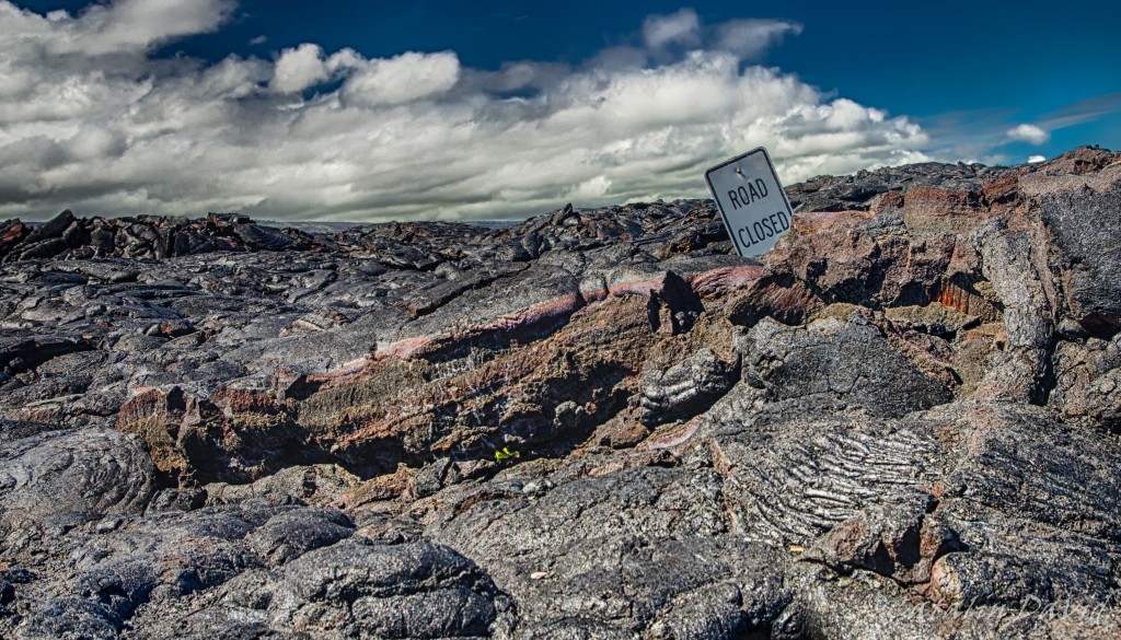
No s**t, Sherlock! That is where the road should have been. Apparently, they had time to evacuate everyone and put a sign that that the road is closed. Lava did not care for road closures, though…
It gets a bit windy out there. Also, in the background you can see the hills covered with lava as well and you can trace where lava is coming from. Pretty neat.
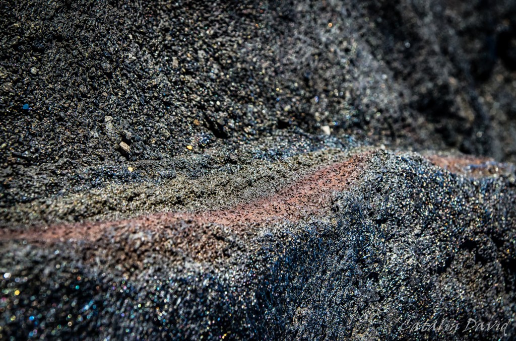
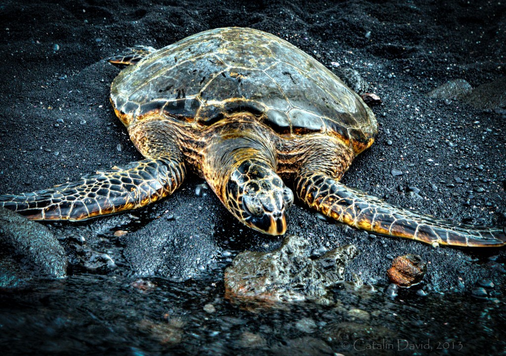
This is a detail of the lava. I like the sparkling and the different layering of the materials inside. This was our extreme point for the day, so we started heading back towards Kona. On the way back, we stopped at Punalu`u Beach – this is a black sand beach. And it just feels weird – every time I look down and expect to see the golden sand between my toes, I find my foot in a black pile of sand. The sand is pretty rough (though you can find some really nice white / gold sand beaches on the Big Island). One interesting thing about this beach – this is where green turtles come to shore during the day – either to get away from the warm water or to plant their eggs. The one below seemed really tired and for the half hour that we were waiting there, it barely moved (side note: one of the best kind of subjects for photography) even though it was 10 centimeters away from the shore.
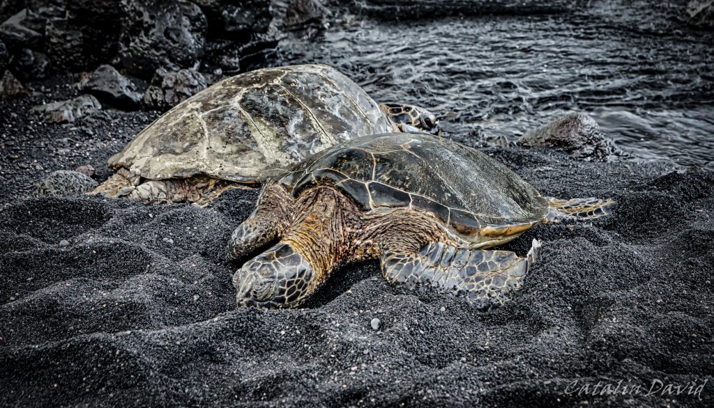
Howdy neighbor! I really like the expression of the turtle in the back of this picture (it is the same turtle in the picture above, so proof it was alive) – what’cha lookin’ at, punk?
On our way back to Kona, we were treated with some clouds, making watching the sunset impossible to watch – but at least this picture of the rays of light going through the clouds was possible.
Over and out (and off to processing day 2),
/cd